Home
Browse
Ask Us
Chat
Harmful Language Statement
Log in
Advanced Search
Year
1933
1934
1935
1936
1937
1938
1939
1940
1941
1942
1943
1944
1945
1946
1947
1948
1949
1950
1951
1952
1953
1954
1955
1956
1957
1958
1959
1960
1961
1962
1963
1964
1965
1966
1967
1968
1969
1970
1971
1972
1973
1974
1975
1976
1977
1978
1979
1980
1981
1982
1983
1984
1985
1986
1987
1988
1989
1990
1991
1992
1993
1994
1995
1996
1997
1998
TO
1933
1934
1935
1936
1937
1938
1939
1940
1941
1942
1943
1944
1945
1946
1947
1948
1949
1950
1951
1952
1953
1954
1955
1956
1957
1958
1959
1960
1961
1962
1963
1964
1965
1966
1967
1968
1969
1970
1971
1972
1973
1974
1975
1976
1977
1978
1979
1980
1981
1982
1983
1984
1985
1986
1987
1988
1989
1990
1991
1992
1993
1994
1995
1996
1997
1998
Type
Image/StillImage
17
Image
7
Text
5
Format
image/jpeg
14
application/pdf
8
application/vnd.google-earth.kmz
3
application/zip
2
Collection
Maps
17
Theses & Dissertations
10
Filters:
Subject:
"Summit County"
1
-
25
of
27
<
1
2
>
Gallery view
Number of results to display per page
10
25
50
100
200
Sort by Relevance
Sort by Title A-Z
Sort by Title Z-A
Sort by Date Ascending
Sort by Date Descending
Sort by Last Modified Ascending
Sort by Last Modified Descending
Title
Date
Type
Setname
1
Areal geology of the Upton Region, Summit County, Utah
1953-06
Text
ir_etd
2
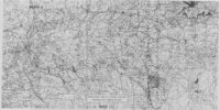
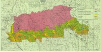
Areal geology of the Upton Region, Summit County, Utah: Georeferenced map files
1953-06
Image
ir_etd
3
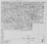
Ashley National Forest - Analysis Units - High Uintas Roadless Area Study
Image/StillImage
ucl_maps
4
Ashley National Forest - Forest Visitor Map 1998
1998
Image/StillImage
ucl_maps
5
Ashley National Forest - Uinta National Forest - Wasatch National Forest - Manti La Sal National Forest
Image/StillImage
ucl_maps
6
Ashley National Forest Utah - Salt Lake and Uinta Special Meridians 1955
1955
Image/StillImage
ucl_maps
7
Ashley National Forest Wilderness Proposal 1967 - South Slope Plan - Roadless Areas - Alternative 1
1967
Image/StillImage
ucl_maps
8
Ashley National Forest Wilderness Proposal 1967 - South Slope Plan - Roadless Areas - Alternative 2
1967
Image/StillImage
ucl_maps
9
Ashley National Forest Wilderness Proposal 1967 - South Slope Plan - Roadless Areas - Alternative 3
1967
Image/StillImage
ucl_maps
10
Ashley National Forest Wilderness Proposal 1967 - South Slope Plan - Roadless Areas - Alternative 4
1967
Image/StillImage
ucl_maps
11
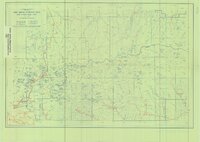
Ashley National Forest, Utah and Wyoming - Salt Lake, Uinta Special, and Sixth Principal Meridians 1933
1933
Image/StillImage
ucl_maps
12
Ashley National Forest, Utah, Salt Lake and Uinta Special Meridians. 1955 - reprint of 1945 edition
1955
Image/StillImage
ucl_maps
13
Bear Lake US DOI BLM 1974
1974
Image/StillImage
ucl_maps
14
Bountiful (Planimetric) NW-12 (US DOI BLM) 1975
1975
Image/StillImage
ucl_maps
15
Duchesne US DOI BLM 1977
1977
Image/StillImage
ucl_maps
16
Geology of the Keetley-Kamas volcanic area
1951
Text; Image
ir_etd
17
Geology of the Keetley-Kamas volcanic area (Google Earth map overlay KMZ file)
1951
Image
ir_etd
18
Geology of the Keetley-Kamas volcanic area: Georeferenced map files
1951
Image
ir_etd
19
Geology of the Morgan-Henefer area Morgan and Summit Counties, Utah
1955-05
Text
ir_etd
20
Geology of the Smith and Morehouse-Hayden Fork area, Utah
1952
Text; Image
ir_etd
21
Geology of the Soapstone Basin and vicinity, Wasatch, Summit, and Duchesne Counties, Utah
1953-06
Text
ir_etd
22
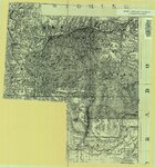
High Uintas Primitive Area - Ashley and Wasatch National Forests, Utah 1958
1958
Image/StillImage
ucl_maps
23
Map1 Geologic map and sections of Smith and Morehouse-Hayden Fork area, Utah (Google Earth map overlay KMZ file)
1952
Image
ir_etd
24
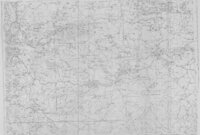
Plate 5: Geologic map of the Upton region, Summit County, Utah (Google Earth map overlay KMZ file)
1953-06
Image
ir_etd
25
Uintah and Uncompahgre Ute Indian Reservation
Image/StillImage
ucl_maps
1
-
25
of
27
<
1
2
>