Home
Browse
Ask Us
Chat
Harmful Language Statement
Log in
Electronic University Archive
Advanced Search
Year
2006
2007
2008
2009
2010
2011
2012
2013
2014
2015
TO
2006
2007
2008
2009
2010
2011
2012
2013
2014
2015
Type
Text
29
Image
1
Format
application/pdf
98
image/jpeg
79
application/vnd.ms-excel
4
application/vnd.ms-powerpoint
3
application/zip
1
Collection
Electronic University Archive
185
Filters:
Research Institute:
"Institute for Clean and Secure Energy (ICSE)"
School Or College:
"University of Utah"
1
-
25
of
185
<
1
2
3
4
5
6
7
8
>
Gallery view
Number of results to display per page
10
25
50
100
200
Sort by Relevance
Sort by Title A-Z
Sort by Title Z-A
Sort by Date Ascending
Sort by Date Descending
Sort by Last Modified Ascending
Sort by Last Modified Descending
Title
Date
Type
1
GEOMECHANICAL AND FLUID TRANSPORT PROPERTIES
Text
2
Clean and Secure Energy from Domestic Oil Shale and Oil Sands Resources Quarterly Progress Report
Text
3
Skyline 16 information
2015-07
4
Skyline 16 XRF
2015-07
5
XRF data for Skyline 16
2011-05-12
6
University of Utah and Utah Geological Survey Green River coring project summary
2015-07
7
Skyline 16 sampling
2015-07
8
Skyline 12 Fisher Assay Data
2015-07
9
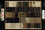
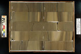
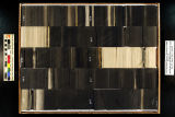
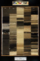
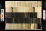
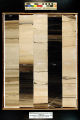
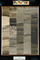
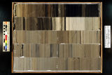
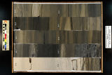
Skyline 16: SW SW sec. 10 11S 25E Uintah County, Utah. Box 77 Depth: 780.0 - 790.0 ft.
2015-07
10
Skyline 16: SW SW sec. 10 11S 25E Uintah County, Utah. Box 98 Depth: 990.0 - 1000.0 ft.
2015-07
11
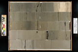
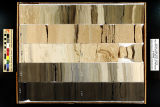
Skyline 16: SW SW sec. 10 11S 25E Uintah County, Utah. Box 82 Depth: 830.0 - 840.0 ft.
2015-07
12
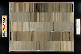
Skyline 16: SW SW sec. 10 11S 25E Uintah County, Utah. Box 83 Depth: 840.0 - 850.0 ft.
2015-07
13
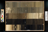
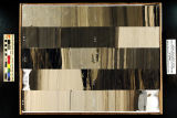
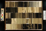
Skyline 16: SW SW sec. 10 11S 25E Uintah County, Utah. Box 95 Depth: 960.0 - 970.0 ft.
2015-07
14
Skyline 16: SW SW sec. 10 11S 25E Uintah County, Utah. Box 73 Depth: 740.0 - 750.0 ft.
2015-07
15
Skyline 16: SW SW sec. 10 11S 25E Uintah County, Utah. Box 80 Depth: 810.0 - 820.0 ft.
2015-07
16
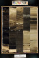
Skyline 16: SW SW sec. 10 11S 25E Uintah County, Utah. Box 79 Depth: 800.0 - 810.0 ft.
2015-07
17
Skyline 16: SW SW sec. 10 11S 25E Uintah County, Utah. Box 92 Depth: 930.0 - 940.0 ft.
2015-07
18
Skyline 16: SW SW sec. 10 11S 25E Uintah County, Utah. Box 87 Depth: 880.0 - 890.0 ft.
2015-07
19
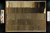
Skyline 16: SW SW sec. 10 11S 25E Uintah County, Utah. Box 86 Depth: 870.0 - 880.0 ft.
2015-07
20
Skyline 16: SW SW sec. 10 11S 25E Uintah County, Utah. Box 88 Depth: 890.0 - 900.0 ft.
2015-07
21
Skyline 16: SW SW sec. 10 11S 25E Uintah County, Utah. Box 78 Depth: 790.0 - 800.0 ft.
2015-07
22
Skyline 16: SW SW sec. 10 11S 25E Uintah County, Utah. Box 81 Depth: 820.0 - 830.0 ft.
2015-07
23
Skyline 16: SW SW sec. 10 11S 25E Uintah County, Utah. Box 96 Depth: 970.0 - 980.0 ft.
2015-07
24
Skyline 16: SW SW sec. 10 11S 25E Uintah County, Utah. Box 76 Depth: 770.0 - 780.0 ft.
2015-07
25
Skyline 16: SW SW sec. 10 11S 25E Uintah County, Utah. Box 93 Depth: 940.0 - 950.0 ft.
2015-07
1
-
25
of
185
<
1
2
3
4
5
6
7
8
>