TO
Filters: Collection: "ir_eua"
| Title | Date | Subject | Description | ||
|---|---|---|---|---|---|
| 1476 |
 |
General_Catalog_2018_2019 | 2019 | Course catalog; classes | University of Utah catalog of course descriptions, majors, minors, colleges, and schools |
| 1477 |
 |
Geochemical analysis of various crude oils Uinta Basin, Utah | 1988-12-01 | geochemical analysis; crude oils; Uinta Basin. | |
| 1478 |
 |
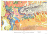
Geologic and structure maps of the Salt Lake City 1º X 2º quadrangle, Utah and Wyoming | 1992 | ||
| 1479 |
 |
Geologic characterization of Utah oil shale deposits | 2010-04-28 | oil shale development; geologic framework; lake evolution; oil shale; stratigraphic correlation | Why Geology? Economic prospectivity of oil shale development in the Uinta Basin relies heavily on establishing a solid geologic framework. Understanding lake evolution matters. |
| 1480 |
 |
Geologic evaluation and reservoir properties of the PR Spring tar sand deposit, Uintah and Grand counties, Utah | 1985-01 | reservoir properties; PR Spring tar sand deposit; tar sand | In 1980, the Laramie Energy Technology Center completed a seven corehole drilling program at the PR Spring tar sand deposit, southeastern Uinta Basin, Utah. The data from this project were integrated with other resource information to complete lithologic correlations, to evaluate general reservoir p... |
| 1481 |
 |
Geologic influences on the in situ processing of tar sand at the northwest Asphalt Ridge deposit, Utah | 1985-01 | in situ oil recovery field experiments; oil recovery; tar sand; in situ tar sand processing; Asphalt Ridge deposit | The Laramie Energy Technology Center, Department of Energy, completed three in situ oil recovery field experiments, two combustion and one steamflood, in tar sand at Northwest Asphalt Ridge, Utah. Inadequate resource and site characterization prior to the field experiments contributed to process des... |
| 1482 |
 |
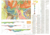
Geologic map of the Salt Lake City 30' X 60' quadrangle, north-central Utah, and Uinta County, Wyoming | 1990 | ||
| 1483 |
 |
Geologic summary report of the 1981 exploration program, Sunnyside Tar Sands project, Carbon County, Utah | 1982-02-19 | Geologic summary; exploration project; Sunnyside Tar Sands project; delta complex. | The 1981 Sunnyside exploration program consisted of: (1) diamond drilling of sixteen drill holes and logging of the core, and (2) initial geologic mapping in the northern area to better define the limits of the tar sands associated with the Sunnyside delta complex. In order to comprehend the geometr... |
| 1484 |
 |
Geologic summary report of the 1982 exploration program, Sunnyside Tar Sands project, Carbon County, Utah | 1983-06-30 | geologic summary report; exploration program; Sunnyside Tar Sands project; tar sands; bituminous sandstone deposits | The Sunnyside tar sands are located within the southwest portion of the Uinta Basin and localized within a small delta complex that formed in Lake Uinta during early Tertiary time. The essence of the Sunnyside tar sands deposit is a sequence of laterally continuous sheet sands or stacked bituminous ... |
| 1485 |
 |
Geologic summary report of the 1984 exploration program, Sunnyside Tar Sands project, Carbon County, Utah--volume 1 | 1985-06 | geologic summary; exploration program; tar sands; Sunnyside tar sand deposit. | The 1984 Sunnyside exploration program consisted of: (1) diamond drilling of fifteen drill holes, (2) logging of all core and (3) additional geological mapping in the north area to better define the limits of the tar sands associated with the Sunnyside delta complex. Both regional and detailed geolo... |
| 1486 |
 |
Geologic summary report of the 1986 exploration program, Sunnyside tar sands project, Carbon County, Utah--volume 1 | 1987-07-19 | geologic summary report; exploration program; Sunnyside tar sands project; hydrocarbon leases; tar sand. | The 1986 exploration program focused on detailed geological and geophysical field work in outlying areas of hydrocarbon leases east of Mt. Bartles. Field work was also completed in the Whitmore Canyon area. The field program extended from June 16 through September 19. During this time geological and... |
| 1487 |
 |
Geologic summary report of the 1987 exploration program, Sunnyside Tar Sands project, Carbon County, Utah--volume 1 | 1988-06-01 | geologic summary report; 1987 exploration program; Sunnyside Tar Sands project; tar sand distribution; tar sands; bituminous sandstones | 1. The distribution of tar sands in the Sunnyside deposit is related to both structure and lithology. The structural control is associated with a northwest trending flexure that segments a large monocline which slopes gently into the Uinta Basin. The lithologic control is determined by porous and pe... |
| 1488 |
 |
Geologic summary report of the 1988 exploration program, Sunnyside Tar Sands project, Carbon County, Utah--volume 1 | 1989-06-01 | geologic summary report; exploration program; Sunnyside tar sands project; tar sand | The 1988 field program focused on completion and logging of twelve core drill holes and three measured sections. Five marker beds were established within the Parachute Creek Member and include the Wavy Bedded Tuff, Mahogany oil shale, R-5 oil shale, lower tuff and Blue Marker containing the R-2 oil ... |
| 1489 |
 |
Geologic summary report of the 1989 exploration program, Sunnyside tar sands project, Carbon County, Utah | 1990-07-30 | geologic summary report; exploration program; Sunnyside tar sands project; tar sand. | This report includes the 1989 data and represents a summary of previous exploration reports. Eight photographs included in Volume I are used to highlight aspects of the Sunnyside. Tar Sands project. Volume II contains five maps and five cross sections. Volume III contains twenty-six strip logs. Both... |
| 1490 |
 |
Geologic summary report of the 1990 exploration program, Sunnyside Tar Sands project, Carbon County, Utah--volume 1 | 1991-02-28 | geologic summary; exploration program; Sunnyside tar sands project; tar sand; regional, engineering geology. | This 1990 report is a supplement to the extensive 1989 report. This 1990 report concentrates on results of the following four categories: (1) regional geology and engineering geology needed to investigate the feasibility of conveyor routes that will bring the tar sand ore down from the Roan Cliffs t... |
| 1491 |
 |
Geologic summary report of the Sunnyside Tar Sands project, Carbon County, Utah | 1981-02-04 | geologic summary report; Sunnyside Tar Sands project; tar sands | The project area is located in the southwest portion of the Uinta Basin, near the northeast portion of the San Rafael Swell and localized within a small delta complex that formed in Lake Uinta during early Tertiary. The delta complex encompasses dimensions approximately 4-6 miles parallel to the anc... |
| 1492 |
 |
Geological assessment of heavy-oil reservoirs in the Lloydminster area, using a computerized data base | 1987 | heavy-oil reservoirs; geological assessment; heavy-oil reservoirs; wells | Heavy-oil reservoirs of the Lower Cretaceous Mannville Group in the Lloydminster area (Western Canada) occur in a sequence of complexly arranged sandstones, siltstones, shales, and coals. Trapping mechanisms vary, and the precise geological controls governing hydrocarbon accumulations are not well u... |
| 1493 |
 |
Geology and genesis of the coast range province of California and its hydrocarbon deposits | 1987 | hydrocarbon deposits; tar sand; oil shale | California is along the western borderland of North America where sedimentary deposits accumulated along the eastern Pacific margin. During that time, subduction diastrophism prevailed in the late Mesozoic-early Cenozoic era, and right-lateral strike-slip shear diastrophism prevailed in the middle a... |
| 1494 |
 |
Geology and geochemistry of Santa Rosa tar sands | 1987-11-02 | Santa Rosa tar sands; tar sands; heavy oil deposits; Triassic Santa Rosa Sandstone | Heavy oil deposits 11 km (7 mi) north of the town of Santa Rosa, Guadalupe County, New Mexico, in the Triassic Santa Rosa Sandstone, were mined during the 1930s. Renewed interest in this deposit in the late 1970s so far has not resulted in exploitation because of unfavorable economics and the encroa... |
| 1495 |
 |
Geology and petroleum resources of the major oil-impregnated sandstone deposits of Utah | 1979-08 | petroleum resources; oil-impregnated sandstone deposits | Near surface, oil-impregnated rock deposits in Utah are estimated to contain as much as 29 billion barrels of petroleum. Over fifty individual deposits have been identified, primarily through field mapping. Over 96 percent of the oil in place occurs in sandstone host rocks in six giant deposits. Fou... |
| 1496 |
 |
Geology and resources of the Tar Sand Triangle, southeastern Utah | 1984-05 | Tar Sand Triangle; geology and resources; Dirty Devil; Colorado River; wells | Dirty Devil and Colorado Rivers and covers an area of about 200 square miles. The geology of the area consists of gently northwest dipping strata exposed in-the box canyons and slopes of the canyonlands morphology. Strata in the area range in age from Jurassic to Permian. The majority of tar sand sa... |
| 1497 |
 |
Geology and tar sand resource Nine Mile Ranch and vicinity Carbon County, Utah: Sunnyside and Cottonwood-Jack Canyon tar sand deposits | 1984-03 | tar sand resource; oil production; Nine Mile Ranch; geology; Sunnyside; Cottonwood-Jack Canyon; tar sand deposits | A very major tar sand resource is located within the study area. This is estimated on a reconnaissance basis at 4.16 billion barrels (gross) of oil in place in beds from a few to more than 700 feet in thickness extending over about 39,400 acres. About 2.50 billion barrels of the total is on lands co... |
| 1498 |
 |
Geology and uranium deposits of the Temple Mountain District Emery County, Utah | 1965 | geology; uranium deposits; Temple Mountain District; geologic formations; mineralogy | |
| 1499 |
 |
Geology of Circle Cliffs Anticline | 1954 | geology; Circle Cliffs Anticline; stratigraphy; physiography | Circle Cliffs anticline occupies an area, approximately fifteen miles wide, which extends in a northnorthwest direction from Kane County on the south through east-central Garfield County to the Wayne County line. Its axis lies approximately 25 miles east of Boulder, Utah. Hall's Creek, located at th... |
| 1500 |
 |
Geology of heavy crude oil and natural bitumen in the USSR, Mongolia, and China | 1987 | geology; heavy crude oil; natural bitumen; USSR, Mongolia, China; heavy oil resources; natural bitumen resources | The USSR, Mongolia, and China occupy an area of 33,385,390 km2, or a quarter of the earth's land area. Large reserves and resources of heavy crude oil and natural bitumen are present, especially on the Eastern European (Russian) and Siberian platforms, where at least 700 billion bbl is present (out ... |
