TO
Filters: Research Institute: "Institute for Clean and Secure Energy (ICSE)" Collection: "ir_eua" Subject: "Green River Formation"
| Title | Date | Subject | Description | ||
|---|---|---|---|---|---|
| 1 |
 |
Analysis of lacustrine deltaic sedimentation in the Green River Formation, southern Uinta Basin, Utah | 1991 | lacustrine deltaic sedimentation; Green River Formation; southern Uinta Basin; sedimentation analysis | Detailed lithofacies analysis of over 4,500 m of measured sections of most of the Eocene portion of the fluvial and lacustrine Green River Formation in the south-central Uinta Basin documents twelve lithofacies: Sa (nonsinuous trunk streams), Sb (meandering delta distributary channels), Sc (amalgama... |
| 2 |
 |
APPENDIX A - Analysis of environmental, legal, socioeconomic and policy issues critical to the development of commercial oil shale leasing on the public lands in Colorado, Utah and Wyoming under the mandates of the Energy Policy Act of 2005 - Final Project Report - Reporting period: June 21, 2006 to October 21, 2009 | 2009-10 | Oil shale; Colorado; Utah; Wyoming; Energy Policy Act of 2005; Green River Formation; Environmental; Legal; Socioeconomic; Policy Issues; Oil shale deposits; BLM; Bureau of Land Management | The United States is home to the largest oil shale deposits in the world. This resource is located in the Green River Formation, spreading across the states of Colorado, Utah and Wyoming. Despite the vast potential of this resource, successful commercial development has yet to occur. To date, concer... |
| 3 |
 |
APPENDIX B - Depositional heterogeneity and fluid flow modeling of the oil shale interval of the upper Green River Formation, eastern Uinta Basin, Utah - Final Project Report - Reporting period: June 21, 2006 to October 21, 2009 | 2009-10 | Green River Formation; Uinta Basin; Utah; Uintah County; Oil shale; Deposition | In this project, a detailed geological analysis was performed followed by a reservoir modeling exercise. For the geological analysis, ~300 m of cores were correlated to gamma and density logs in well P4 in the lower to middle Eocene (49.5-48.0 million years ago (Ma)), upper Green River Formation of ... |
| 4 |
 |
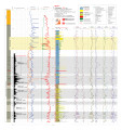
Asphalt Wash 1 (U086) - Plate 9 | 2014 | Green River Formation; well log; core log; Asphalt Wash 1; plate 9 | |
| 5 |
 |
Basin-wide evaluation of the uppermost Green River Formation's oil-shale resource, Uinta Basin, Utah and Colorado | 2008 | Green River; Uinta Basin; Utah; Colorado; Crude oil; Green River Formation; Oil; Gas; Oil yield; Oil shale; Oil-shale thickness; Mahogany zone; R-7; Parachute Creek Member; Richness grade; Uintah County; Salt Lake Base Line and Meridian; BLM; U.S. Bureau of Land Management | Due to the recent increase in crude oil prices and concerns over diminishing conventional reserves, the Utah Geological Survey has reexamined the Uinta Basin's oil-shale resource, primarily in the Mahogany zone of the Green River Formation. Past assessments, the first conducted in 1964 and subsequen... |
| 6 |
 |
Clean and secure energy from domestic oil shale and oil sands resources: Quarterly progress report: January 1, 2010 to March 31, 2010 | 2010-05-13 | ICSE; University of Utah; CO2 capture; Mahogany zone; Green River Formation; Utah; Uinta Basin; Oil sands; Crude oil refining; International Flame Research Foundation; Liquid fuel production; In-situ thermal treatment; Oil shale; Pyrolysis | The Clean and Secure Energy from Domestic Oil Shale and Oil Sands Resources program is part of the research agenda of the Institute for Clean and Secure Energy (ICSE) at the University of Utah. In this quarter, the Clean and Secure Energy program continued its focus on enhancing industrial, national... |
| 7 |
 |
Clean and secure energy from domestic oil shale and oil sands resources: Quarterly progress report: October 2012 to December 2012 | 2013-01 | ICSE; Oil shale; oil sands; CO2 management; Uinta Basin; Liquid fuel production; In-situ thermal processing; White River oil shale; Green River Formation; American Shale Oil; AMSO; X-ray flourescence; Pyrolysis; Demineralized kerogen | The Clean and Secure Energy from Domestic Oil Shale and Oil Sands Resources program, part of the research agenda of the Institute for Clean and Secure Energy (ICSE) at the University of Utah, is focused on engineering, scientific, and legal research surrounding the development of these resources in ... |
| 8 |
 |
Constructing a basin-scale geologic model | 2013-05-07 | Unconventional fuels; Green River Formation; Uinta Basin; Geologic model; Workflow; Reservoir; Basin-scale model | Presentation given at the University of Utah Unconventional Fuels Conference, Salt Lake City, Utah, May 7, 2013. |
| 9 |
 |
Core-based integrated sedimentologic, stratigraphic, and geochemical analysis of the oil shale bearing Green River Formation, Uinta Basin, Utah | 2011-04 | Utah; Green River Formation; Lake Uinta; Mahogany zone; Lake evolution; Oil shale development; Uinta Basin | An integrated detailed sedimentologic, stratigraphic, and geochemical study of Utah's Green River Formation has found that Lake Uinta evolved in three phases 1) a freshwater rising lake phase below the Mahogany zone, 2) an anoxic deep lake phase above the base of the Mahogany zone and 3) a hypersali... |
| 10 |
 |
Depositional heterogeneity and fluid flow modeling of the oil shale interval of the Upper Green River Formation, Eastern Uinta Basin, Utah | 2008-03-12 | Green River Formation; Eastern Uinta Basin; Utah; Oil shale; Sedimentology; Sequence stratigraphy; Mahogany zone; Depositional heterogeneity; Fluid flow modeling | Discussion of depositional and sequence stratigraphic characterization of the upper Green River Formation based on core and well log correlation and production modeling of the richest zone (Mahogany) based on sedimentological and other information. |
| 11 |
 |
EX-1 Plate 3 | 2014 | plate 3; well log; Green River Formation; core log | |
| 12 |
 |
Interpretation of fischer assay data for the evaluation of analcime-bearing oil shale in the Green River Formation, Colorado and Utah | 1975 | fischer assay data; analcime-bearing oil shale; Green River Formation; potential oil yeild of sediments | Using Fischer assay data, an empirical method has been devised for distinguishing analcime-rich oil shale from oil shale which is essentially free of analcime in the Parachute Creek Member, Green River Formation, Colorado and Utah. This method permits evaluation of Fischer assay data in order to com... |
| 13 |
 |
Measured section, Green River Formation | 1977-09-05 | Green River Formation; Sunnyside Asphalt Quarry area | Sunnyside Asphalt Quarry area, Carbon Co., Utah, September 5-8, 1977, by Jock A. Campbell, assisted by Craig R. Dixon. |
| 14 |
 |
Mechanism of low-temperature water evolution from Green River Formation oil shale | 1989-04 | low-temperature water evolution; Green River Formation; oil shale; Mahogany Zone | The water evolved from Green River Formation oil shale (Mahogany Zone) at temperatures between 150 and 400°C as heated at the rate of 4°C/min results from analcime dehydration, and its rate of evolution is affected by the kinetics of dehydration, the transport of water inside and outside oil shale... |
| 15 |
 |
Mineralogy of oil shale in the upper part of Parachute Creek member of the Green River Formation in the Eastern Uinta Basin, Utah | 1976 | Parachute Creek; Green River Formation; Uinta Basin; Utah; X-ray diffraction; Oil shale; Curly bed; Wavy bed tuffs; Mahogany zone; Naval Oil Shale Reserve No. 2; Federal Prototype Oil Shale Leas Tract Ua; Smectite; Mineralogy | The relative abundance and distribution of major and minor minerals have been determined by X-ray diffraction for samples of Green River Formation oil shale in three drill cores from the eastern part of the Uinta Basin, Utah. The samples in each core are from the same rock stratigraphic interval bet... |
| 16 |
 |
Mono Power Company: Sunnyside tar sands project--1983 geologic evaluation | 1984-03 | Mono Power; Sunnyside, Utah; Range Creek; Bruin Point; Whitmore Canyon; Uinta Basin; Wasatch Formation; Green River Formation; Mono Power's Sunnyside tar sand leases | This report presents the results of the 1983 geologic evaluation which M-K performed on Mono Power's tar sand leases near Sunnyside, Utah. The project's scope of work involved: - P. R. Spring Drilling - Sunnyside Drilling - Logging and Sampling - Assaying and Testing - Surveying - Aerial Photography... |
| 17 |
 |
North-South core-based cross section through the middle to upper Green River Formation, Uinta Basin, Utah - Plate 2 | 2014 | oil shale; economic oil shale; oil shale zone; cross section; Green River Formation; well log; core log | The top of economic oil shale was picked at the top of the lower R-8 zone (top of the Big Three rich oil shale beds). This zone was selected to avoid the abundant saline minerals found in the overlaying saline zone, which often contains high-TDS water. If saline minerals (and high-TDS water) do not ... |
| 18 |
 |
Occurrence of biomarkers in Green River shale oil | 1983-03 | Biomarkers; Biological markers; Shale oils; In-situ retorting; Green River Formation | Biological markers, compounds derived essentially unchanged from living organisms, are found in oil-bearing rocks, petroleum and most ancient sediments. We are investigating the variation in ratios of certain biomarkers in shale oils and their use as tracers for relating oil to source rock during in... |
| 19 |
 |
Oil-impregnated sandstone mapping project Nine Mile Canyon area Carbon and Duchesne Counties, Utah: A field examination for the Utah Geological Survey | 1971-10-04 | Tributaries; Nine Mile canyon; Argyle canyon; Uinta Basin; Deltaic facies; Green River Formation; Parachute Creek | A reconnaissance survey of tributaries to Nine Mile and Argyle canyons in the southern Uinta Basin showed widespread but erratic distribution of oil-impregnated sandstones. The occurrences are mainly in the Deltaic facies of the Green River formation. The bituminous material is believed to have been... |
| 20 |
 |
Oil-impregnated sandstones of Raven Ridge, Vernal, Utah | 1972 | Oil-impregnated sandstone; Raven Ridge; Vernal, Utah; Uinta Basin; Utah; Colorado; Wasatch Formation; Green River Formation; Uinta Formation | The area of this report is in the northeastern part of the Uinta Basin of northeastern Utah and northwestern Colorado. The area covers approximately 52 square miles of what is regionally called Raven Ridge. Raven Ridge, a series of hogback ridges, trends northwest-southeast, and includes three Eocen... |
| 21 |
 |
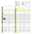
P4 Plate 6 | 2014 | well log; core log; plate 6; P4; White River Shale Project; Green River Formation | |
| 22 |
 |
Red Wash 1 (U045) - Plate 8 | 2014 | plate 8; Red Wash 1; well log; core log; Green River Formation | |
| 23 |
 |
Redwash 1 XRF depth plots | 2014 | depth plots; Green River Formation; XRF | |
| 24 |
 |
Skyline 16 - Plate 7 | 2014 | well log; core log; Skyline 16; plate 7; Green River Formation | |
| 25 |
 |
Skyline 16 information | 2015-07 | Skyline 16; preliminary stratigraphy of Skyline 16; Green River Formation; Protecore samples |
