| Publication Type |
thesis |
| School or College |
College of Mines & Earth Sciences |
| Department |
Geology & Geophysics |
| Author |
Brox, George Stanley |
| Title |
The geology and erosional development Northern Bryce Canyon National Park |
| Date |
1961 |
| Description |
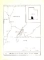
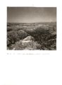
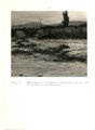
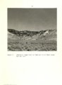
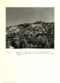
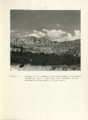
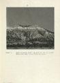
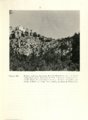
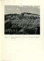
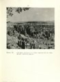
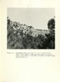
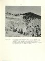
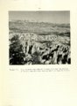
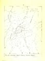
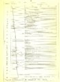
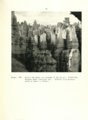
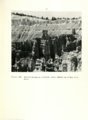
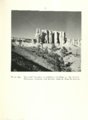
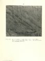
Bryce Canyon National Park lies on the eastern rim of the Paunsaugunt Plateau in southern Utah. The major portion of the park lies within Garfield County while the southern Portion extends into northern Kane COU11.t.Yo The northern portion encompasses the adjoining portions of Townships 36 and 37 South Ranges 3 and 4 West:) Salt Lake Base and Meridian (Figure 1)., A topographic map of Bryce Canyon is available from the United States Geological Survey, Department of the Interior. |
| Type |
Text |
| Publisher |
University of Utah |
| Subject |
Geology; Utah; Bryce Canyon National Park Erosion; Utah; Bryce Canyon National Park |
| Dissertation Name |
Master of Science |
| Language |
eng |
| Rights Management |
(c) George Stanley Brox |
| Format Medium |
application/pdf |
| ARK |
ark:/87278/s68w8057 |
| Setname |
ir_etd |
| ID |
1440400 |
| Reference URL |
https://collections.lib.utah.edu/ark:/87278/s68w8057 |