| Title |
Columbia Reservation maps |
| Description |
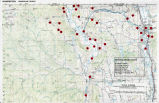
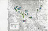
Twelve maps of the former Columbia Reservation in Washington State; Cover description document by "ERH" (E. Richard Hart) November 24, 1998 |
| Subject |
Indians of North America--Washington (State)--Land tenure--Maps; Sinkiuse-Columbia Indians--Land tenure--Maps; Colville Indians--Land tenure--Maps |
| Creator |
Hart, E. Richard |
| Additional Information |
Includes: Tribal territorial boundaries of the Okanogan. Methow. Chelan. Entiat and Wenatchi; The Columbia Reservation; The tribes of the Columbia Reservation; Villages; Similkameen Okanogan land use (key); Similkameen Okanogan land use; Trust lands on the Columbia Reservation, Southern portion; Village sites at allotments on the southern portion of the Columbia Reservation Wenatchi Allotments and Homesteads; Columbia Allotments in 1886; Columbia Allotments today |
| Spatial Coverage |
Columbia River Watershed; Columbia Plateau; Washington (State); Colville Indian Reservation (Wash.) |
| Collection Number and Name |
Accn1251 bx 379 fd 1; E. Richard Hart papers |
| Rights Management |
Digital Image Copyright 2009, University of Utah. All Rights Reserved. |
| Holding Institution |
J. Willard Marriott Library, University of Utah |
| Date |
1998-11-24 |
| Digitization Specifications |
Original scanned on Epson Expression 10000 XL and saved as 400 ppi Tiff. Display image generated in Contentdm. |
| Publisher |
Digitized by J. Willard Marriott Library, University of Utah |
| Type |
Text |
| ARK |
ark:/87278/s6416w1k |
| Setname |
wwdl_neh |
| ID |
1148498 |
| Reference URL |
https://collections.lib.utah.edu/ark:/87278/s6416w1k |


