| Title |
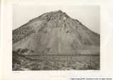
Report on the Geology of the High Plateaus of Utah, with Atlas |
| Creator |
Dutton, Clarence E. (Clarence Edward), 1841-1912. |
| Subject |
Geology; Rocks, Igneous |
| Publisher |
Washington, Govt. Print. Off., 1879-80. |
| Date |
1879; 1880 |
| Type |
Text |
| Format |
application/pdf |
| Digitization Specifications |
Originals scanned on Epson Expression 10000 XL flatbed scanner and saved as 400 ppi uncompressed tiffs. Display image created in PhotoshopCS as jpegs 800 pixels in width. |
| Language |
eng |
| Rights Management |
Digital image copyright 2007, University of Utah. All rights reserved. |
| Holding Institution |
Western Americana, J. Willard Marriott Library, University of Utah (801) 581-8863 |
| Source Physical Dimensions |
24 cm x 30 cm |
| Scanning Technician |
Louise Radcliffe |
| Call Number |
I17.2: Ut1 |
| ARK |
ark:/87278/s6ms3rp7 |
| Setname |
wwdl_books |
| ID |
1132777 |
| Reference URL |
https://collections.lib.utah.edu/ark:/87278/s6ms3rp7 |


