| OCR Text |
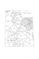
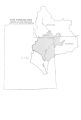
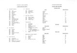
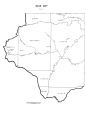
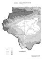
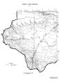
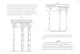
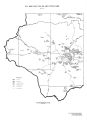
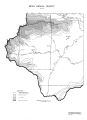
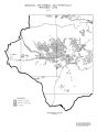
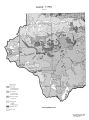
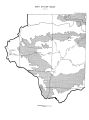
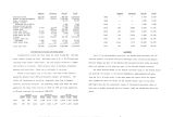
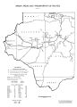
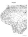
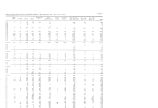
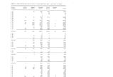
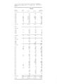
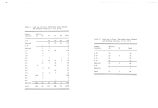
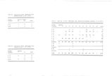
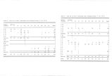
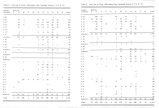
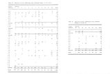
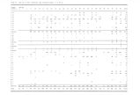
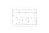
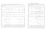
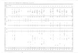
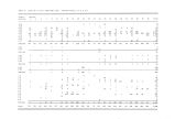
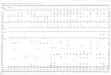
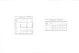
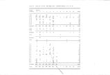
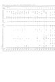
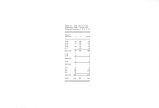
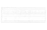
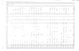
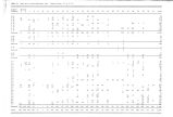
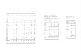
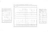
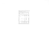
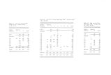
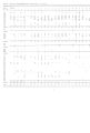
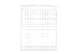
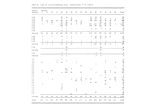
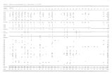
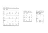
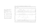
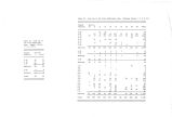
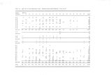
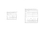
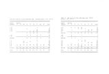
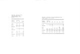
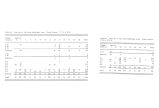
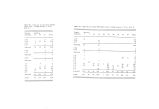
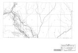
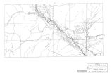
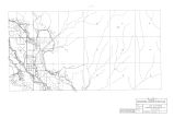
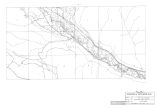
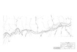
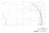
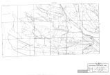
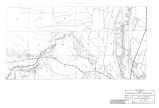
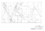
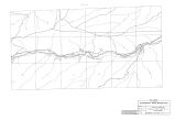
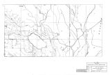
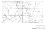
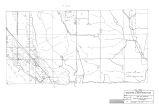
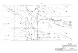
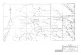
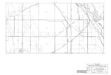
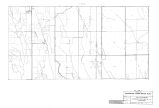
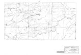
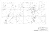
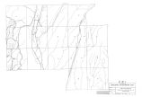
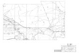
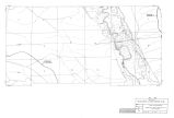
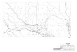
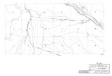
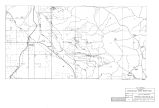
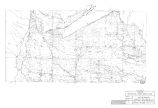
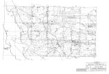
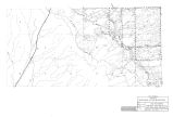
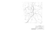
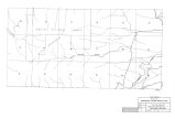
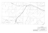
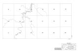
Show Daggett Duchesne Uintah Total National Forest 235,309 739,414 268,053 1 ,242,776 Bureau of Land Management 110,117 212,414 1,438,405 1 ,760,936 Depte of Defense 93,376 93,376 Bureau of Sport Fisheries and Wildlife 7,448 7,448 National Park Service 47,989 47,989 Bureau of Reclamation 2,915 28,769 1,258 32,942 Indian Land 204,164 411,023 651,187 State Land Board 21,058 48,108 230,775 299,941 State Fish and Game 3,113 26,310 1,848 31,271 State Parks and Rec. 84 2 86 Private 63,552 783,587 349,931 1 ,197,070 Cities, Towns and Railroads 2,066 4,317 10,576 16,959 Small Water Areas 550 733 1,396 2,679 Total Land Area 438,680 2,083,900 2,862,080 5. ,384,660 Transportation Routes and Urban Areas Transportation routes and urban areas are shown on map # 16. The only major highway through the Uinta Hydrologic Area is U. S. 40 although good secondary roads connect urban areas0 The only airport served by a commercial airline is in Vernal. Small airports exist at Duchesne, Roosevelt, Bonanza, and Dutch John. There are no railroads in the area. Vernal is the largest city in the area. The other cities having a population greater than 1,000 are Roosevelt, Maeser, and Duchesne. Virtually all inhabitants of the Uinta Hydrologic Area live in Daggett, Duchesne, and Uintah Counties. The following tables show urban and rural population for these three counties in 1960 and 1970 and total population at 10- year intervals for the period 1890- 1970. Daggett Duchesne Uintah Urban Rural Total Urban Rural Total Urban Rural Total 1970 226 440 666 4,520 2,779 7,299 6,851 5,833 12,684 1960 329 835 1,164 4,075 3,104 7,179 6,279 5,303 11,582 Daggett Duchesne Uintah Total 1890 1900 1910 1920 400 9,093 2,762 2,762 6,458 6,458 7,050 7,050 8,470 17,963 9,035 17,709 9,898 19,420 10,300 18,798 11,582 19,925 1930 411 8,263 1940 564 8,958 1950 364 8,134 1960 1,164 7,179 1970 666 7,299 12,684 20,649 LANDFORMS Parts of two physiographic provinces, the Middle Rocky Mountains and the Colorado Plateau, lie within the Uinta Hydrologic Area. The Uinta and Wasatch Mountain Ranges are part of the Middle Rocky Mountain Province while the Uinta Basin and plateaus to the south are part of the Colorado Plateau Province. The Uinta Mountain Range is the largest east- west range in the United States and possibly the largest in the Western Hemisphere. Approximately 150 miles long and 30 to 40 miles wide, it has many peaks and crests which are higher than 12,000 feet above sea level. In the extreme western part of the Uinta Hydrologic Area lie the easternmost ranges of the Wasatch Mountains. Most of this area is highly dissected and lies between 7,000 and 10,000 feet above sea level. |