| OCR Text |
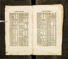
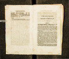
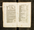
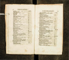
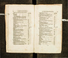
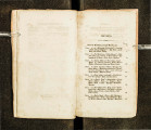
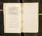
Show 50 GUIDE TO CALIFORNIA, Miry Do· • • • • Sweet Water River, (Take right hand road.) •••• • • • • . Sweet W nter, • • • • •••• Sage Creek, • • • • Good Camp, • • • ~ Creek, • • • • • • • • •• ••• •••• •••• Road leaves the River, • • • ·. ' Strikes it again (ford-2~ ft. deep,) Ford and rcford, •• •. • • •• Ford (some heavy road,) Ice sprmgs, • • • • • • • • Allmline Swamps, Ford, • · • • ••.•• Branch of Sweet water, Summit of hill, • • • • • • • • Ford, • • • • • • • • Reford, • • • • 1 • • • • Creek and spring (good camp,) Hilly road for, • • • • • • • • Creek, • • • • • • • • • ••• 2 Small creeks in next, Straw berry creek, • • • • • • • • Quaking Aspen creek, Branch of Sweet Water, (Moy 16th. 1850 10 feet snow.) Willow Creek, • • • • • • • • .Sweet W atcr ford South Pass, • • • • • • • • Pacific Springs, • • • • • • • • Do. Creel{, • • • • • • • • Dry Sandy (no water 1n this distance.) Junction of Oregon and Salt Lake roads, (R1ght hnnd road to Ft. Hall.) Little Sandy, • • • • • • • • Big Sandy, • • • • · • • • • · May 19, 1850-40 ft. wide-2~ ft. deep.) Green River, • • • • • • • • (No water in this distance·) Ford the river at the islands. Strike the upper pomt of first one, then lower pomt. of second one, then t~e shore. Bold stream, generally dangerous to cross. Muddy creelt, • • •. • • •·• • · · • · Branch of Green Rivel', {Road hilly and crooked.) . .J . . . 6 miles, 4 3 2 3 2 2 6 1~ 8 5! f 10 ~ lt 2 ~ 3 3 3 2 2 1 2! 21 4! 10-9~9 3 1 10 6 5 5 .. 35 BY THE OVERLAND ROUTE. 51 Fvrd of U.is branch, • • • • • ••• (May 21st, 1850-60 fee.t wide-3~ deep-current rapid.) ''Bluff~" (good camp,) Ham's Fork of Green River, (Road billy-water plenty.) (May 22nd, 60 feet wide-8ft. deep-cu r·rent rapid.) · Grove of 'rim.ber, •••• •••• Small stream, • • • • • ••• Bear River valley, • • • • • ••• (Small ~tream here to the right of the road.) T~omas' Fork of Bear (ford,) (Tt you cannot cross at the ordjnary fo.rd go. haifa m·ile higher up.) ' Branch (road good water plenty,) (May 27th, 40 feet wide-7ft. deep.) Foot of Bluffs, • • • • • ••• Bear River, ••• ·• • ••• Creek 2ft. deep (road good,) Camp (water plenty, road good) Beer or Soda Springs, Steamboat Springs, •••• · •••• Road leaves the River, (Take the right hand road to Ft. HalJ. The left _JS ''Hedgpeth's Cut-off" strikes the other · · roou nbout 70 miles be!ow Ft. Hall.) Small Stream nnd Voicanic Spring (Good Camping place.) • : • • Creek (Road good,) •••• M try Stream, • • • • • ••• Summit of Ridge, •••• • }.,t. Hall (marshy or sandy road ) Trading Statwn of Hudson's Bn~.. Co. Creek 60 ft. wide, •••• Ford of Port N euf {1 00 yds. wide--4" it' ~ deep,) • • • .. • Pan~ack River (somewhat miry,) •••• Spnng to the right of the road American F~ll on Lewis Rive:. Good cam ping place ( 2 or 3 ra ~ines) Small Rocky Stream ' Fall River ford (30 n: wide_:~ ·f~ dee • ) ••. Raft River ford (good camp ) · p, · Reford, • • • • ••••' (Oregon road bet ween these fords ) ' ~ 5 miles, 12 17 12 4 4 12 17 I 5 6 15 15 ~ 4-lJl)l 4 8 7 5 25-1200 5 3 4 7 6 4 10 I .6~ 7.t l |


