| OCR Text |
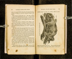
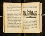
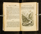
Show ' 122 NATIONAL WAGON ROAD GUIDE. HAM'S FORK.. . . . . . . . . . . . • ........••.•............ 3U Good camping. BLACI{'S FORK SECOND TIME .................. 1~ Now bad, uneven road, to SMITH'S FO Rl{. . . . . . . . . . . . . . . . ..•.. · ............. 10 No camping here. BLACI{'S FORK THIRD TIME ..................... 2 Fair grass and camping. BLACK'S FORI\: FOUl{TH TIME ................... 2 You will now cross two or three small creeks and reacn FORT RIDGER............... . .................... 14 You will now cross nutnerons small creeks, and high r~dges, to MUDDY FORI\: ...•......... ......................... 12 Good camping. Some springs of alkaline water ahead. HIGH RIDGE ....................................... 5~ The altitude of this ridge is 7,320 feet above the sea. One mile ahead is another alkaline spring, water not very bad; but by passing on four miles further you will find a spring of good, pure water on your left, and a little ahead another on your right. You 'vill now soon attain the highest elevation yet reached sinee leaving the States, 7, 710 feet above the sea. From high ridge, and on over this highest summit, and down to SULPHUR CREEK ............................. ..... 12 Good camping. A mile and a half south-west of this, is a celebrated mineral-oil spring. · BEAR RIVER. . . . . . . . . . . . . . . . . . . . . . . . . . . . . . . . . . . . . 1% A fine stream ; grass and wood abundant. YELLOW CREEK. . . . . . . . . . . . . . . . . . . . . . . . . . . . . . . . . . 9 You cross thi~ creek twice, then over a ridge, and down to . ECHO CREEK ....... : .............................. 5 Cache cave is but a short distance from this to the right of the road in the bluffs. You will now follow Echo • NATIONAL WAGON ROAD GUIDE. 123 k and valley crossing the creek 15 or 20 times' to cree . ' 20 ED FORK OF WEBER RIVE~ .. ········ .... · · ·: · ·. 1 There are two roads from this pomt to Salt Lake CI~Y' we gi. ve them both .' and first the right hand road, which is the shortest. Follow down the river to . 4 E FORD . . . . .............. . • • • • • • • • • • • • TH ~ .. : .... .y. ou will cross two small creeks before Good camping. reaching 10 EK ............... . CANON CRE · · · · · · · · · · · · · . . . . . . . · . d You will have to cross this creek a dozen times, an cross two swamps, before you . 7 ~ LEAVE CANON CREEK ............................ . ~ow over a high mountain~and down to 5 BROWN'S CREEl{................... . . . . ......... . Fair camping on this creek a little ahead. Now all ~orts d d . hilly rough and even mountanious, of a ba roa 'miry, ' k You now hard on teams and wagons' to Canon cree . . pass down a canon, crosst. ng the cre ek some 18 times over a miserably had road, and through, to 11 MOUTI-I OF CANON· · · · · · · · · · · · · · · · ............... . You have now reached Salt Lake Valley. TO SALT LAKE CITY· · · · · · · · · · · · ............... .. 5 We will now go back to R ed Fork o f W eb er river, and take the left hand road 5 ~ TO :FORI{ OF RED FORI{ · · .. · · · · ........ : . ...... . y' ou will cross two small streams before reachmg 10 DAVIS' FORK. · · · · •· · · · · · .. · · ' .. ' • • • • • • • • • • • • • • • • • 4 POPLAR CREEK· · · · · · · · · · · · · · ..... ' ............ h .. Now a bad road, crossing two creeks before you reac 18 CAN ON CREEl(· · · · · · · · · · · · · · · · : . ' . ' . . . . . . . • • • • • • • • 1 Ya TO HEAD OF CANON · · · · · · · · ............. k. . h. .. . N ow for miles down a canon, WI• th walls of roc und- dreds of feet high on e1. th er SI. de ., ov er· a very bad roa ' crossing a.nd re·cross1. ng f rom 8.1· de to side of the canon |