| Title |
Kennecott property facilities removal action site maps [part three] |
| File Number |
2107_049_003 |
| File Name |
2107_049_003.pdf |
| Description |
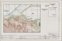
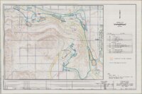
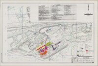
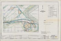
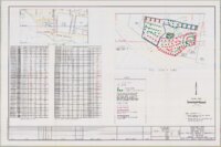
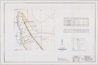
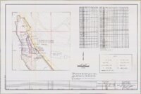
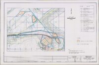
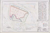
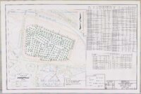
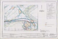
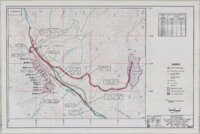
Maps showing various Superfund sites within the Kennecott Utah Copper Corporation's properties in western Salt Lake County, Utah, where soil removal took place in the mid-1990s. Includes the North Concentrator area; Smelter area; various Refinery area sites; Wastewater treatment plant; Butterfield Mine waste dumps (see box 39, folder 2). Also a facilities location map for the northern properties. Maps probably accompanied various reports in this collection. This digital file contains the entire contents of folder 3 from box 49 of the Supefund Records Center records collection. |
| Creator |
Kennecott Corporation |
| Date |
1992; 1996; 1997; 1998 |
| Spatial Coverage |
Salt Lake County, Utah, United States |
| Subject |
Hazardous waste site remediation--Utah--Salt Lake County--Maps; Soil pollution--Utah--Salt Lake County--Maps; United States. Comprehensive Environmental Response, Compensation, and Liability Act of 1980--Archives |
| Collection Number and Name |
Accn2107 Superfund Records Center records |
| Holding Institution |
Special Collections, J. Willard Marriott Library, University of Utah |
| Finding Aid |
https://archiveswest.orbiscascade.org/ark:80444/xv19958 |
| Type |
Image/StillImage |
| Genre |
reports |
| Format |
application/pdf |
| Language |
eng |
| Rights Management |
This digital file is comprised of multiple documents with varying copyright status. Users are responsible for determining the copyright status of these documents. |
| Rights |
 |
| ARK |
ark:/87278/s6qrffjd |
| Metadata Cataloger |
Ken Rockwell |
| Setname |
uum_srcr |
| ID |
2627621 |
| Reference URL |
https://collections.lib.utah.edu/ark:/87278/s6qrffjd |