| OCR Text |
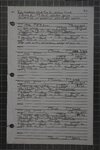
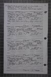
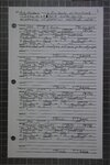
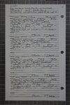
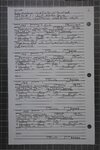
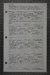
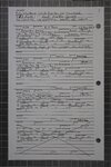
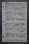
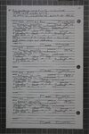
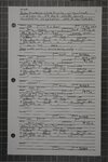
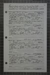
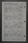
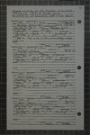
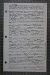
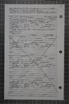
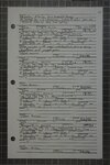
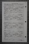
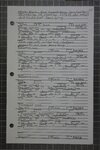
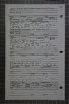
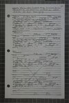
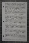
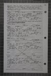
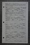
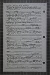
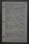
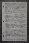
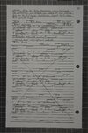
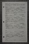
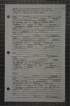
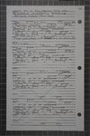
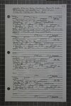
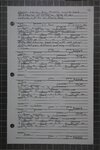
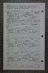
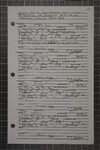
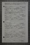
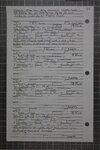
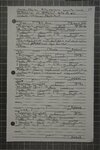
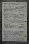
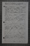
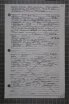
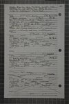
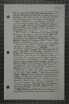
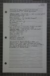
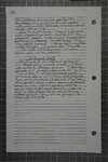
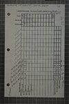
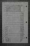
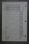
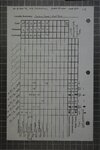
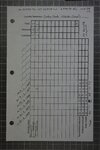
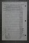
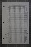
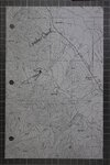
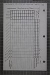
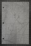
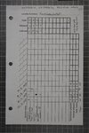
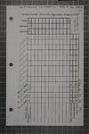
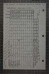
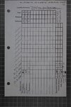
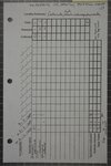
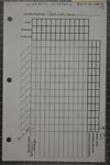
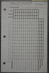
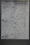
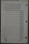
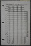
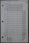
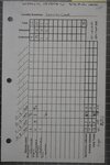
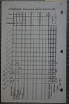
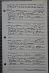
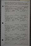
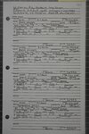
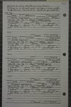
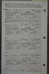
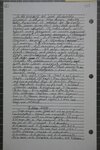
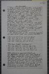
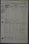
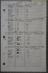
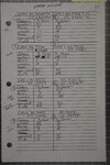
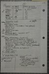
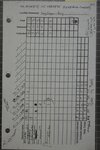
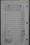
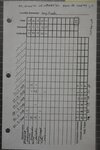
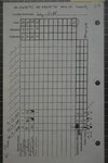
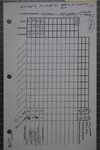
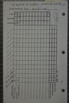
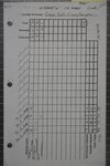
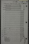
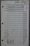
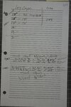
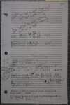
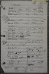
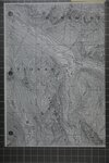
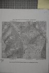
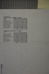
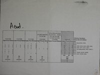
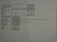
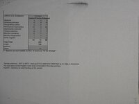
Show Long Creek (South Fork) Site Description: "We are located about 1/2 mile above the American Beauty Mine, which, according to the map and all information | can gather here, is 1.5 miles from a little lake which feeds long creek which is a tributary to the south fork of the Humboldt River.[AB pg 654] .... [he floor of the canyon and well up on the mtns is a solid mass (?) of aspen. In exposed places the aspen are much dwarfed and gs 8 gnarled (?). The willows along the creek are not over 4 ft high. The dryer slopes and ridges are covered with sage. Above the aspen are scattered limber pines and mt mahogany. Some of the dryer meadows are covered with a composite (?) called resin weed. Among aspen are chokecherry, service and snow berries and wild honey suckle" [AB pg 652] Trap Total snaps gophers steels vitae aire i etait eaten 34 33 35 34 unknown 1 34 oo unknown 1 & NO o—_— NOON DN W O CG) 2 BDO oO wo 4 4 NO — ead at & OD ao oO) NO © — Co. NO 7/6/1928 7/7/1928 7/8/1928 7/9/1928 7/10/1928 7/11/1928 Capture Process Releas Capture Proces Releasé Captur Proce Releas Captur Proc: Releag Captur Proces Releas Captur Proc Releas 1 0 1 © (A) Trap line/ Micro habitat: along creek under aspen, under wet overhanging banks, and among wet rocks Species Lemmiscus curtatus Microtus montanus Microtus longicaudus Peromyscus maniculatus sorex Sorex palustris Thomomys talpoides Zapus princeps ct (2429 m elev, 40.52321N, 115.44466W) No Nh [PT OOo LOWER te Based on site description we divided the trap lines into upper and lower. As listed on the first sheet, lines A and C = Lower and B and D = upper, near the bog & talus. Coordinates and elevations determined from the NV digital topo maps, NAD 27. |