|
|
Title | Date | Type |
| 201 |
 |
Petroglyphs; Story Rock, Deseret, Millard County, Utah [II] | 1926 | Image/StillImage |
| 202 |
|
Petroglyphs; Story Rock, Deseret, Millard County, Utah [III] | | Image/StillImage |
| 203 |
|
Petroglyphs; Story Rock, Deseret, Millard County, Utah [IV] | | Image/StillImage |
| 204 |
|
Petroglyphs; Story Rock, Deseret, Millard County, Utah [V] | | Image/StillImage |
| 205 |
|
Petroglyphs; Story Rock, Deseret, Millard County, Utah [VI] | | Image/StillImage |
| 206 |
|
Petroglyphs; Story Rock, Deseret, Millard County, Utah [VII] | | Image/StillImage |
| 207 |
|
Petroglyphs; Track Rock, Little Creek, Millard County, Utah | 1926 | Image/StillImage |
| 208 |
|
Petroglyphs; Vernal, Uintah County, Utah [I] | | Image/StillImage |
| 209 |
|
Petroglyphs; Vernal, Uintah County, Utah [II] | 1936; 1937; 1938; 1939; 1940; 1941; 1942; 1943; 1944 | Image/StillImage |
| 210 |
|
Petroglyphs; Vernal, Uintah County, Utah [III] | 1936; 1937; 1938; 1939; 1940; 1941; 1942; 1943; 1944 | Image/StillImage |
| 211 |
|
Petroglyphs; Vernal, Uintah County, Utah [IV] | 1936; 1937; 1938; 1939; 1940; 1941; 1942; 1943; 1944 | Image/StillImage |
| 212 |
|
Petroglyphs; Vernal, Uintah County, Utah [IX] | 1936-07 | Image/StillImage |
| 213 |
|
Petroglyphs; Vernal, Uintah County, Utah [V] | 1936; 1937; 1938; 1939; 1940; 1941; 1942; 1943; 1944 | Image/StillImage |
| 214 |
|
Petroglyphs; Vernal, Uintah County, Utah [VI] | 1936; 1937; 1938; 1939; 1940; 1941; 1942; 1943; 1944 | Image/StillImage |
| 215 |
|
Petroglyphs; Vernal, Uintah County, Utah [VII] | 1936-07 | Image/StillImage |
| 216 |
|
Petroglyphs; Vernal, Uintah County, Utah [VIII] | 1936; 1937; 1938; 1939; 1940; 1941; 1942; 1943; 1944 | Image/StillImage |
| 217 |
|
Petroglyphs; Vernal, Uintah County, Utah [X] | 1936; 1937; 1938; 1939; 1940; 1941; 1942; 1943; 1944 | Image/StillImage |
| 218 |
|
Petroglyphs; Vernal, Uintah County, Utah [XI] | 1936 | Image/StillImage |
| 219 |
|
Petroglyphs; Vernal, Uintah County, Utah [XII] | 1936; 1937; 1938; 1939; 1940; 1941; 1942; 1943; 1944 | Image/StillImage |
| 220 |
|
Petroglyphs; Vernal, Uintah County, Utah [XIII] | 1936; 1937; 1938; 1939; 1940; 1941; 1942; 1943; 1944 | Image/StillImage |
| 221 |
 |
Restored homes; Lost City, Nevada | 1958 | Image/StillImage |
| 222 |
|
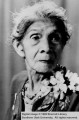
Ruth and Luther Frank; Cedar City, Iron County, Utah | 1936 | Image/StillImage |
| 223 |
|
Shivwits at Presbyterian church with house at right; Santa Clara, Washington County, Utah | 1935 | Image/StillImage |
| 224 |
|
Six men and blanket; Lees Ferry, Arizona | 1936 | Image/StillImage |
| 225 |
|
Six men seated in a circle; Lees Ferry, Arizona | 1936 | Image/StillImage |