Home
Browse
Ask Us
Chat
Harmful Language Statement
Log in
Advanced Search
Year
1845
1846
1847
1848
1849
1850
1851
1852
1853
1854
1855
1856
1857
1858
1859
1860
1861
1862
1863
1864
1865
1866
1867
1868
1869
1870
1871
1872
1873
1874
1875
1876
1877
1878
1879
1880
1881
1882
1883
1884
1885
1886
1887
1888
1889
1890
1891
1892
1893
1894
1895
1896
1897
1898
1899
1900
1901
1902
1903
1904
1905
1906
1907
1908
1909
1910
1911
1912
1913
1914
1915
1916
1917
1918
1919
1920
1921
1922
1923
1924
1925
1926
1927
1928
1929
1930
1931
1932
1933
1934
1935
1936
1937
1938
1939
1940
1941
1942
1943
1944
1945
1946
1947
1948
1949
1950
1951
1952
1953
1954
1955
1956
1957
1958
1959
1960
1961
1962
1963
1964
1965
1966
1967
1968
1969
1970
1971
1972
1973
1974
1975
1976
1977
1978
1979
1980
1981
1982
1983
1984
1985
1986
1987
1988
1989
1990
1991
1992
1993
1994
1995
1996
1997
1998
1999
2000
2001
2002
2003
2004
2005
2006
2007
2008
2009
2010
2011
2012
2013
2014
2015
TO
1845
1846
1847
1848
1849
1850
1851
1852
1853
1854
1855
1856
1857
1858
1859
1860
1861
1862
1863
1864
1865
1866
1867
1868
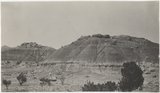
1869
1870
1871
1872
1873
1874
1875
1876
1877
1878
1879
1880
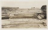
1881
1882
1883
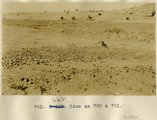
1884
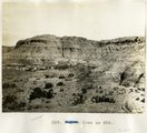
1885
1886
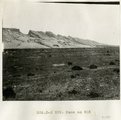
1887
1888
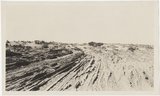
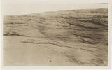
1889
1890
1891
1892
1893
1894
1895
1896
1897
1898
1899
1900
1901
1902
1903
1904
1905
1906
1907
1908
1909
1910
1911
1912
1913
1914
1915
1916
1917
1918
1919
1920
1921
1922
1923
1924
1925
1926
1927
1928
1929
1930
1931
1932
1933
1934
1935
1936
1937
1938
1939
1940
1941
1942
1943
1944
1945
1946
1947
1948
1949
1950
1951
1952
1953
1954
1955
1956
1957
1958
1959
1960
1961
1962
1963
1964
1965
1966
1967
1968
1969
1970
1971
1972
1973
1974
1975
1976
1977
1978
1979
1980
1981
1982
1983
1984
1985
1986
1987
1988
1989
1990
1991
1992
1993
1994
1995
1996
1997
1998
1999
2000
2001
2002
2003
2004
2005
2006
2007
2008
2009
2010
2011
2012
2013
2014
2015
Type
Image
3,908
Format
image/jpeg
3,908
Collection
Beckwith Photograph Collection
2
City Engineers
124
Classified Photographs
71
Extractions from the Land: Mining and...
51
Hotel Utah
133
Murray Museum
8
Park City Historical Society & Museum
98
Peoples of Utah Revisited
2
Photo Archives
2,565
Regional History Center
101
Richard K. A. Kletting Architectural ...
27
Sanborn Fire Insurance Maps
12
Sanborn Fire Insurance Maps, Division...
2
Shipler Commercial Photographers
363
Ski and Snow Sports Archives
121
Taylor Woolley Photograph Collection
2
Thorne Photographs
29
University Archival Photographs (P0305)
44
Utah Postcards Collection, 1880s-1924
3
Utah River Running Photo Archives
56
Vernal Express Photographs
1
Westminster College Photographs
9
William Edward Hook Glass Negatives
84
More
Filters:
Date:
"1913"
Type:
"Image"
Format:
"image/jpeg"
Setname:
!(ir* OR ehsl*)
201
-
225
of
3,908
<
4
5
6
7
8
9
10
11
12
13
>
Gallery view
Number of results to display per page
10
25
50
100
200
Sort by Relevance
Sort by Title A-Z
Sort by Title Z-A
Sort by Date Ascending
Sort by Date Descending
Sort by Last Modified Ascending
Sort by Last Modified Descending
Title
Date
Type
Setname
201
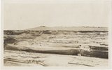
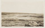
Grand Falls, panorama (Photos G415)
1913
Image
uum_map
202
Grand Falls, panorama (Photos G416)
1913
Image
uum_map
203
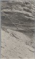
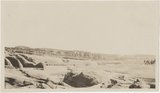
Gypsum in Permian. 2± mi. east of Holbrook (Photo G402)
1913
Image
uum_map
204
Peneplain; looking southeast from cliffs 5± mi. N 80 deg E, Black Falls (Photo N-M176 and G423)
1913
Image
uum_map
205
View from "Beast" dike north across Red Lake (Photo G391)
1913
Image
uum_map
206
View looking northeast up Black Creek from "Beast" dike (Photo G392)
1913
Image
uum_map
207
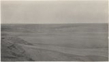
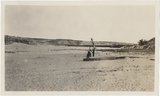
Waterhole in desert 1± mi. below Sunrise Spgs. (Photo G395)
1913
Image
uum_map
208
Wind carving Kaibab 2 mi. above Tolchaco (Photo G414)
1913
Image
uum_map
209
Wind erosion, La Plata, Tuba (Photo G435)
1913
Image
uum_map
210
Dolores Badlands 1 1/2 mile west of Nashlini. (I-5 & I-7 in film book just like this) (Photo N-M135)
1913
Image
uum_map
211
Same as 627 (LaPlata cross-bedding, Totocong, Photo G332)
1913
Image
uum_map
212
Totocong Spg., Chinlee valley, below Tsenakahn. LaPlata cross-bedding (Photo G331)
1913
Image
uum_map
213
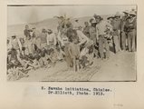
Navajo initiation, Chinlee. Dr. Elliott, Photo. 1913.
1913
Image
uum_map
214
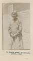
Navajo woman. Dr. Elliott, photo. 1913.
1913
Image
uum_map
215
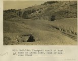
Prospect shaft at east base of Laden Peak, head of Des-chee Creek
1913
Image
uum_map
216
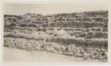
Ripple marks and mud cracks. At LaPlata-Dolores contact 6 mi. east of Tanners Crossing.
1913
Image
uum_map
217
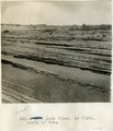
Rock floor, La Plata, north of Tuba
1913
Image
uum_map
218
Rock floor, La Plata, north of Tuba
1913
Image
uum_map
219
Same as 790 & 791 [Desert pavement between Red Lake and Tuba]
1913
Image
uum_map
220
Same as 826 ["Painted Desert", four miles west of Tuba]
1913
Image
uum_map
221
Same as 827 ["Painted Desert", 2 mi. west of Tuba]
1913
Image
uum_map
222
Same as 835 [La Plata in Marsh Pass]
1913
Image
uum_map
223
Same as 835 [La Plata in Marsh Pass]
1913
Image
uum_map
224
Sand dune and rock floor north of Tuba
1913
Image
uum_map
225
Sand dune on mesa east of Tuba
1913
Image
uum_map
201
-
225
of
3,908
<
4
5
6
7
8
9
10
11
12
13
>