| Title | Date | Type | Setname | ||
|---|---|---|---|---|---|
| 176 |
 |
Cat Creek & Pebble Puppy Placer Gold Claims, Uintah County, Utah 1994 | 1994 | Image/StillImage | ucl_maps |
| 177 |
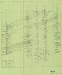 |
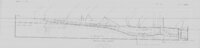
NW-SE Electric Log Cross Profile A-A Bluebell to Gusher, Upper Green River Sand Development 1958 | 1958 | Image/StillImage | ucl_maps |
| 178 |
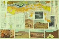
 |
Geological Map of the Dinosaur National Monument | 1965 | Image/StillImage | ucl_maps |
| 179 |
 |
Geological Map DNM Quarry | 1979 | Image/StillImage | ucl_maps |
| 180 |
 |
Geologic Map of the Blue Mountain Area 1963 | 1963 | Image/StillImage | ucl_maps |
| 181 |
 |
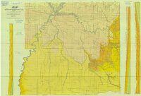
Index To Geologic Atlas of Utah - Daggett County - 1950s | 1950; 1951; 1952; 1953; 1954; 1955; 1956; 1957; 1958; 1959 | Image/StillImage | ucl_maps |
| 182 |
 |
Geologic Map of Uintah County, Utah - North Half - 1950s | 1950; 1951; 1952; 1953; 1954; 1955; 1956; 1957; 1958; 1959 | Image/StillImage | ucl_maps |
| 183 |
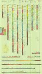 |
Surficial Deposits and Ingenious Rocks 1980 | 1980 | Image/StillImage | ucl_maps |
| 184 |
 |
Geologic Map of Uintah County, Utah - South Half - 1950s | 1950; 1951; 1952; 1953; 1954; 1955; 1956; 1957; 1958; 1959 | Image/StillImage | ucl_maps |
| 185 |
 |
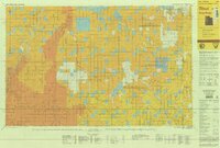
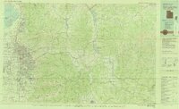
Dutch John, Utah 1997 | 1997 | Image/StillImage | ucl_maps |
| 186 |
 |
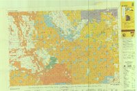
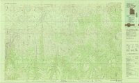
Seep Ridge, Utah 1999 | 1999 | Image/StillImage | ucl_maps |
| 187 |
 |
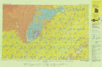
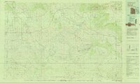
Vernal, Utah 1993 | 1993 | Image/StillImage | ucl_maps |
| 188 |
 |
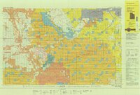
Westwater, Utah-Colorado 1981 | 1980; 1981 | Image/StillImage | ucl_maps |
| 189 |
 |
Seep Ridge, Utah-Colorado 1982 | 1981; 1982 | Image/StillImage | ucl_maps |
| 190 |
 |
Dutch John, Utah-Colorado-Wyoming 1982 | 1981; 1982 | Image/StillImage | ucl_maps |
| 191 |
 |
Vernal, Utah-Colorado 1982 | 1980; 1982 | Image/StillImage | ucl_maps |
| 192 |
 |
Dutch John, Utah-Colorado-Wyoming 1981 | 1981 | Image/StillImage | ucl_maps |
| 193 |
 |
Kings Peak, Utah-Wyoming 1982 | 1982 | Image/StillImage | ucl_maps |
| 194 |
 |
Price, Utah 1980 | 1980 | Image/StillImage | ucl_maps |
| 195 |
 |
Salt Lake City, Utah-Wyoming 1980 | 1980 | Image/StillImage | ucl_maps |
| 196 |
 |
Seep Ridge, Utah-Colorado 1981 | 1981 | Image/StillImage | ucl_maps |
| 197 |
 |
Vernal, Utah-Colorado 1980 | 1980 | Image/StillImage | ucl_maps |
| 198 |
 |
Taylor Mountain Formations | Image/StillImage | ucl_maps | |
| 199 |
 |
Wasatch US DOI BLM 1973 | 1973 | Image/StillImage | ucl_maps |
| 200 |
 |
Wah Wah US DOI BLM 1978 | 1978 | Image/StillImage | ucl_maps |