Home
Browse
Ask Us
Chat
Harmful Language Statement
Log in
Advanced Search
Year
1873
1874
1875
1876
1877
1878
1879
1880
1881
1882
1883
1884
1885
1886
1887
1888
1889
1890
1891
1892
1893
1894
1895
1896
1897
1898
1899
1900
1901
1902
1903
1904
1905
1906
1907
1908
1909
1910
1911
1912
1913
1914
1915
1916
1917
1918
1919
1920
1921
1922
1923
1924
1925
1926
1927
1928
1929
1930
1931
1932
1933
1934
1935
1936
1937
1938
1939
1940
1941
1942
1943
1944
1945
1946
1947
1948
1949
1950
1951
1952
1953
1954
1955
1956
1957
1958
1959
1960
1961
1962
1963
1964
1965
1966
1967
1968
1969
1970
1971
1972
1973
1974
1975
1976
1977
1978
1979
1980
1981
1982
1983
1984
1985
1986
1987
1988
1989
1990
1991
1992
1993
1994
1995
1996
1997
1998
1999
2000
2001
2002
TO
1873
1874
1875
1876
1877
1878
1879
1880
1881
1882
1883
1884
1885
1886
1887
1888
1889
1890
1891
1892
1893
1894
1895
1896
1897
1898
1899
1900
1901
1902
1903
1904
1905
1906
1907
1908
1909
1910
1911
1912
1913
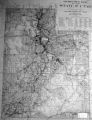
1914
1915
1916
1917
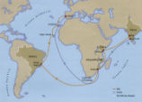
1918
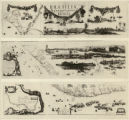
1919
1920
1921
1922
1923
1924
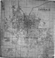
1925
1926
1927
1928
1929
1930
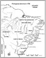
1931
1932
1933
1934
1935
1936
1937
1938
1939
1940
1941
1942
1943
1944
1945
1946
1947
1948
1949
1950
1951
1952
1953
1954
1955
1956
1957
1958
1959
1960
1961
1962
1963
1964
1965
1966
1967
1968
1969
1970
1971
1972
1973
1974
1975
1976
1977
1978
1979
1980
1981
1982
1983
1984
1985
1986
1987
1988
1989
1990
1991
1992
1993
1994
1995
1996
1997
1998
1999
2000
2001
2002
Type
Image
269
Image/StillImage
140
Text
5
Format
image/jpeg
413
Collection
Art and Art History
169
Beckwith Photograph Collection
8
Classified Photographs
62
Clifton Bray Film Negatives
10
Extractions from the Land: Mining and...
2
Olympic Legacy
5
Peoples of Utah Revisited
1
Photo Archives
12
Salt Lake Tribune Negative Collection
14
Shipler Collection Negative Preservat...
18
Shipler Commercial Photographers
6
Ski and Snow Sports Archives
1
UAIDA Main Collection
98
Vernal Express Photographs
2
Westminster College Photographs
5
More
Filters:
Subject:
"Maps"
Format:
image
176
-
200
of
413
<
3
4
5
6
7
8
9
10
11
12
>
Gallery view
Number of results to display per page
10
25
50
100
200
Sort by Relevance
Sort by Title A-Z
Sort by Title Z-A
Sort by Date Ascending
Sort by Date Descending
Sort by Last Modified Ascending
Sort by Last Modified Descending
Title
Date
Type
Setname
176
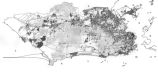
Map: Areas in northeast Brazil occupied by the Dutch, showing the main regions under Johan Maurits van Nassau's rule, 1637 - 1644
Image
uu_aah_art
177
Journal of Two Campaigns by the Utah Territorial Militia Against the Navajo Indians, 1869
1961
Text
uaida_main
178
Notes on the History of the Southern Paiutes and Western Shoshonis
1971
Text
uaida_main
179
Ute Indians: Before and after White Contact
1966
Text
uaida_main
180
Father Escalante's Map
1941
Text
uaida_main
181
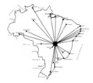
New Hydrographic and Geographic Map of Brazil, containing the Provinces of Ciriji, with Itapuama in Paranambuca, Itamaraca, Paraiba, and Potigi to the Rio Grande
Image
uu_aah_art
182
Map of America
Image
uu_aah_art
183
Map: Pedro Álvares Cabral's Voyage to and from India with the discovery of Brazil
Image
uu_aah_art
184
Map: Portuguese Voyage Routes, 15th and 16th Century CE
Image
uu_aah_art
185
Map: Rio de Janeiro
Image
uu_aah_art
186
Map: Distances between Brasilia and other major Brazilian cities
Image
uu_aah_art
187
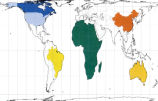
Peters Projection Map of the World
Image
uu_aah_art
188
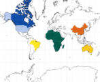
Mercator's Map of the World
Image
uu_aah_art
189
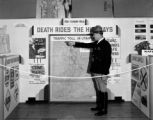
Safety Exhibit at Coconut Grove, Apr. 1938
1938-04-07
Image
dha_cbfm
190
Safety Exhibit at Coconut Grove, Apr. 1938
1938-04-07
Image
dha_cbfm
191
Map, July 1938
1938-07-12
Image
dha_cbfm
192
Map, Mar. 1938
1938-03-03
Image
dha_cbfm
193
Map, Mar. 1938
1938-03-03
Image
dha_cbfm
194
Map, Mar. 1938
1938-03-03
Image
dha_cbfm
195
Map, July 1938
1938-07-12
Image
dha_cbfm
196
Map, May 1938
1938-05-16
Image
dha_cbfm
197
Map: Portuguese America in 1750
Image
uu_aah_art
198
Map on Wall at Walgreen Drug Store, May 1936
1936-05-28
Image
dha_cbfm
199
Map on Wall at Walgreen Drug Store, May 1936
1936-05-28
Image
dha_cbfm
200
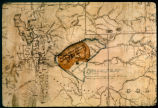
Map of Uintah Valley Reserve, formed by order of President Abraham Lincoln, 1861.
Image/StillImage
uaida_main
176
-
200
of
413
<
3
4
5
6
7
8
9
10
11
12
>