Home
Browse
Ask Us
Chat
Harmful Language Statement
Log in
Advanced Search
Year
1853
1854
1855
1856
1857
1858
1859
1860
1861
1862
1863
1864
1865
1866
1867
1868
1869
1870
1871
1872
1873
1874
1875
1876
1877
1878
1879
1880
1881
1882
1883
1884
1885
1886
1887
1888
1889
1890
1891
1892
1893
1894
1895
1896
1897
1898
1899
1900
1901
1902
1903
1904
1905
1906
1907
1908
1909
1910
1911
1912
1913
1914
1915
1916
1917
1918
1919
1920
1921
1922
1923
1924
1925
1926
1927
1928
1929
1930
1931
1932
1933
1934
1935
1936
1937
1938
1939
1940
1941
1942
1943
1944
1945
1946
1947
1948
1949
1950
1951
1952
1953
1954
1955
1956
1957
1958
1959
1960
1961
1962
1963
1964
1965
1966
1967
1968
1969
1970
1971
1972
1973
1974
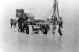
1975
1976
1977
1978
1979
1980
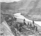
1981
1982
1983
1984
1985
1986
1987
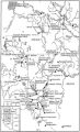
1988
1989
1990
1991
1992
1993
1994
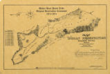
1995
1996
1997
1998
1999
2000
2001
2002
2003
2004
TO
1853
1854
1855
1856
1857
1858
1859
1860
1861
1862
1863
1864
1865
1866
1867
1868
1869
1870
1871
1872
1873
1874
1875
1876
1877
1878
1879
1880
1881
1882
1883
1884
1885
1886
1887
1888
1889
1890
1891
1892
1893
1894
1895
1896
1897
1898
1899
1900
1901
1902
1903
1904
1905
1906
1907
1908
1909
1910
1911
1912
1913
1914
1915
1916
1917
1918
1919
1920
1921
1922
1923
1924
1925
1926
1927
1928
1929
1930
1931
1932
1933
1934
1935
1936
1937
1938
1939
1940
1941
1942
1943
1944
1945
1946
1947
1948
1949
1950
1951
1952
1953
1954
1955
1956
1957
1958
1959
1960
1961
1962
1963
1964
1965
1966
1967
1968
1969
1970
1971
1972
1973
1974
1975
1976
1977
1978
1979
1980
1981
1982
1983
1984
1985
1986
1987
1988
1989
1990
1991
1992
1993
1994
1995
1996
1997
1998
1999
2000
2001
2002
2003
2004
Type
Image/StillImage
159
Format
image/jpeg
159
Collection
Al W. Morton Collection, 1930s-1950s
1
American Westward Migration
5
Classified Photographs
11
Multimedia Archives Photographs - Res...
1
Photo Archives
34
UAIDA Main Collection
17
Uintah County Regional History Center...
1
Utah River Running Photo Archives
89
More
Filters:
Type:
"Image/StillImage"
Spatial Coverage:
"Nevada"
Format:
image
Setname:
!(ir* OR ehsl*)
126
-
150
of
159
<
1
2
3
4
5
6
7
>
Gallery view
Number of results to display per page
10
25
50
100
200
Sort by Relevance
Sort by Title A-Z
Sort by Title Z-A
Sort by Date Ascending
Sort by Date Descending
Sort by Last Modified Ascending
Sort by Last Modified Descending
Title
Date
Type
Setname
126
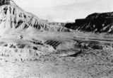
Tarantula Canyon p.1
1920; 1921; 1922; 1923; 1924; 1925; 1926; 1927; 1928; 1929; 1930
Image/StillImage
dha_cp
127
Pilot Peak p.1
1929; 1930
Image/StillImage
dha_cp
128
Bovine Peak, Nevada p.1
1940; 1941; 1942; 1943; 1944; 1945; 1946; 1947; 1948; 1949; 1950
Image/StillImage
dha_cp
129
Auerbach Bros. P.15
1863
Image/StillImage
dha_cp
130
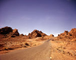
Valley of Fire
1950; 1951; 1952; 1953; 1954; 1955; 1956; 1957; 1958; 1959; 1960
Image/StillImage
dha_alwmc
131
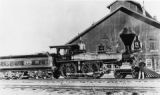
Central Pacific RR - Locomotives P.10
1891; 1892; 1893; 1894; 1895
Image/StillImage
dha_cp
132
Central Pacific RR - Locomotives P.9
1865; 1866; 1867; 1868; 1869
Image/StillImage
dha_cp
133
Telephone Lines P.5
1914
Image/StillImage
dha_cp
134
Telephone Lines P.7
1914
Image/StillImage
dha_cp
135
Telephone Lines P.8
1914
Image/StillImage
dha_cp
136
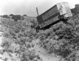
Central Pacific R.R. -- Construction P.16
1868
Image/StillImage
dha_cp
137
Goshute Indian Reservation Nevada and Utah
Image/StillImage
uaida_main
138
Figure 18: The western limit of the Gosiute, the east slope of the Steptoe Mountains in Nevada. View south toward Spring Valley
1939
Image/StillImage
uum_mapr
139
Map of Western Shoshone and Northern Paiute Territory
Image/StillImage
uaida_main
140
Boundary of Shoshone Indian Territory, showing the locations of the Bannock from 1819 to 1951
1957
Image/StillImage
uaida_main
141
Boundary of Shoshone Indian Territory, showing the locations where the Bannock and Shoshone reported together 1819-1956
1957
Image/StillImage
uaida_main
142
Boundary of Shoshone Indian Territory; Doty Map of 1863 Indian Claims Commission
1957
Image/StillImage
uaida_main
143
Map of Shoshone Indian Territory, and the Division of Shoshone Boundaries in Nevada
Image/StillImage
uaida_main
144
Map of Western Indian Territory Before 1850
Image/StillImage
uaida_main
145
Boundary of Shoshone Indian Territory according to Swanton, 1952
1952
Image/StillImage
uaida_main
146
Boundary of Shoshone Indian Territory, showing the locations of the Bannock
1957
Image/StillImage
uaida_main
147
Boundary of Shoshone Indian Territory, Linguistic Boundaries of Shoshone and Bannock.
1941
Image/StillImage
uaida_main
148
Map showing the boundary of the Shoshone Indian territory
1941
Image/StillImage
uaida_main
149
Map of Shoshone, Goshute, Bannock, Wind River and Panamint Indian Tribal Groups
1957
Image/StillImage
uaida_main
150
Map of Walker River Paiute Tribe Original Reservation Centennial 1874-1974
1874
Image/StillImage
uaida_main
126
-
150
of
159
<
1
2
3
4
5
6
7
>