Home
Browse
Ask Us
Chat
Harmful Language Statement
Log in
Advanced Search
Year
1822
1823
1824
1825
1826
1827
1828
1829
1830
1831
1832
1833
1834
1835
1836
1837
1838
1839
1840
1841
1842
1843
1844
1845
1846
1847
1848
1849
1850
1851
1852
1853
1854
1855
1856
1857
1858
1859
1860
1861
1862
1863
1864
1865
1866
1867
1868
1869
1870
1871
1872
1873
1874
1875
1876
1877
1878
1879
1880
1881
1882
1883
1884
1885
1886
1887
1888
1889
1890
1891
1892
1893
1894
1895
1896
1897
1898
1899
1900
1901
1902
1903
1904
1905
1906
1907
1908
1909
1910
1911
1912
1913
1914
1915
1916
1917
1918
1919
1920
1921
1922
1923
1924
1925
1926
1927
1928
1929
1930
1931
1932
1933
1934
1935
1936
1937
1938
1939
1940
1941
1942
1943
1944
1945
1946
1947
1948
1949
1950
1951
1952
1953
1954
1955
1956
1957
1958
1959
1960
1961
1962
1963
1964
1965
1966
1967
1968
1969
1970
1971
1972
1973
1974
1975
1976
1977
1978
1979
1980
1981
1982
1983
1984
1985
1986
1987
1988
1989
1990
1991
1992
1993
1994
1995
1996
1997
1998
1999
2000
2001
2002
2003
2004
2005
2006
2007
2008
2009
2010
2011
2012
2013
2014
2015
2016
2017
2018
2019
2020
2021
2022
2023
2024
TO
1822
1823
1824
1825
1826
1827
1828
1829
1830
1831
1832
1833
1834
1835
1836
1837
1838
1839
1840
1841
1842
1843
1844
1845
1846
1847
1848
1849
1850
1851
1852
1853
1854
1855
1856
1857
1858
1859
1860
1861
1862
1863
1864
1865
1866
1867
1868
1869
1870
1871
1872
1873
1874
1875
1876
1877
1878
1879
1880
1881
1882
1883
1884
1885
1886
1887
1888
1889
1890
1891
1892
1893
1894
1895
1896
1897
1898
1899
1900
1901
1902
1903
1904
1905
1906
1907
1908
1909
1910
1911
1912
1913
1914
1915
1916
1917
1918
1919
1920
1921
1922
1923
1924
1925
1926
1927
1928
1929
1930
1931
1932
1933
1934
1935
1936
1937
1938
1939
1940
1941
1942
1943
1944
1945
1946
1947
1948
1949
1950
1951
1952
1953
1954
1955
1956
1957
1958
1959
1960
1961
1962
1963
1964
1965
1966
1967
1968
1969
1970
1971
1972
1973
1974
1975
1976
1977
1978
1979
1980
1981
1982
1983
1984
1985
1986
1987
1988
1989
1990
1991
1992
1993
1994
1995
1996
1997
1998
1999
2000
2001
2002
2003
2004
2005
2006
2007
2008
2009
2010
2011
2012
2013
2014
2015
2016
2017
2018
2019
2020
2021
2022
2023
2024
Type
Image
8,444
Image/StillImage
526
Text
112
Sound
10
Image/MovingImage
1
Format
image/jpeg
8,891
application/pdf
235
application/xml
3
image/png
3
Collection
American Flame Research Committee
1
Clifton Bray Film Negatives
1
Encoded Archival Description (EAD) Fi...
3
Extractions from the Land: Mining and...
55
Frederick William Reynolds Lectures
1
Lennox and Catherine Tierney Photogra...
14
Life Story Library collection
1
More Than A Flag: Utah State Flag Red...
7,031
Neighborhood Partners
8
Park City Historical Society & Museum
3
Peoples of Utah Revisited
19
Photo Archives
46
Regional History Center
20
Ski and Snow Sports Archives
2
Thorne Photographs
1
Topaz Museum
4
UAIDA Main Collection
113
Uintah County Regional History Center...
415
University Archival Photographs (P0305)
1,250
Utah COVID-19
20
Utah Historical Society Oral History ...
10
Utah River Running Photo Archives
61
Utah State Constitution and Historica...
1
Vernal Express Photographs
8
Water Wise Utah
15
Western Soundscape Spectrograms
28
Westminster University Institutional ...
6
More
Filters:
Subject:
"Utah"
Setname:
!(ir* OR ehsl*)
126
-
150
of
9,137
<
1
2
3
4
5
6
7
8
9
10
>
Gallery view
Number of results to display per page
10
25
50
100
200
Sort by Relevance
Sort by Title A-Z
Sort by Title Z-A
Sort by Date Ascending
Sort by Date Descending
Sort by Last Modified Ascending
Sort by Last Modified Descending
Title
Date
Type
Setname
126
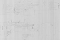
Lapoint Townsite - Hand Drawn Map
Image/StillImage
ucl_maps
127
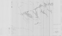
Ashley and Brush Creeks Dye Tests
1978
Image/StillImage
ucl_maps
128
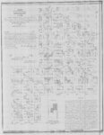
Plat of the Townsite of Randlett, Utah 1905
1905
Image/StillImage
ucl_maps
129
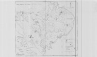
Brush Creek and Pot Creek Distribution Systems
Image/StillImage
ucl_maps
130
Plat of the Townsite of Avalon, Utah 1923
1923
Image/StillImage
ucl_maps
131
Ouray Wildlife Refuge Scheme 3 - 1995 - Semi-Control of Flood Inflow to the Leota Odd-Numbered Ponds
1995
Image/StillImage
ucl_maps
132
Ouray Wildlife Refuge Scheme 1 - 1995 - Natural Flood Inflow to Leota Odd-Numbered Ponds
1995
Image/StillImage
ucl_maps
133
Ouray Wildlife Refuge Scheme 2 - 1995 - Semi-Natural Flood Inflows to Pond L-7
1995
Image/StillImage
ucl_maps
134
Ouray Wildlife Refuge Scheme 5 - 1995 - Semi-Control of Flood Inflow to Pond L-7, Two Low Head Weirs
1995
Image/StillImage
ucl_maps
135
Ouray Wildlife Refuge Scheme 6 - 1995 - Control of Flood Inflow to the Nursery Habitat
1995
Image/StillImage
ucl_maps
136
Ouray Wildlife Refuge Scheme 4 - 1995 - Semi-Control of Flood Inflow to Pond L-7, One Low Head Weir
1995
Image/StillImage
ucl_maps
137
Ouray Wildlife Refuge Exhibit 7 - 1995 - Improvement of Existing Main Canal Inlet
1995
Image/StillImage
ucl_maps
138
Ouray SE, Utah 1999 - National Wetlands Inventory
1999
Image/StillImage
ucl_maps
139
Ouray, Utah 1999 - National Wetlands Inventory
1999
Image/StillImage
ucl_maps
140
Pelican Lake, Utah 1999 - National Wetlands Inventory
1999
Image/StillImage
ucl_maps
141
Brennan Basin Quad 1999 - National Wetlands Inventory
1999
Image/StillImage
ucl_maps
142
Moon Lake Project Deserado Mine Sheet 2
1981
Image/StillImage
ucl_maps
143
Map 68 Energy Resources Map of Utah 1983
1983
Image/StillImage
ucl_maps
144
Grazing Service C.C.C. Range Surveys, 1927
1927
Image/StillImage
ucl_maps
145
Bonneville Fuels Corp - Wolf Point Pipeline Project - Uintah County, Utah - Project Site Map
Image/StillImage
ucl_maps
146
Critical Habitat Polygons for Penstemon Grahamii
Image/StillImage
ucl_maps
147
Veritus Seismec Surveying and Positioning
Image/StillImage
ucl_maps
148
BLM Vernal Field Office Grazing Allotments 2004
2004
Image/StillImage
ucl_maps
149
State Open Ride for Mountain Bikes Map of Trails 2001
2001
Image/StillImage
ucl_maps
150
Central Business District Vernal, Utah - 1970s
1970; 1971; 1972; 1973; 1974; 1975; 1976; 1977; 1978; 1979
Image/StillImage
ucl_maps
126
-
150
of
9,137
<
1
2
3
4
5
6
7
8
9
10
>