|
|
Author | Title | Subject | Date | Publication Type |
| 101 |
 |
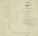
Mount, Donald Lee | Plate 3: Geologic map and sections of Wanship-Park City region, Utah | | 1952-06 | thesis |
| 102 |
 |
Mount, Donald Lee | Plate 3: Geologic map and sections of Wanship-Park City region, Utah (Google Earth map overlay KMZ file) | Geology -- Utah -- Summit County | 1952-06 | thesis |
| 103 |
 |
Hooper, Warren G. | Plate 3: Geologic map of portion of Northwestern Uinta Mountains, Utah | | 1951 | thesis |
| 104 |
 |
Sadeghi, Ali Reza | Plate 3: Palinspastic middle and upper Cambrian columnar sections from western and northern Utah | | 1972-12 | thesis |
| 105 |
 |
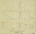
Neff, Thomas Rodney | Plate 3: Structural map of the Little Willow Series, Wasatch Mountains, Utah | | 1962-11 | thesis |
| 106 |
 |
Blakey, Ronald Clyde | Plate 3: Structural map of the Paria NW quadrangle, Kane County, Utah | | 1970-08 | thesis |
| 107 |
 |
Blakey, Ronald Clyde | Plate 3: Structural sections | | 1970-08 | thesis |
| 108 |
 |
Sadeghi, Ali Reza | Plate 4: Correlation of Precambrian rocks of the lower plate and upper plate of the Willard thrust with the Huntsville and Cottonwood areas | | 1972-12 | thesis |
| 109 |
 |
Rodriguez, Enrique Levy | Plate 4: Detailed map showing diamond drill hole locations and vertical cross sections of the Sulphurdale Orebody, Beaver County, Utah | | 1960-08 | thesis |
| 110 |
 |
Baker, Walker Holcombe | Plate 4: Evolution of the eastern fault block | | 1959-06 | thesis |
| 111 |
 |
Neff, Thomas Rodney | Plate 4: Map variations of the Little Willow Series, Wasatch Mountains, Utah | | 1962-11 | thesis |
| 112 |
 |
Blakey, Ronald Clyde | Plate 4: Topographic features of the Paria NW quadrangle, Kane County, Utah | | 1970-08 | thesis |
| 113 |
|
Stark, Norman Paul | Plate 5: Geologic map of the Upton region, Summit County, Utah (Google Earth map overlay KMZ file) | Geology -- Utah -- Upton area; Summit County; Coalville region; Thesis and dissertation georeferencing project | 1953-06 | thesis |
| 114 |
 |
Johnson, Eric Henry | Plate1 Map of Fumarole Butte showing topography, geology, and locations of dipole-dipole profiles and Schlumberger soundings | Basalt -- Utah; Geothermal resources -- Utah | 1975-08 | thesis |
| 115 |
 |
Earll, Fred Nelson | Plate1-part1 Geologic map of the Central Mineral Range, Beaver County, Utah | Geology -- Utah -- Mineral Mountains; Geology -- Utah -- Beaver County | 1957-08 | thesis |
| 116 |
|
Temple, Dennis Charles | Plates 2-3 Geologic map of the Mount Ogden granite, Weber County, Utah and Geologic sections to accompany the Geologic map of the Mount Ogden granite, Weber County, Utah (Google Earth map overlay KMZ file) | Granite; Utah; Mount Ogden; Geology; Stratigraphic; Precambrian ; Rocks; Crystalline; Metamorphic; Thesis and dissertation georeferencing project | 1969-06 | thesis |
| 117 |
 |
Johnson, Eric Henry | Resistivity and induced polarization survey of a basalt flow in a geothermal environment, Western Utah | Basalt -- Utah; Geothermal resources -- Utah | 1975-08 | thesis |
| 118 |
 |
Winkler, Gary Ralphs | Sedimentology and geomorphic significance of the bishop conglomerate and the Browns Park Formation, Eastern Uinta Mountains, Utah, Colorado, And Wyoming (Thesis and maps) | Sediments (Geology); Uinta Mountains; Structural; Stratigraphic; Tertiary; Thesis and dissertation georeferencing project | 1970-06 | thesis |
| 119 |
 |
Gross, Larry T. | Stratigraphic analysis of the Mesaverde Group, Uinta Basin, Utah | Geology; Stratigraphic; Cretaceous; Uinta Basin (Utah and Colo.) | 1961-05 | thesis |
| 120 |
 |
Gross, Larry T. | Stratigraphic analysis of the Mesaverde Group, Uinta Basin, Utah: Georeferenced map files | Geology; Stratigraphic; Cretaceous; Uinta Basin (Utah and Colo.) | 1961-05 | thesis |
| 121 |
 |
Baetcke, Gustav Berndt | Stratigraphy of the Star Range and reconnaissance study of three selected mines-Maps | Geology: Stratigraphic-Paleozoic; Stratigraphic-Mesozoic; Utah-Star Range; Mines and mineral resources-Beaver County | 1969-06 | thesis |
| 122 |
 |
Sadeghi, Ali Reza | Structural geology of the Willard Peak Area, North-Central Wasatch Mountains, Utah-Maps | Geology -- Structural -- Utah -- Willard Peak area | 1972-12 | thesis |
| 123 |
|
Sadeghi, Ali Reza | Structural geology of the Willard Peak Area, North-Central Wasatch Mountains, Utah: Georeferenced map files | Geology -- Structural -- Utah -- Willard Peak area | 1972-12 | thesis |
| 124 |
 |
Groenewold, Bernard Cyrus | Subsurface geology of the Mesozoic formations overlying the Uncompahgre Uplift in Grand County, Utah | Geology; Utah; Grand County; Stratigraphic; Mesozoic | 1961-06 | thesis |
| 125 |
|
Groenewold, Bernard Cyrus | Subsurface geology of the Mesozoic formations overlying the Uncompahgre Uplift in Grand County, Utah: Georeferenced map files | Geology; Utah; Grand County; Stratigraphic; Mesozoic | 1961-06 | thesis |