101 - 125 of 3,384
Number of results to display per page
TitleDateType
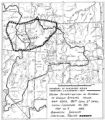
101 Township 9th South, Range 19th West, Salt Lake Meridian_001Image/StillImage
102 Township 9th South, Range 19th West, Salt Lake Meridian_003Image/StillImage
103 Ancient Mound Grains1941Text
104 Bert chopping wood at campImage/StillImage
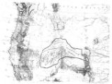
105 Map of Uintah Basin and Fort DuchesneImage/StillImage
106 Interview with Henry Harris Jr.1967-07-19Text
107 Map of Chief Washakie's Hunting and Fighting Territory, prepare by Oscar Mosserly, 1930Image/StillImage
108 Map of Indian Territory in the Western United StatesImage/StillImage
109 Map of Indian Tribes of North AmericaImage/StillImage
110 Map of North America and Original Inhabitants' Territory.Image/StillImage
111 Map of the Homelands of Northern Shoshone, 1863Image/StillImage
112 Map of the original range of the Bannock Indians according to Bureau of Indian Affairs, 1952.Image/StillImage
113 Map of the Shoshone TribesImage/StillImage
114 Navaho Indians around a council fire, trying to hide their faces from the photographer. Bluff, UtahImage/StillImage
115 Navajo babyImage/StillImage
116 Navajo Frontiers in Utah and Troublous Times in Monument Valley1971Text
117 Navajo Book 1b: Photo Description1892; 1893Image/StillImage
118 Double photograph, John P. Lower, Denver, Colo.Image/StillImage
119 Group of Uintah Utes, White Rocks, Summer '09Image/StillImage
120 Jim Duncan, White Rocks, Summer '09Image/StillImage
121 Man and woman posingImage/StillImage
122 Map of Northern Utah, Early SettlementsImage/StillImage
123 Navajo Book 3b: Caption1900Image/StillImage
124 Photograph entitled Irene CesspoochImage/StillImage
125 Reservation Boundary and General Land StatusImage/StillImage
101 - 125 of 3,384