76 - 100 of 162
Number of results to display per page
TitleDateType
76 Lower Glen Canyon1952-08Image
77 Lower Glen Canyon1952-08Image
78 Lower Glen Canyon1952-08Image
79 Lower Glen Canyon1952-08Image
80 Lower Glen Canyon, sidewalls start to steepen1952-08Image
81 Lower White Canyon, Henry Mountains1952-08-11Image
82 Map drawn by Barfoot of formation of Rainbow Bridge1952Image
83 Map drawn by Barfoot of Glen Canyon Detail1952Image
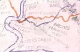
84 Map drawn by Barfoot of Hite's Landing, White Canyon, Red Canyon, Loper's Cabin, and Bear's Ear1952Image
85 Map drawn by Barfoot of Hole in Rock detail1952-08-14Image
86 Map drawn by Barfoot of mid-Glen Canyon detail1952Image
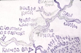
87 Map drawn by Barfoot of Narrow Canyon, Music Temple1952Image
88 Map drawn by Barfoot of Rainbow Bridge detail1952Image
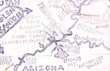
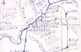
89 Map drawn by Barfoot of the Four Corner's Area1952Image
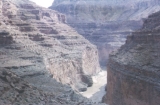
90 Marble Canyon, from ledge near dam site1952-08-18Image
91 Mealtime1952-08Image
92 Mid Glen Canyon, above Rincon, shallow water, wide and slow river1952-08-14Image
93 Mid Glen Canyon, drifting just below Escalante1952-08-14Image
94 Middle Glen Canyon, Narrow Canyon1952-08-15Image
95 Mile 15, dam site, USBR, Glen Canyon1952-08-18Image
96 Monument Valley, August, 19551952-08Image
97 Mouth of Escalante1952-08-14Image
98 Mouth of Narrow Canyon1952-08-15Image
99 Mouth of Narrow Canyon1952-08-15Image
100 Mouth of the Escalante, north shore (note "Bullfrog")1952-08-14Image
76 - 100 of 162