|
|
Author | Title | Subject | Date | Publication Type |
| 51 |
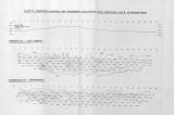 |
Johnson, Eric Henry | Plate 3 Topography, resistivity, and chargeability cross-sections along dipole-dipole line 2 on Fumarole Butte | Basalt -- Utah; Geothermal resources -- Utah | 1975-08 | thesis |
| 52 |
 |
Temple, Dennis Charles | Mount Ogden granite: Georeferenced map files | Granite; Utah; Mount Ogden; Geology; Stratigraphic; Precambrian ; Rocks; Crystalline; Metamorphic | 1969-06 | thesis |
| 53 |
 |
Temple, Dennis Charles | Mount Ogden granite (Thesis and maps) | Granite; Utah; Mount Ogden; Geology; Stratigraphic; Precambrian ; Rocks; Crystalline; Metamorphic | 1969-06 | thesis |
| 54 |
 |
Morris, Elliot Cobia | Map 1 Geologic map and sections of Big Piney Area, Utah (Google Earth map overlay KMZ file) | Geology -- Utah -- Summit County | 1953-06 | thesis |
| 55 |
 |
Mount, Donald Lee | Plate 3: Geologic map and sections of Wanship-Park City region, Utah (Google Earth map overlay KMZ file) | Geology -- Utah -- Summit County | 1952-06 | thesis |
| 56 |
 |
Boschetto, Harold Bradley | Plate 1: Geologic map of the Lothidok Range, Kenya | Geology; Kenya; Lothidok Range | 1988-08 | map |
| 57 |
 |
Dolan, Michael | Sandy fitness environment, Sandy City, Utah | Recreation centers; Designs; Plans | 2007 | thesis |
| 58 |
 |
Temple, Dennis Charles | Plates 2-3 Geologic map of the Mount Ogden granite, Weber County, Utah and Geologic sections to accompany the Geologic map of the Mount Ogden granite, Weber County, Utah (Google Earth map overlay KMZ file) | Granite; Utah; Mount Ogden; Geology; Stratigraphic; Precambrian ; Rocks; Crystalline; Metamorphic; Thesis and dissertation georeferencing project | 1969-06 | thesis |
| 59 |
 |
Blue, Donald McCoy | Plate 1: Lucin mining district and vicinity, Northern Pilot Range, Box Elder County, Utah - Elko County, Nevada (Google Earth map overlay KMZ file) | Thesis and dissertation georeferencing project | 1960-08 | thesis |
| 60 |
 |
Condie, Kent C. | Map 1 Geologic map of the Mineral Range, Utah (Google Earth map overlay KMZ file) | Petrology -- Utah -- Beaver County; Millard County; Geology -- Utah -- Beaver County; Millard County; Mineral Range (Utah); Thesis and dissertation georeferencing project | 1960-06 | thesis |
| 61 |
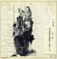 |
Blue, Donald McCoy | Geology and ore deposits of the lucin mining district, Box Elder County, Utah, and Elko County, Nevada-Maps | | 1960-08 | thesis |
| 62 |
 |
Baker, Walker Holcombe | Geologic setting and origin of the Grouse Creek pluton, Box Elder County, Utah-Maps | Geology--Utah | 1959-06 | thesis |
| 63 |
 |
Baker, Walker Holcombe | Plate 2: Cross-section A-A' | | 1959-06 | thesis |
| 64 |
 |
Baker, Walker Holcombe | Plate 3: Cross-section B-B' | | 1959-06 | thesis |
| 65 |
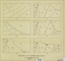 |
Baker, Walker Holcombe | Plate 4: Evolution of the eastern fault block | | 1959-06 | thesis |
| 66 |
 |
Gates, Joseph S. | Figure 4: Longitudinal profile of Middle Canyon showing locations of the profiles across the canyon, the nickpoint, and the hypothetical profile before rejuvenation | Thesis and dissertation georeferencing project | 1960-08 | thesis |
| 67 |
 |
Neff, Thomas Rodney | Petrology and structure of the little willow series, Wasatch Mountains, Utah: Georeferenced map files | Petrology -- Utah -- Wasatch Mountains | 1962-11 | thesis |
| 68 |
 |
Schaeffer, Jr. Frederick Ernst | Geology of the Central and Southern Silver Island Mountains Tooele County, Utah and Elko County, Nevada: Georeferenced map files | | 1961-06 | thesis |
| 69 |
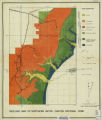 |
Brox, George Stanley | Plate 1: Geologic map of Northern Bryce Canyon National Park | | 1961-06 | thesis |
| 70 |
 |
Hooper, Warren G. | Geology of the Smith and Morehouse-South Fork Area, Utah: Georeferenced map files | Geology -- Uinta Mountains (Utah and Wyo.) | 1951 | thesis |
| 71 |
 |
Mount, Donald Lee | Plate 3: Geologic map and sections of Wanship-Park City region, Utah | | 1952-06 | thesis |
| 72 |
 |
Blue, Donald McCoy | Geology and ore deposits of the Lucin Mining District, Box Elder County, Utah and Elko County, Nevada: Georeferenced map files | | 1960-08 | thesis |
| 73 |
 |
Amin, Surendra R. | Map 1: Geologic map of Antelope intrusive and vicinity | | 1950 | thesis |
| 74 |
 |
Hooper, Warren G. | Plate 3 Geologic map of portion of Northwestern Uinta Mountains, Utah (Google Earth map overlay KMZ file) | Geology -- Uinta Mountains (Utah and Wyo.); Thesis and dissertation georeferencing project | 1951 | thesis |
| 75 |
 |
Paddock, Robert Edwards | Map1 Geologic map and sections of Newfoundland Mountains, Box Elder County, Utah (Google Earth map overlay KMZ file) | Geology; Utah; Newfoundland Mountains; Box Elder County; Thesis and dissertation georeferencing project | 1956-12 | thesis |