Home
Browse
Ask Us
Chat
Harmful Language Statement
Log in
Advanced Search
Year
1493
1494
1495
1496
1497
1498
1499
1500
1501
1502
1503
1504
1505
1506
1507
1508
1509
1510
1511
1512
1513
1514
1515
1516
1517
1518
1519
1520
1521
1522
1523
1524
1525
1526
1527
1528
1529
1530
1531
1532
1533
1534
1535
1536
1537
1538
1539
1540
1541
1542
1543
1544
1545
1546
1547
1548
1549
1550
1551
1552
1553
1554
1555
1556
1557
1558
1559
1560
1561
1562
1563
1564
1565
1566
1567
1568
1569
1570
1571
1572
1573
1574
1575
1576
1577
1578
1579
1580
1581
1582
1583
1584
1585
1586
1587
1588
1589
1590
1591
1592
1593
1594
1595
1596
1597
1598
1599
1600
1601
1602
1603
1604
1605
1606
1607
1608
1609
1610
1611
1612
1613
1614
1615
1616
1617
1618
1619
1620
1621
1622
1623
1624
1625
1626
1627
1628
1629
1630
1631
1632
1633
1634
1635
1636
1637
1638
1639
1640
1641
1642
1643
1644
1645
1646
1647
1648
1649
1650
1651
1652
1653
1654
1655
1656
1657
1658
1659
1660
1661
1662
1663
1664
1665
1666
1667
1668
1669
1670
1671
1672
1673
1674
1675
1676
1677
1678
1679
1680
1681
1682
1683
1684
1685
1686
1687
1688
1689
1690
1691
1692
1693
1694
1695
1696
1697
1698
1699
1700
1701
1702
1703
1704
1705
1706
1707
1708
1709
1710
1711
1712
1713
1714
1715
1716
1717
1718
1719
1720
1721
1722
1723
1724
1725
1726
1727
1728
1729
1730
1731
1732
1733
1734
1735
1736
1737
1738
1739
1740
1741
1742
1743
1744
1745
1746
1747
1748
1749
1750
1751
1752
1753
1754
1755
1756
1757
1758
1759
1760
1761
1762
1763
1764
1765
1766
1767
1768
1769
1770
1771
1772
1773
1774
1775
1776
1777
1778
1779
1780
1781
1782
1783
1784
1785
1786
1787
1788
1789
1790
1791
1792
1793
1794
1795
1796
1797
1798
1799
1800
1801
1802
1803
1804
1805
1806
1807
1808
1809
1810
1811
1812
1813
1814
1815
1816
1817
1818
1819
1820
1821
1822
1823
1824
1825
1826
1827
1828
1829
1830
1831
1832
1833
1834
1835
1836
1837
1838
1839
1840
1841
1842
1843
1844
1845
1846
1847
1848
1849
1850
1851
1852
1853
1854
1855
1856
1857
1858
1859
1860
1861
1862
1863
1864
1865
1866
1867
1868
1869
1870
1871
1872
1873
1874
1875
1876
1877
1878
1879
1880
1881
1882
1883
1884
1885
1886
1887
1888
1889
1890
1891
1892
1893
1894
1895
1896
1897
1898
1899
1900
1901
1902
1903
1904
1905
1906
1907
1908
1909
1910
1911
1912
1913
1914
1915
1916
1917
1918
1919
1920
1921
1922
1923
1924
1925
1926
1927
1928
1929
1930
1931
1932
1933
1934
1935
1936
1937
1938
1939
1940
1941
1942
1943
1944
1945
1946
1947
1948
1949
1950
1951
1952
1953
1954
1955
1956
1957
1958
1959
1960
1961
1962
1963
1964
1965
1966
1967
1968
1969
1970
1971
1972
1973
1974
1975
1976
1977
1978
1979
1980
1981
1982
1983
1984
1985
1986
1987
1988
1989
1990
1991
1992
1993
1994
1995
1996
1997
1998
1999
2000
2001
2002
2003
2004
2005
2006
2007
2008
2009
2010
2011
2012
2013
2014
2015
2016
2017
2018
2019
2020
TO
1493
1494
1495
1496
1497
1498
1499
1500
1501
1502
1503
1504
1505
1506
1507
1508
1509
1510
1511
1512
1513
1514
1515
1516
1517
1518
1519
1520
1521
1522
1523
1524
1525
1526
1527
1528
1529
1530
1531
1532
1533
1534
1535
1536
1537
1538
1539
1540
1541
1542
1543
1544
1545
1546
1547
1548
1549
1550
1551
1552
1553
1554
1555
1556
1557
1558
1559
1560
1561
1562
1563
1564
1565
1566
1567
1568
1569
1570
1571
1572
1573
1574
1575
1576
1577
1578
1579
1580
1581
1582
1583
1584
1585
1586
1587
1588
1589
1590
1591
1592
1593
1594
1595
1596
1597
1598
1599
1600
1601
1602
1603
1604
1605
1606
1607
1608
1609
1610
1611
1612
1613
1614
1615
1616
1617
1618
1619
1620
1621
1622
1623
1624
1625
1626
1627
1628
1629
1630
1631
1632
1633
1634
1635
1636
1637
1638
1639
1640
1641
1642
1643
1644
1645
1646
1647
1648
1649
1650
1651
1652
1653
1654
1655
1656
1657
1658
1659
1660
1661
1662
1663
1664
1665
1666
1667
1668
1669
1670
1671
1672
1673
1674
1675
1676
1677
1678
1679
1680
1681
1682
1683
1684
1685
1686
1687
1688
1689
1690
1691
1692
1693
1694
1695
1696
1697
1698
1699
1700
1701
1702
1703
1704
1705
1706
1707
1708
1709
1710
1711
1712
1713
1714
1715
1716
1717
1718
1719
1720
1721
1722
1723
1724
1725
1726
1727
1728
1729
1730
1731
1732
1733
1734
1735
1736
1737
1738
1739
1740
1741
1742
1743
1744
1745
1746
1747
1748
1749
1750
1751
1752
1753
1754
1755
1756
1757
1758
1759
1760
1761
1762
1763
1764
1765
1766
1767
1768
1769
1770
1771
1772
1773
1774
1775
1776
1777
1778
1779
1780
1781
1782
1783
1784
1785
1786
1787
1788
1789
1790
1791
1792
1793
1794
1795
1796
1797
1798
1799
1800
1801
1802
1803
1804
1805
1806
1807
1808
1809
1810
1811
1812
1813
1814
1815
1816
1817
1818
1819
1820
1821
1822
1823
1824
1825
1826
1827
1828
1829
1830
1831
1832
1833
1834
1835
1836
1837
1838
1839
1840
1841
1842
1843
1844
1845
1846
1847
1848
1849
1850
1851
1852
1853
1854
1855
1856
1857
1858
1859
1860
1861
1862
1863
1864
1865
1866
1867
1868
1869
1870
1871
1872
1873
1874
1875
1876
1877
1878
1879
1880
1881
1882
1883
1884
1885
1886
1887
1888
1889
1890
1891
1892
1893
1894
1895
1896
1897
1898
1899
1900
1901
1902
1903
1904
1905
1906
1907
1908
1909
1910
1911
1912
1913
1914
1915
1916
1917
1918
1919
1920
1921
1922
1923
1924
1925
1926
1927
1928
1929
1930
1931
1932
1933
1934
1935
1936
1937
1938
1939
1940
1941
1942
1943
1944
1945
1946
1947
1948
1949
1950
1951
1952
1953
1954
1955
1956
1957
1958
1959
1960
1961
1962
1963
1964
1965
1966
1967
1968
1969
1970
1971
1972
1973
1974
1975
1976
1977
1978
1979
1980
1981
1982
1983
1984
1985
1986
1987
1988
1989
1990
1991
1992
1993
1994
1995
1996
1997
1998
1999
2000
2001
2002
2003
2004
2005
2006
2007
2008
2009
2010
2011
2012
2013
2014
2015
2016
2017
2018
2019
2020
Type
Image/StillImage
9,016
Text
119
Format
application/pdf
9,016
Collection
Aziz Suryal Atiya papers
15
College of Law Publications
7
Juanita Brooks Photograph Collection,...
1
Manuscripts
1
Maps
145
Marriott Library Digital Stacks
2
Marriott Library Permanent Art Collec...
130
Movies Made in Utah Photograph Collec...
1
Our Daily Diary, Topaz War Relocation...
1
Pantages Theatre - Salt Lake City
58
Park City Historical Society
16
Photo Archives
4,891
Regional History Center
1,800
Richard Wright Young Papers
57
Rural Utah Curated Collection
1
Ski and Snow Sports Archives
45
Sustainability U
16
Theater Programs Collection, 1866-1995
57
UAIDA Main Collection
868
Utah Artists Project - Ephemera
3
Utah River Running Photo Archives
813
We Remember, We Celebrate, We Believe...
45
Western Federation of Watercolors Soc...
43
More
Filters:
Format:
"application/pdf"
Type:
"Image/StillImage"
51
-
75
of
9,016
<
1
2
3
4
5
6
7
8
9
10
>
Gallery view
Number of results to display per page
10
25
50
100
200
Sort by Relevance
Sort by Title A-Z
Sort by Title Z-A
Sort by Date Ascending
Sort by Date Descending
Sort by Last Modified Ascending
Sort by Last Modified Descending
Title
Date
Type
Setname
51
Meeker Incident
Image/StillImage
uaida_main
52
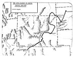
The Utes Journey to South Dakota 1906-1908
Image/StillImage
uaida_main
53
Opening of the Uncompahgre Reservation
Image/StillImage
uaida_main
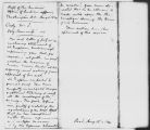
54
Letter from Commissioner, Office of Indian Affairs to Superintendent of Indian Affairs, Utah Territory
Image/StillImage
uaida_main
55
Ute-White Relations in Colorado and New Mexico 1848-1855
Image/StillImage
uaida_main
56
Independence Vein (Plat of Claim of Arthur W. Sweail; known as the Triumph & Cumberland Land)
Image/StillImage
ucl_maps
57
Profile Map of the Country Boy Mine (copy of original)
Image/StillImage
ucl_maps
58
Dragon Area, R25E, Property Map
Image/StillImage
ucl_maps
59
Pariatte-Northwest Castle Peak Area (Ziegler Chemical & Mineral Corp)
Image/StillImage
ucl_maps
60
Little Emma Vein - Plane Table Sheet (American Gilsonite, Uintah, Utah)
Image/StillImage
ucl_maps
61
Map of Little Bonanza Gilsonite District
Image/StillImage
ucl_maps
62
Letter from Luther Mann Jr.
Image/StillImage
uaida_main
63
Superintendency Invoice of Goods dated Nov. 1859
Image/StillImage
uaida_main
64
Uintah Unit Alernative No. 4 Coyote Basin Alternative
Image/StillImage
uaida_main
65
Upalco Unit Alternative No. 8 Twin Pots Alternative
Image/StillImage
uaida_main
66
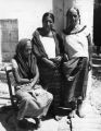
Group of women
Image/StillImage
uaida_main
67
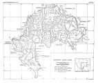
Southern Paiute Bands
Image/StillImage
uaida_main
68
Trappers and Traders in Ute Lands 1820-1844
Image/StillImage
uaida_main
69
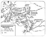
Early Roads and Railroads circa 1895
Image/StillImage
uaida_main
70
Superintendency Report of Employees dated 1867
Image/StillImage
uaida_main
71
Superintendency Report of Employees dated 1868
Image/StillImage
uaida_main
72
SuperintendencyReceipt dated 1866
Image/StillImage
uaida_main
73
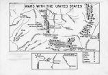
Map titled Wars with the United States
Image/StillImage
uaida_main
74
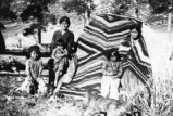
Navajo family, Antonito's
Image/StillImage
uaida_main
75
Navajo Symbolic Associations
Image/StillImage
uaida_main
51
-
75
of
9,016
<
1
2
3
4
5
6
7
8
9
10
>