TO
| Author | Title | Subject | Date | Publication Type | ||
|---|---|---|---|---|---|---|
| 51 |
 |
Ward, Danielle Marie | Holocene chemostratigraphy of spring sediments in Range Creek Canyon, Utah | 2016 | thesis | |
| 52 |
 |
Li, Dapeng | Modeling wildfire evacuation as a coupled human-environmental system using triggers | fire spread modeling; GIS; reverse geocoding; traffic simulation; triggers; wildfire evacuation | 2016 | dissertation |
| 53 |
 |
Bishop, Seth Arthur | Spatial access and local demand for emergency medical services in utah | 2SFCA; accessibility; ambulance; emergency medical service; floating catchment area; spatial access | 2016 | thesis |
| 54 |
 |
Salter, Richard Gene | Tooele Valley, Utah: A regional interpretation of the changing economies | Tooele Valley, Utah | 1953-08 | thesis |
| 55 |
 |
Theobald, Megan | Master of geographic science informatoin portfolio | Geography--Research--United States | online portfolio | |
| 56 |
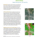 |
Remote sensing: green coverage area in Salt Lake City | Geography--Research--United States; Remote sensing | online portfolio | ||
| 57 |
 |
Welker, Chelsea | Master of Geographic Information Science | Geography--Research--United States | 2017 | online portfolio |
| 58 |
 |
Eichorn, Michael | Master of Geographic Information Science Portfolio | Geography--Research--United States; Remote sensing | 2017 | online portfolio |
| 59 |
 |
Ottesen, Mitchell | Master of Geographic Information Science Portfolio | Geography--Research--United States; Cartography--United States | online portfolio | |
| 60 |
 |
Cheng, Siwen | Master of Geographic Information Science Portfolio | Geography - Research - information services | 2017 | thesis |
| 61 |
|
Eichorn, Micheal | Master of Geographic Information Science portfolio | Geography - Research - Information services | 2017 | online portfolio |
| 62 |
 |
Rivera, Sarah | Master of Geographic Information Science Portfolio | Geography - information services | 2017 | online portfolio |
| 63 |
 |
Carter, Vachel Ashley | The role of climate variability and disturbances on forest ecology in the intermountain west | climate change; disturbance; Intermountain West; Rocky Mountains; vegetation change | 2016 | dissertation |
| 64 |
 |
Chavez, Vanessa Grace | Climatic influences on two cienega complexes from northern baja california: a ~45,000 year paleoecological record | Baja California; ENSO; Fire; Late-glacial; Monsoon | 2016 | thesis |
| 65 |
 |
Mcnerney, Laura | Constraining the greenland firn aquifer's ability to hydrofracture a crevasse to the bed of the ice sheet | crevasses; fluid dynamics; Greenland ice sheet; groundwater flow; hydrofracture | 2016 | thesis |
| 66 |
 |
Howard, Kelsey Ann | A late pleistocene to early holocene climate, vegetation and fire history record for the bonneville basin, utah, usa | Bonneville Basin; Climate; Vegetation; Fire History; Heinrich Events; Lake Bonneville; Paleoecology; Paleo Indians | 2016-05 | thesis |
| 67 |
 |
Coates, Austin Reece | Hyperspectral remote sensing for monitoring species-specific drought impacts in Southern California | Drought; Hyperspectral; Species-Specific; Spectral Mixture Analysis | 2015 | thesis |
| 68 |
 |
Fu, Liwei | Bicycling preferences and behavior in salt lake city | attitude; bicycling frequency; preferences; route choice; values | 2015 | thesis |
| 69 |
 |
Conrad, Edward C. | Using species distribution models to quantify climate change impacts on the rosy-finch superspecies: an alpine obligate | boosted regression trees; calibrated AUC; climate change impacts; Leucosticte; niche modeling; random forest regression trees | 2015-08 | thesis |
| 70 |
 |
Hile, Ryan Patrick | Thinking inside the black box: enhancing the social vulnerability index with an artificial neural network | Artificial Neural Networks; Environmental Hazards; Geocomputation; GIS; Social Vulnerability; Social Vulnerability Index | 2015-08 | thesis |
| 71 |
 |
Miege, Clement | Recent ice sheet snow accumulation and firn storage of meltwater inferred by ground and airborne radars | Antarctica; Aquifer; Firn; Greenland; Radar | 2015-08 | dissertation |
| 72 |
 |
Maezumi, Shira Yoshimi | Neotropical climate, vegetation, and fire histories on local to regional scales | Amazon; Bolivia; Paleoecology; Paleofire; Phytoliths; Pollen | 2015-05 | dissertation |
| 73 |
 |
Unger, Corey Daniel | Creating spatial data infrastructure to facilitate the collection and dissemination of geospatial data to aid in disaster management | Disaster management; Geographic information systems; GIS; SDI; Spatial data infrastructure; Volunteer geographic information | 2015-05 | thesis |
| 74 |
 |
Li, Xiao | Spatial representation in the social interaction potential metric: an analysis of scale and parameter sensitivity | Joint accessibility; Sensitivity analysis; Social interaction potential metric; Time geography | 2015-05 | thesis |
| 75 |
 |
Huang, Hao | Geographic information system spatial-temporal evolution of multiscalar patterns and determinants of foreign direct investment in China | China; Foreign direct investment; GIS; Patterns and determinants; Spatial-temporal evolution; Wuhan | 2014-08 | dissertation |