Home
Browse
Ask Us
Chat
Harmful Language Statement
Log in
Photo Archives
Advanced Search
About
Over 70,000 photos covering a variety of topics from Marriott Library Special Collections
Year
1950
1951
1952
1953
1954
1955
1956
1957
1958
1959
1960
1961
1962
1963
1964
1965
1966
1967
1968
1969
1970
1971
1972
1973
1974
1975
TO
1950
1951
1952
1953
1954
1955
1956
1957
1958
1959
1960
1961
1962
1963
1964
1965
1966
1967
1968
1969
1970
1971
1972
1973
1974
1975
Type
Image
594
Format
image/jpeg
594
Collection
Photo Archives
594
26
-
50
of
594
<
1
2
3
4
5
6
7
8
9
10
>
Gallery view
Number of results to display per page
10
25
50
100
200
Sort by Relevance
Sort by Title A-Z
Sort by Title Z-A
Sort by Date Ascending
Sort by Date Descending
Sort by Last Modified Ascending
Sort by Last Modified Descending
Title
Date
Type
26
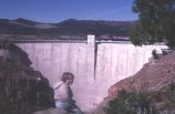
Flaming Gorge Dam
1968-10-19
Image
27
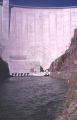
Flaming Gorge Dam from just downstream
1968-10-19
Image
28
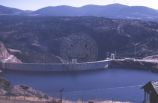
Flaming Gorge Dam from north
1968-10-19
Image
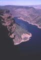
29
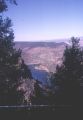
Flaming Gorge Lake from near Red Canyon Visitor Center [1]
1968-10-19
Image
30
Flaming Gorge Lake from near Red Canyon Visitor Center [2]
1968-10-19
Image
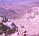
31
Goosenecks view, San Juan County, Utah [2]
1960; 1961; 1962; 1963; 1964; 1965; 1966; 1967; 1968; 1969; 1970; 1971; 1972; 1973; 1974; 1975
Image
32
Goosenecks view, San Juan County, Utah [4]
1960; 1961; 1962; 1963; 1964; 1965; 1966; 1967; 1968; 1969; 1970; 1971; 1972; 1973; 1974; 1975
Image
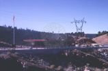
33
Highway near Flaming Gorge Dam
1968-10-19
Image
34
Visitor Center near Flaming Gorge Dam
1968-10-19
Image
35
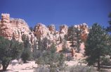
Along Navajo Trail, Bryce Canyon [1]
1959-06-25
Image
36
Along Navajo Trail, Bryce Canyon [2]
1959-06-25
Image
37
Along Navajo Trail, Bryce Canyon [5]
1959-06-25
Image
38
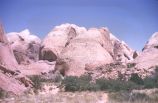
Arch and castle-like erosion forms, Bryce Canyon
1959-06-25
Image
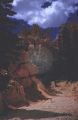
39
Bridge Canyon scene
1960-06-12
Image
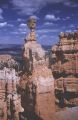
40
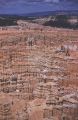
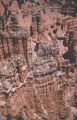
Bryce Canyon spires
1959-06-25
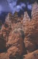
Image
41
Bryce Canyon spires
1959-06-25
Image
42
Cedar Breaks National Monument view
1966-07-04
Image
43
Cedar Breaks view
1966-07-04
Image
44
Cliff-like formation of Bryce Canyon
1959-06-25
Image
45
Cliffs just outside park, Bryce Canyon
1959-06-25
Image
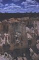
46
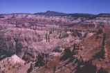
Closer view of spires, Bryce Canyon
1959-06-25
Image
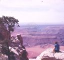
47
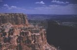
Grand View Point and Canyonlands from Henry Mountains
1963-06-26
Image
48
Hog Spring between Hite and Hanksville
1965-09-22
Image
49
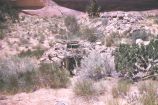
Hogan near Redbud Pass
1960-06-12
Image
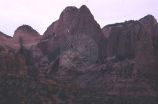
50
Kolob Canyon, Zion National Park
1974-04-19
Image
26
-
50
of
594
<
1
2
3
4
5
6
7
8
9
10
>