Home
Browse
Ask Us
Chat
Harmful Language Statement
Log in
Advanced Search
Year
1873
1874
1875
1876
1877
1878
1879
1880
1881
1882
1883
1884
1885
1886
1887
1888
1889
1890
1891
1892
1893
1894
1895
1896
1897
1898
1899
1900
1901
1902
1903
1904
1905
1906
1907
1908
1909
1910
1911
1912
1913
1914
1915
1916
1917
1918
1919
1920
1921
1922
1923
1924
1925
1926
1927
1928
1929
1930
1931
1932
1933
1934
1935
1936
1937
1938
1939
1940
1941
1942
1943
1944
1945
1946
1947
1948
1949
1950
1951
1952
1953
1954
1955
1956
1957
1958
1959
1960
1961
1962
1963
1964
1965
1966
1967
1968
1969
1970
1971
1972
1973
1974
1975
1976
1977
1978
1979
1980
1981
1982
1983
1984
1985
1986
1987
1988
1989
1990
1991
1992
1993
1994
1995
1996
1997
1998
1999
2000
2001
2002
2003
2004
2005
2006
2007
2008
2009
2010
2011
2012
2013
2014
2015
2016
2017
2018
2019
2020
2021
2022
2023
2024
TO
1873
1874
1875
1876
1877
1878
1879
1880
1881
1882
1883
1884
1885
1886
1887
1888
1889
1890
1891
1892
1893
1894
1895
1896
1897
1898
1899
1900
1901
1902
1903
1904
1905
1906
1907
1908
1909
1910
1911
1912
1913
1914
1915
1916
1917
1918
1919
1920
1921
1922
1923
1924
1925
1926
1927
1928
1929
1930
1931
1932
1933
1934
1935
1936
1937
1938
1939
1940
1941
1942
1943
1944
1945
1946
1947
1948
1949
1950
1951
1952
1953
1954
1955
1956
1957
1958
1959
1960
1961
1962
1963
1964
1965
1966
1967
1968
1969
1970
1971
1972
1973
1974
1975
1976
1977
1978
1979
1980
1981
1982
1983
1984
1985
1986
1987
1988
1989
1990
1991
1992
1993
1994
1995
1996
1997
1998
1999
2000
2001
2002
2003
2004
2005
2006
2007
2008
2009
2010
2011
2012
2013
2014
2015
2016
2017
2018
2019
2020
2021
2022
2023
2024
Type
Text
46
Image/StillImage
45
Image
3
Format
application/pdf
62
image/jpeg
44
application/zip
3
Collection
American West Center Research Projects
1
Continuum
1
Department of City and Metropolitan P...
8
Electronic University Archive
2
Everett L. Cooley Oral History Project
3
Historic and Prehistoric Publications
16
Kem C. Gardner Policy Institute Colle...
1
Marriott Library Digital Stacks
1
Theses & Dissertations
9
UAIDA Main Collection
55
UScholar Works
1
Undergrad Research Abstracts Journal
1
Utah Historic Building Records
8
Water Wise Utah
1
Westminster University Institutional ...
2
More
26
-
50
of
110
<
1
2
3
4
5
>
Gallery view
Number of results to display per page
10
25
50
100
200
Sort by Relevance
Sort by Title A-Z
Sort by Title Z-A
Sort by Date Ascending
Sort by Date Descending
Sort by Last Modified Ascending
Sort by Last Modified Descending
Title
Date
Type
Setname
26
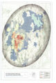
Goshute Traditional Territory
Image/StillImage
uaida_main
27
Areas Used by the Goshute People and Areas Potentially Impacted by Southern Nevada Water Authority
Image/StillImage
uaida_main
28
Goshute Skull Valley Reservation Geothermal Resources Map
2004-01-14
Image/StillImage
uaida_main
29
Map of Shoshone, Goshute, Bannock, Wind River and Panamint Indian Tribal Groups
1957
Image/StillImage
uaida_main
30
Boundary of Shoshone Indian Territory according to Swanton, 1952
1952
Image/StillImage
uaida_main
31
Boundary of Shoshone Indian Territory and Neighboring Tribes
1957
Image/StillImage
uaida_main
32
Map of Indian Reservations in the Western United States
Image/StillImage
uaida_main
33
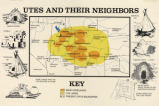
Map titled, "Utes and Their Neighbors"
Image/StillImage
uaida_main
34
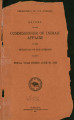
Annual Report of the Commissioner of Indian Affairs to the Secretary of the Interior for the Fiscal Year Ending June 30, 1922
1922
Text
uaida_main
35
Indian Names in Utah Geography
1928; 1929; 1930; 1931; 1932; 1933
Text
uaida_main
36
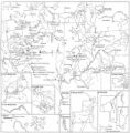
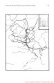
Map of Major Historical Trails of Southern Utah
uaida_main
37
Map of Indian Tribes of North America
Image/StillImage
uaida_main
38
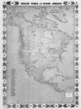
Map of North America and Original Inhabitants' Territory.
Image/StillImage
uaida_main
39
By Path and Trail
1908
Text
uaida_main
40
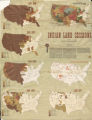
Map of Indian Land Cessions in the United States
Image/StillImage
uaida_main
41
Boundary of Shoshone Indian Territory, showing the locations of the Bannock
1957
Image/StillImage
uaida_main
42
Map of Shoshone Indian Territory, and the Division of Shoshone Boundaries in Nevada
Image/StillImage
uaida_main
43
Boundary of Shoshone Indian Territory, showing the locations of the Bannock from 1819 to 1951
1957
Image/StillImage
uaida_main
44
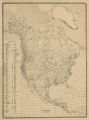
Map of Indian Territory in the Western United States
Image/StillImage
uaida_main
45
Boundary of Shoshone Indian Territory, Linguistic Boundaries of Shoshone and Bannock.
1941
Image/StillImage
uaida_main
46
Boundary of Shoshone Indian Territory, showing the locations where the Bannock and Shoshone reported together 1819-1956
1957
Image/StillImage
uaida_main
47
Boundary of Shoshone Indian Territory; Doty Map of 1863 Indian Claims Commission
1957
Image/StillImage
uaida_main
48
Map of Western Indian Territory Before 1850
Image/StillImage
uaida_main
49
Map of Reservations of the Western United States and the Religions that Worked on the Reservations 1870's
1873
Image/StillImage
uaida_main
50
We Shall Remain: Utah Indian Elementary Curriculum Guide; 4th Grade
2009
Text
uaida_main
26
-
50
of
110
<
1
2
3
4
5
>