Home
Browse
Ask Us
Chat
Harmful Language Statement
Log in
Art and Art History
Advanced Search
Subject
Maps
169
Asian Art
27
Brazil
13
Buddhism
9
Buddhist Art
8
Architecture
6
Latin America
5
Ruins
5
Colonial Latin America
4
Japanese Art
3
Latin American Art
3
Asia
2
Boston Massacre
2
French History
2
French Revolution
2
History
2
Islamic Art
2
Napoleon Bonaparte
2
Napoleonic Wars
2
South America
2
Art Academy
1
Aztec Empire
1
Ceramics
1
China
1
Contemporary Asian Art
1
Dutch Brazil
1
Hindu Art
1
Hinduism
1
India
1
Korean Art
1
Middle East
1
Religious Art
1
Religious Buildings
1
World History
1
More
Filters:
Subject:
"Maps"
Collection:
"uu_aah_art"
Type:
"Image"
Format:
"image/jpeg"
Setname:
!(ir* OR ehsl*)
26
-
50
of
169
<
1
2
3
4
5
6
7
>
Gallery view
Number of results to display per page
10
25
50
100
200
Sort by Relevance
Sort by Title A-Z
Sort by Title Z-A
Sort by Date Ascending
Sort by Date Descending
Sort by Last Modified Ascending
Sort by Last Modified Descending
Sort by Module Order
Title
Creator
Creation Date
26
Map: Spread of Buddhism, ca. 200-900 CE
ca. 200 - 900 CE
27
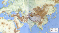
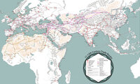
Map: The Silk Roads, ca. 200-900 CE
ca. 200 - 900 CE
28
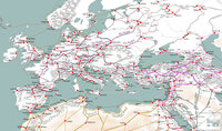
Map: 11th - 12th Century Trade Routes including Rome, Constantinople, Damascus, Jerusalem, and Dura-Europos
11th - 12th Century CE
29
Map: 11th - 12th Century Trade Routes
11th - 12th Century CE
30
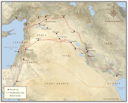
Map: Location of Dura Europos in the Middle East
31
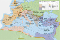
Map: The Rise of Constantine, 306 - 324 CE
306 - 324 CE
32
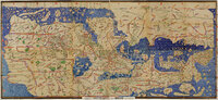
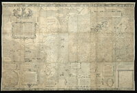
Tabula Rogeriana
Muhammad al-Idrisi
1154 CE
33
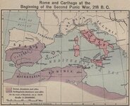
Map: Roman and Carthaginian Territories at the beginning of the Second Punic War, 218 BCE
218 BCE
34
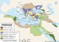
Map: Extent of Ottoman Empire, 1300-1699 CE
1300 - 1699 CE
35
Map: British Empire, excluding Americas, 1921 CE
1921 CE
36
Map: Osogbo
37
Map: Mediterranean and Northern Africa
38
Map: Senegal
39
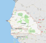
Map: Nigeria in West Africa
40
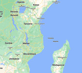
Map: Makonde people were in contemporary Kenya, Tanzania, and Mozambique
41
Mercator world map of 1569 (Nova et Aucta Orbis Terrae Descriptio ad Usum Navigantium Emendate Accommodata)
Gerardus Mercator
1569 CE
42
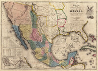
Map of the United States of Méjico (Mexico)
John Disturnell
1846 CE
43
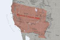
Map: Mexican Cession 1848
44
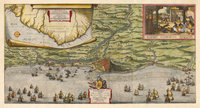
Map of the Dutch capture of the town of Olinda in Pernambuco by the Dutch West Indies Company in February 1630
1630 CE
45
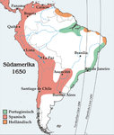
Map: South America around 1650
1650 CE
46
Map: Brazil
47
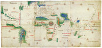
Cantino Planisphere
unknown
1502 CE
48
New World Map
Diogo Homem
1568 CE
49
World Map showing areas controlled by Europeans, European Settlers, and Non-Europeans in 1922
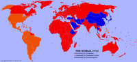
50
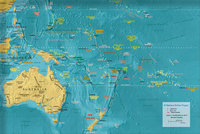
Map: Oceania
26
-
50
of
169
<
1
2
3
4
5
6
7
>