Home
Browse
Ask Us
Chat
Harmful Language Statement
Log in
Advanced Search
Year
1872
1873
1874
1875
1876
1877
1878
1879
1880
1881
1882
1883
1884
1885
1886
1887
1888
1889
1890
1891
1892
1893
1894
1895
1896
1897
1898
1899
1900
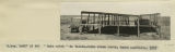
1901
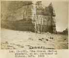
1902
1903
1904
1905
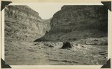
1906
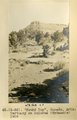
1907
1908
1909
1910
1911
1912
1913
1914
1915
1916
1917
1918
1919
1920
1921
1922
1923
1924
1925
1926
1927
1928
1929
1930
1931
1932
1933
1934
1935
1936
1937
1938
1939
1940
1941
1942
1943
1944
1945
1946
1947
1948
1949
1950
1951
1952
1953
1954
1955
1956
1957
1958
1959
1960
1961
1962
1963
1964
1965
1966
1967
1968
1969
1970
1971
1972
1973
1974
1975
1976
1977
1978
1979
1980
1981
1982
1983
1984
1985
1986
1987
1988
1989
1990
1991
1992
1993
TO
1872
1873
1874
1875
1876
1877
1878
1879
1880
1881
1882
1883
1884
1885
1886
1887
1888
1889
1890
1891
1892
1893
1894
1895
1896
1897
1898
1899
1900
1901
1902
1903
1904
1905
1906
1907
1908
1909
1910
1911
1912
1913
1914
1915
1916
1917
1918
1919
1920
1921
1922
1923
1924
1925
1926
1927
1928
1929
1930
1931
1932
1933
1934
1935
1936
1937
1938
1939
1940
1941
1942
1943
1944
1945
1946
1947
1948
1949
1950
1951
1952
1953
1954
1955
1956
1957
1958
1959
1960
1961
1962
1963
1964
1965
1966
1967
1968
1969
1970
1971
1972
1973
1974
1975
1976
1977
1978
1979
1980
1981
1982
1983
1984
1985
1986
1987
1988
1989
1990
1991
1992
1993
Type
Image
3,451
Image/StillImage
143
Format
image/jpeg
3,594
Collection
Photo Archives
3,451
UAIDA Main Collection
143
Filters:
Format:
"image/jpeg"
Collection Name:
"Herbert E. Gregory"
26
-
50
of
3,594
<
1
2
3
4
5
6
7
8
9
10
>
Gallery view
Number of results to display per page
10
25
50
100
200
Sort by Relevance
Sort by Title A-Z
Sort by Title Z-A
Sort by Date Ascending
Sort by Date Descending
Sort by Last Modified Ascending
Sort by Last Modified Descending
Title
Date
Type
Setname
26
"North Forest", Carrizo Creek Wash (Photo G447)
1913
Image
uum_map
27
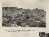
"Painted Desert Bads", 1 mi. below Farm, Tuba (Photo G432)
1913
Image
uum_map
28
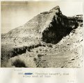
"Painted Desert", 2 mi. west of Tuba
1913
Image
uum_map
29
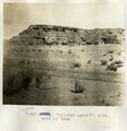
"Painted Desert", four miles west of Tuba
1913
Image
uum_map
30
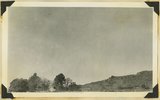
"Pryor Knoll, eroded basaltic cone and lava flows over Cretaceous rocks. View looking northwest. Western edge of Kolob Terrace. Just back of the yellow pines are the cliffs at the head of the westward flowing Shurtz Creek. Iron County, UT, 1942
1942
Image
uum_map
31
"Rain catch" on Yalata-Oldea stock route, South Australia, 1916
1916
Image
uum_map
32
"Round Top," Ganado, Ariz. Tertiary on Dolores (Triassic), 1909 (photo G-36)
1909
Image
uum_map
33
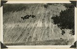
"Sand waves" just breaking and flattening near Honoker Trail, San Juan canyon, 1921.
1921
Image
uum_map
34
"Sentinel formation." Contact upper sandstone Section A with banded portion beneath, Section B. Cottonwood Canyon. Kane County, UT. 1922
1922
Image
uum_map
35
"Sentinel formation." Section B banded strata below heavy sandstone. Kaiparowitz region. Kane County, UT. 1922
1922
Image
uum_map
36
"Sentinel formation." Section B banded strata below heavy sandstone. Kaiparowitz region. Kane County, UT. 1922
1922
Image
uum_map
37
"Sigh," the pack mule, 1910 (Photo N-M103)
1910
Image
uum_map
38
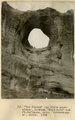
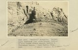
"The Church" (McElmo strata?), 4± mi southeast of Hlohala, Ariz., 1909 (photo G-107)
1909
Image
uum_map
39
"The Twins," LaPlata strata, Bluff, Utah, 1910 (Photo G134)
1910
Image
uum_map
40
"The Washboard," head of North Canyon, looking west. Erosion caused by sheep grazing. Abajo Mountains. Utah, San Juan, 1915.
1915
Image
uum_map
41
"The Window" (La Plata sandstone), between "Haystacks" and Ft. Defiance, Ariz. (Schwemberger photo), 1906
1906
Image
uum_map
42
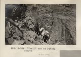
"Trail" out of PahUte canyon (Photo G354)
1913
Image
uum_map
43
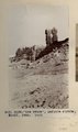
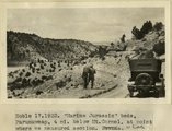
"Windsor Castle," Pipe Springs, 1936.
1936
Image
uum_map
44
'"Sentinel formation." Contact upper sandstone just below Dakota, Section A, with banded strata beneath, Section B. Cottonwood Canyon. Kane County, UT. 1922
1922
Image
uum_map
45
'Elephant feet'. Wingate sandstone, Kayenta above. Three Lakes Canyon, Kane County, UT, 1939
1939
Image
uum_map
46
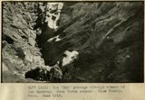
The 'Gut' passage through branch of the Wahweap. Mesa Verde strata. Kane County, UT. June 1918
1915
Image
uum_map
47
'Marine Jurassic' beds, Paunuweap, 4 miles below Mt. Carmel., at point where we measured section. UT
1922
Image
uum_map
48
'The Granary': one of many natural cavities in Wingate sandstone utilized for storage, Johnson Canyon, Kane County, UT, 1939
1939
Image
uum_map
49
'White Throne' remnant of Navajo sandstone in branch of Paria River. Kane County, UT, 1940
1940
Image
uum_map
50
'Winsor Castle', old fort at Pipe Springs, looking south over Unikaret Plateau, Kanab Canyon upper right
1939
Image
uum_map
26
-
50
of
3,594
<
1
2
3
4
5
6
7
8
9
10
>