Home
Browse
Ask Us
Chat
Harmful Language Statement
Log in
Advanced Search
Year
1872
1873
1874
1875
1876
1877
1878
1879
1880
1881
1882
1883
1884
1885
1886
1887
1888
1889
1890
1891
1892
1893
1894
1895
1896
1897
1898
1899
1900
1901
1902
1903
1904
1905
1906
1907
1908
1909
1910
1911
1912
1913
1914
1915
1916
1917
1918
1919
1920
1921
1922
1923
1924
1925
1926
1927
1928
1929
1930
1931
1932
1933
1934
1935
1936
1937
1938
1939
1940
1941
1942
1943
1944
1945
1946
1947
1948
1949
1950
1951
1952
1953
1954
1955
1956
1957
1958
1959
1960
1961
1962
1963
1964
1965
1966
1967
1968
1969
1970
1971
1972
1973
1974
1975
1976
1977
1978
1979
1980
1981
1982
1983
1984
1985
1986
1987
1988
1989
1990
1991
1992
1993
TO
1872
1873
1874
1875
1876
1877
1878
1879
1880
1881
1882
1883
1884
1885
1886
1887
1888
1889
1890
1891
1892
1893
1894
1895
1896
1897
1898
1899
1900
1901
1902
1903
1904
1905
1906
1907
1908
1909
1910
1911
1912
1913
1914
1915
1916
1917
1918
1919
1920
1921
1922
1923
1924
1925
1926
1927
1928
1929
1930
1931
1932
1933
1934
1935
1936
1937
1938
1939
1940
1941
1942
1943
1944
1945
1946
1947
1948
1949
1950
1951
1952
1953
1954
1955
1956
1957
1958
1959
1960
1961
1962
1963
1964
1965
1966
1967
1968
1969
1970
1971
1972
1973
1974
1975
1976
1977
1978
1979
1980
1981
1982
1983
1984
1985
1986
1987
1988
1989
1990
1991
1992
1993
Type
Image
3,521
Image/StillImage
143
Format
image/jpeg
3,594
application/pdf
70
Collection
Photo Archives
3,521
UAIDA Main Collection
143
Filters:
Collection Name:
"Herbert E. Gregory"
26
-
50
of
3,664
<
1
2
3
4
5
6
7
8
9
10
>
Gallery view
Number of results to display per page
10
25
50
100
200
Sort by Relevance
Sort by Title A-Z
Sort by Title Z-A
Sort by Date Ascending
Sort by Date Descending
Sort by Last Modified Ascending
Sort by Last Modified Descending
Title
Date
Type
Setname
26
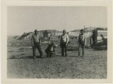
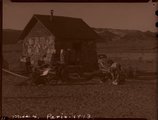
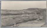
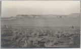
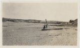
Paria Valley camp, 1943
1943
Image
uum_map
27
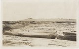
Paria Valley camp, 1943
1943
Image
uum_map
28
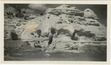
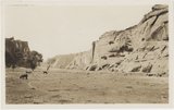
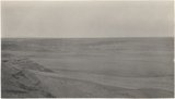
Shinarump outcrop near Paria, 1943
1943
Image
uum_map
29
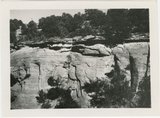
Starlight Canyon 1943
1943
Image
uum_map
30
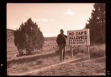
"No Japs allowed" sign, 1943
1943
Image
uum_map
31
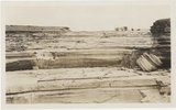
Paria Valley camp, 1943
1943
Image
uum_map
32
Gypsum seams near Holbrook E.C.Case, photo. (Moencopie)
1913
Image
uum_map
33
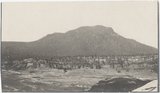
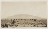
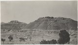
Baigaiche Mt. from "Beast" dike (Photo G388)
1913
Image
uum_map
34
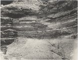
Canyon de Chelly. Cross-bedding (III-9 just like this) (Photo G374)
1913
Image
uum_map
35
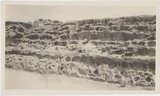
Canyon de Chelly. Shinarump capping Permian (Photo G373)
1913
Image
uum_map
36
Distant (10 mi.) view of Navaho Mt., southeast (Photo G368)
1913
Image
uum_map
37
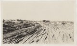
Dunes filling Reservoir Canyon, Tuba (IV-8 in film book is also like this) (Photo G441)
1913
Image
uum_map
38
Flat between Little Colorado and Dolores cliff, Tolchaco. "Lake" shown is mirage (Photo G411)
1913
Image
uum_map
39
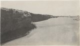
Grand Falls, Little Colorado (Photo N-M175)
1913
Image
uum_map
40
Grand Falls, panorama (Photos G415)
1913
Image
uum_map
41
Grand Falls, panorama (Photos G416)
1913
Image
uum_map
42
Gypsum in Permian. 2± mi. east of Holbrook (Photo G402)
1913
Image
uum_map
43
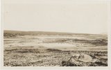
Panorama, Red Wall and Baigaiche, looking across Red Lake (Photo G-378-380)
1913
Image
uum_map
44
Peneplain; looking southeast from cliffs 5± mi. N 80 deg E, Black Falls (Photo N-M176 and G423)
1913
Image
uum_map
45
View from "Beast" dike north across Red Lake (Photo G391)
1913
Image
uum_map
46
View looking northeast up Black Creek from "Beast" dike (Photo G392)
1913
Image
uum_map
47
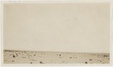
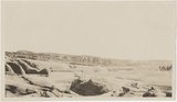
Waterhole in desert 1± mi. below Sunrise Spgs. (Photo G395)
1913
Image
uum_map
48
Wind carving Kaibab 2 mi. above Tolchaco (Photo G414)
1913
Image
uum_map
49
Wind erosion, La Plata, Tuba (Photo G435)
1913
Image
uum_map
50
Dolores Badlands 1 1/2 mile west of Nashlini. (I-5 & I-7 in film book just like this) (Photo N-M135)
1913
Image
uum_map
26
-
50
of
3,664
<
1
2
3
4
5
6
7
8
9
10
>