|
|
Author | Title | Subject | Date | Publication Type |
| 401 |
 |
Siddique, Mohammad | Kinetic approach to ball mill scale-up for dry and wet systems | Mill work; Dry and wet grinding | 1977-04-02 | thesis |
| 402 |
 |
Paik, Young Hyun | Kinetics of elevated temperature hydrolysis of aluminum sulfate | | 1970 | thesis |
| 403 |
 |
Cardoen, Carlos Remigio | The kinetics of molybenum disulfide oxidation | | 1969 | thesis |
| 404 |
 |
Stephens, Miles | Laboratory and numerical modeling used to characterize leakage in underground coal mines | Booster fan; Coal mine; Leakage; Numerical model; Underground; Ventilation | 2011-05 | thesis |
| 405 |
 |
Huth, Tyler Edward | Laminated soil carbonate rinds as a high resolution paleoclimate and paleoecologic proxy record | | 2018 | dissertation |
| 406 |
 |
Stouffer, Stephen Gerald | Landslides in the Coal Hill area, Kane County, Utah (Google Earth map overlay KMZ file) | Landslides -- Utah -- Kane County; Geology -- Utah -- Kane County | 1964-06 | map |
| 407 |
 |
Stouffer, Stephen Gerald | Landslides in the Coal Hill area, Kane County, Utah (Thesis and maps) | Landslides -- Utah -- Kane County; Geology -- Utah -- Kane County | 1964-06 | thesis |
| 408 |
 |
Stouffer, Stephen Gerald | Landslides in the Coal Hill area, Kane County, Utah: Georeferenced map files | Landslides -- Utah -- Kane County; Geology -- Utah -- Kane County | 1964-06 | thesis |
| 409 |
 |
Xue, Yanwei | Least squares datuming and surface waves prediction with interferometry | Geophysics | 2010 | dissertation |
| 410 |
 |
Medina, Juan Francisco | Liberation-limited grade/recovery curves for auriferous pyrite ores as determined by high resolution x-ray microtomography | Grade/recovery; Liberation; Microtomography; Auriferous pyrite ores | 2012-08 | dissertation |
| 411 |
 |
Good, Thomas Roger | Life in an ancient sea of sand: trace fossil associations and their paleoecological implications in the Upper Triassic/Lower Jurassic Nugget Sandstone, Northeastern Utah | Entradichnus; Fossils; Ichnology; Nugget; Sandstone; Trace | 2013-12 | thesis |
| 412 |
 |
Zdunkowski, Wildord Gustav | The long wave flux density leaving the Earth under various meteorological conditions | | 1959 | thesis |
| 413 |
 |
Gammans, Christine Naomi Louise | Low-angle normal faulting in the basin and range-Colorado plateau transition zone during the January 3, 2011 circleville, UT earthquake sequence | Low-angle normal faulting | 2013-08 | thesis |
| 414 |
 |
Lefler, Hyrum David | Low-cost production of titanium metal powder by the Hamr Process | | 2018 | dissertation |
| 415 |
 |
Willhard, Travis Paul | Magnetostriction and Ordering in Fe-16.4 AT.% Al Single Crystals | Physics; Engineering; Materials science | 2018 | thesis |
| 416 |
 |
Janwong, Adirek | Magnetostriction measurements in Ni alloy single crystals at cryogenic temperatures | Nickel alloys, Magnetic properties; Magnetostriction; Low temperature engineering | 2008-05 | thesis |
| 417 |
 |
MacArthur, W. E. | The manufacture of zinc oxide directly from oxidized ores | Zinc -- Metallurgy; Zinc oxide | 1920 | thesis |
| 418 |
 |
Morris, Elliot Cobia | Map 1 Geologic map and sections of Big Piney Area, Utah (Google Earth map overlay KMZ file) | Geology -- Utah -- Summit County | 1953-06 | thesis |
| 419 |
 |
Condie, Kent C. | Map 1 Geologic map of the Mineral Range, Utah (Google Earth map overlay KMZ file) | Petrology -- Utah -- Beaver County; Millard County; Geology -- Utah -- Beaver County; Millard County; Mineral Range (Utah); Thesis and dissertation georeferencing project | 1960-06 | thesis |
| 420 |
 |
Moussa, Mounir Tawfik | Map 1 Geologic map of the Soldier Summit Quadrangle, Utah (Google Earth map overlay KMZ file) | Geology; Utah; Utah County; Carbon County; Wasatch County | 1965-06 | thesis |
| 421 |
 |
Eriksson, Yves | Map 1 Geology of the upper Ogden Canyon, Weber County, Utah (Google Earth map overlay KMZ file) | Geology -- Utah -- Weber County; Thesis and dissertation georeferencing project | 1960-06 | thesis |
| 422 |
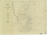 |
Amin, Surendra R. | Map 1: Geologic map of Antelope intrusive and vicinity | | 1950 | thesis |
| 423 |
 |
Amin, Surendra R. | Map 1: Geologic map of Antelope intrusive and vicinity (Google Earth map overlay KMZ file) | Thesis and dissertation georeferencing project | 1950 | map |
| 424 |
 |
Paddock, Robert Edwards | Map1 Geologic map and sections of Newfoundland Mountains, Box Elder County, Utah (Google Earth map overlay KMZ file) | Geology; Utah; Newfoundland Mountains; Box Elder County; Thesis and dissertation georeferencing project | 1956-12 | thesis |
| 425 |
 |
Root, Robert L. | Map1 Geologic map and sections of Smith and Morehouse-Hayden Fork area, Utah (Google Earth map overlay KMZ file) | Geology; Utah; Summit County; Thesis and dissertation georeferencing project | 1952 | thesis |