351 - 375 of 3,384
Number of results to display per page
TitleDateType
351 Women dancers and spectators at Bear Dance. Baby on cradle board against fence center backgroundImage/StillImage
352 Women dancers and spectators at Bear Dance. Baby on cradle board against fence center backgroundImage/StillImage
353 Women's line of dancersImage/StillImage
354 White River, Stage Station between Dragon and Ouray, Summer '09Image/StillImage
355 A group of St. George (Sibwit) Paiutes and Wickiups (cedar)Image/StillImage
356 Woman basket-weavingImage/StillImage
357 Woman tanning leatherImage/StillImage
358 Chief WashakieImage/StillImage
359 Map of the South West Boundary of the Uintah Indian Reserve Utah Territory.Image/StillImage
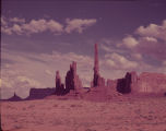
360 Monument ValleyImage/StillImage
361 Monument Valley sandstone monolithsImage/StillImage
362 Moshoquop, the Avenger, as Loyal Friend1928; 1929; 1930; 1931; 1932; 1933Text
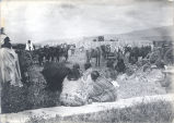
363 Scene at White Rocks, Ration day, Summer '091909Image/StillImage
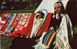
364 Ute Indian and handicraftsImage/StillImage
365 Map of Dry Gulch Irrigation District, Uintah Indian Reservation, UtahImage/StillImage
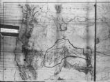
366 Map of Shoshone Territory; Prepared by Doty, 1859Image/StillImage
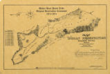
367 Map of Walker River Paiute Tribe Original Reservation Centennial 1874-19741874Image/StillImage
368 Shoshone Language Materials: Gosiute ReservationSound
369 The Unwanted Indians: The Southern Utes in Southeastern Utah1981Text
370 Some Useful Early Utah Indian References1928; 1929; 1930; 1931; 1932; 1933Text
371 Reminiscences of Indian Habits and Character, and Death of Captain May1928; 1929; 1930; 1931; 1932; 1933Text
372 Uintah and Ouray Indian Agency, Fort Duchesne, Utah1928; 1929; 1930; 1931; 1932; 1933Text
373 Buckskin CharleyImage/StillImage
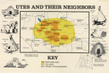
374 Map titled, "Utes and Their Neighbors"Image/StillImage
375 Map of a portion of the Uncompahgre Ute Indian Reservation1908Image/StillImage
351 - 375 of 3,384