Home
Browse
Ask Us
Chat
Harmful Language Statement
Log in
Advanced Search
Year
1872
1873
1874
1875
1876
1877
1878
1879
1880
1881
1882
1883
1884
1885
1886
1887
1888
1889
1890
1891
1892
1893
1894
1895
1896
1897
1898
1899
1900
1901
1902
1903
1904
1905
1906
1907
1908
1909
1910
1911
1912
1913
1914
1915
1916
1917
1918
1919
1920
1921
1922
1923
1924
1925
1926
1927
1928
1929
1930
1931
1932
1933
1934
1935
1936
1937
1938
1939
1940
1941
1942
1943
1944
1945
1946
1947
1948
1949
1950
1951
1952
1953
1954
1955
1956
1957
1958
1959
1960
1961
1962
1963
1964
1965
1966
1967
1968
1969
1970
1971
1972
1973
1974
1975
1976
1977
1978
1979
1980
1981
1982
1983
1984
1985
1986
1987
1988
1989
1990
1991
1992
1993
TO
1872
1873
1874
1875
1876
1877
1878
1879
1880
1881
1882
1883
1884
1885
1886
1887
1888
1889
1890
1891
1892
1893
1894
1895
1896
1897
1898
1899
1900
1901
1902
1903
1904
1905
1906
1907
1908
1909
1910
1911
1912
1913
1914
1915
1916
1917
1918
1919
1920
1921
1922
1923
1924
1925
1926
1927
1928
1929
1930
1931
1932
1933
1934
1935
1936
1937
1938
1939
1940
1941
1942
1943
1944
1945
1946
1947
1948
1949
1950
1951
1952
1953
1954
1955
1956
1957
1958
1959
1960
1961
1962
1963
1964
1965
1966
1967
1968
1969
1970
1971
1972
1973
1974
1975
1976
1977
1978
1979
1980
1981
1982
1983
1984
1985
1986
1987
1988
1989
1990
1991
1992
1993
Type
Image
3,521
Image/StillImage
143
Format
image/jpeg
3,594
application/pdf
70
Collection
Photo Archives
3,521
UAIDA Main Collection
143
301
-
325
of
3,664
<
8
9
10
11
12
13
14
15
16
17
>
Gallery view
Number of results to display per page
10
25
50
100
200
Sort by Relevance
Sort by Title A-Z
Sort by Title Z-A
Sort by Date Ascending
Sort by Date Descending
Sort by Last Modified Ascending
Sort by Last Modified Descending
Title
Date
Type
Setname
301
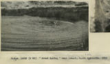
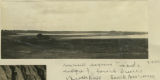
"Mound spring" near Coward, South Australia, 1916
1916
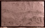
Image
uum_map
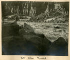
302
"Mound spring" near Coward, South Australia, 1916
1916
Image
uum_map
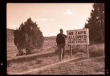
303
"No Japs allowed" sign, 1943
1943
Image
uum_map
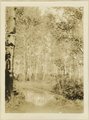
304
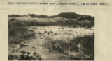
"Rain catch" on Yalata-Oldea stock route, South Australia, 1916
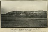
1916
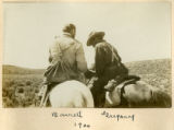
Image
uum_map
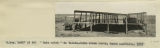
305
"Sigh," the pack mule, 1910 (Photo N-M103)
1910
Image
uum_map
306
3± mi. north of Ganado, Ariz. Tertiary in angular unconformity with Dolores (Triassic), 1909 (photo G-37)
1909
Image
uum_map
307
[Grand Gulch, Wayne Co., Ut.]
1935
Image
uum_map
308
A basin range, Toquerville region, 190
1900
Image
uum_map
309
Abancay to La Estrella. Concacha. Nearer view of the same.
1911; 1912; 1915
Image
uum_map
310
Alluvial terraces made since 1900, Johnson Creek, Kane County, UT, 1939
1939
Image
uum_map
311
Along Wahweap Stream. Cross bedding sandstone. Kane County, UT. June 1918
1918
Image
uum_map
312
Alton-Johnson Road
1936
Image
uum_map
313
Ancient irrigation ditch, La Plata sandstone, Moencopie wash, 10± mil east of Tuba, Ariz., 1909 (photo G-101)
1909
Image
uum_map
314
Ancient lagoons inside ridge of fossil dunes, Beachport, South Australia, 1916
1916
Image
uum_map
315
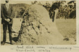
Ant hill near Wallerawang, New South Wales
1916
Image
uum_map
316
Arroyo in Cienega (meadow), line of bushes shows position of water table, St. Michaels, Ariz., 1909 (photo G-3)
1909
Image
uum_map
317
Aspens on Elk Ridge
1907
Image
uum_map
318
At the River
1900
Image
uum_map
319
Baby Llamas.
1911
Image
uum_map
320
Bank of Paria River near Paria. Kane County, UT. June 1918
1918
Image
uum_map
321
Barrett, Gregory
1900
Image
uum_map
322
Barrett, Gregory, 1900
1900
Image
uum_map
323
Basalt flow from Bald Knob Volcano, upper Johnson Canyon. Kane County, Utah, 1938.
1938
Image
uum_map
324
Basalt in Moenkopi, north wash.
1930; 1931; 1932; 1933; 1934; 1935; 1936; 1937
Image
uum_map
325
Basalt-capped mesa, Biddehoche, Ariz. (negative for photo G-68)
1909
Image
uum_map
301
-
325
of
3,664
<
8
9
10
11
12
13
14
15
16
17
>