Home
Browse
Ask Us
Chat
Harmful Language Statement
Log in
Advanced Search
Year
1800
1801
1802
1803
1804
1805
1806
1807
1808
1809
1810
1811
1812
1813
1814
1815
1816
1817
1818
1819
1820
1821
1822
1823
1824
1825
1826
1827
1828
1829
1830
1831
1832
1833
1834
1835
1836
1837
1838
1839
1840
1841
1842
1843
1844
1845
1846
1847
1848
1849
1850
1851
1852
1853
1854
1855
1856
1857
1858
1859
1860
1861
1862
1863
1864
1865
1866
1867
1868
1869
1870
1871
1872
1873
1874
1875
1876
1877
1878
1879
1880
1881
1882
1883
1884
1885
1886
1887
1888
1889
1890
1891
1892
1893
1894
1895
1896
1897
1898
1899
1900
1901
1902
1903
1904
1905
1906
1907
1908
1909
1910
1911
1912
1913
1914
1915
1916
1917
1918
1919
1920
1921
1922
1923
1924
1925
1926
1927
1928
1929
1930
1931
1932
1933
1934
1935
1936
1937
1938
1939
1940
1941
1942
1943
1944
1945
1946
1947
1948
1949
1950
1951
1952
1953
1954
1955
1956
1957
1958
1959
1960
1961
1962
1963
1964
1965
1966
1967
1968
1969
1970
1971
1972
1973
1974
1975
1976
1977
1978
1979
1980
1981
1982
1983
1984
1985
1986
1987
1988
1989
1990
1991
1992
1993
1994
1995
1996
1997
1998
1999
2000
2001
2002
2003
2004
2005
2006
2007
2008
2009
2010
2011
2012
2013
2014
2015
TO
1800
1801
1802
1803
1804
1805
1806
1807
1808
1809
1810
1811
1812
1813
1814
1815
1816
1817
1818
1819
1820
1821
1822
1823
1824
1825
1826
1827
1828
1829
1830
1831
1832
1833
1834
1835
1836
1837
1838
1839
1840
1841
1842
1843
1844
1845
1846
1847
1848
1849
1850
1851
1852
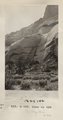
1853
1854
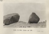
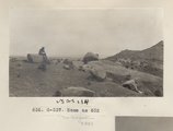
1855
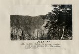
1856
1857
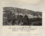
1858
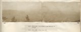
1859
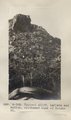
1860
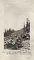
1861
1862
1863
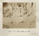
1864
1865
1866
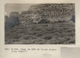
1867
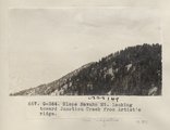
1868
1869
1870
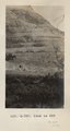
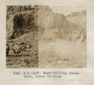
1871
1872
1873
1874
1875
1876
1877
1878
1879
1880
1881
1882
1883
1884
1885
1886
1887
1888
1889
1890
1891
1892
1893
1894
1895
1896
1897
1898
1899
1900
1901
1902
1903
1904
1905
1906
1907
1908
1909
1910
1911
1912
1913
1914
1915
1916
1917
1918
1919
1920
1921
1922
1923
1924
1925
1926
1927
1928
1929
1930
1931
1932
1933
1934
1935
1936
1937
1938
1939
1940
1941
1942
1943
1944
1945
1946
1947
1948
1949
1950
1951
1952
1953
1954
1955
1956
1957
1958
1959
1960
1961
1962
1963
1964
1965
1966
1967
1968
1969
1970
1971
1972
1973
1974
1975
1976
1977
1978
1979
1980
1981
1982
1983
1984
1985
1986
1987
1988
1989
1990
1991
1992
1993
1994
1995
1996
1997
1998
1999
2000
2001
2002
2003
2004
2005
2006
2007
2008
2009
2010
2011
2012
2013
2014
2015
Type
Image
38,143
Format
image/jpeg
38,143
Collection
American Westward Migration
1
Artifact Collection
3
Beckwith Photograph Collection
165
City Engineers
1,000
Classified Photographs
18,272
Clifton Bray Film Negatives
1
Hotel Utah
6
Murray Museum
4,199
Olympic Legacy
18
Peoples of Utah
1
Photo Archives
1,926
Regional History Center
93
Shipler Commercial Photographers
10,121
Ski and Snow Sports Archives
1,271
Thorne Photographs
5
Utah River Running Photo Archives
948
Vernal Express Photographs
1
Westminster College Photographs
32
William Edward Hook Glass Negatives
80
More
Filters:
Spatial Coverage:
"Utah"
Type:
"Image"
Format:
"image/jpeg"
Format:
image
Setname:
!(ir* OR ehsl*)
276
-
300
of
38,143
<
7
8
9
10
11
12
13
14
15
16
>
Gallery view
Number of results to display per page
10
25
50
100
200
Sort by Relevance
Sort by Title A-Z
Sort by Title Z-A
Sort by Date Ascending
Sort by Date Descending
Sort by Last Modified Ascending
Sort by Last Modified Descending
Title
Date
Type
Setname
276
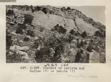
Contact of LaPlata and McElmo (?) or Dakokta (?) (Photo G357)
1913
Image
uum_map
277
Detail of 661 (Photo G362)
1913
Image
uum_map
278
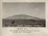
Distant (10 mi.) view of Navaho Mt., southeast (Photo G368)
1913
Image
uum_map
279
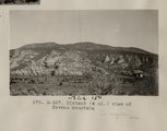
Distant (4 mi.) view of Navaho Mountain (Photo G367)
1913
Image
uum_map
280
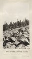
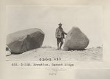
Erratics, Garnet Ridge (Photo G335)
1913
Image
uum_map
281
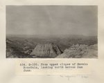
From upper slopes of Navaho Mountain, looking north across San Juan (Photo G355)
1913
Image
uum_map
282
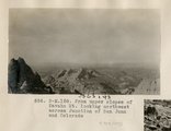
From upper slopes of Navaho Mt. looking northwest across Junction of San Juan and Colorado (Photo N-M158)
1913
Image
uum_map
283
LaPlata in unnamed canyon, northwest base of Navaho Mt., Camp 22 (Photo G358)
1913
Image
uum_map
284
Panorama from Artist's ridge (Photo N-M159 and N-M160)
1913
Image
uum_map
285
Pinnacles, La Plata and McElmo (?), north side of Navaho Mountain (I-33 is same) (Photo G356)
1913
Image
uum_map
286
Rock slide, east side of Navaho Mt., elevation 9300' (Photo G361)
1913
Image
uum_map
287
Same as 632 (Erratics, Garnet Ridge, Photo G336)
1913
Image
uum_map
288
Same as 632 (Photo G337)
1913
Image
uum_map
289
Same as 634 (Wash-filling structure, Lower Chinlee, Photo N-M158)
1913
Image
uum_map
290
Same as 658 (La Plata, NW Navajo Mtn., Photo G359)
1913
Image
uum_map
291
Same as 658 (La Plata, NW Navajo Mtn., Photo G360)
1913
Image
uum_map
292
Same as 668 at lower elevation (6500') (Navajo Mtn, Photo G366)
1913
Image
uum_map
293
Slope Navaho Mt. looking toward Junction Creek from Artist's ridge (Photo G364)
1913
Image
uum_map
294
Talus in gorge, southwest side Navaho Mt. Elevation 6500'-9500' (Photo G363)
1913
Image
uum_map
295
Typical cliff, LaPlata and McElmo, southeast base of Navaho Mt. (Photo G365)
1913
Image
uum_map
296
Wash-filling structure, Lower Chinlee (Photo N-M157)
1913
Image
uum_map
297
Dr. Pogue on Greybird, 1910
1910
Image
uum_map
298
San Francisco Mountain (Photo N-M83a)
1910
Image
uum_map
299
Smelter workers
1922
Image
mc_mcm
300
Home at 75 East 5100 South
1938
Image
mc_mcm
276
-
300
of
38,143
<
7
8
9
10
11
12
13
14
15
16
>