Home
Browse
Ask Us
Chat
Harmful Language Statement
Log in
Photo Archives
Advanced Search
About
Over 70,000 photos covering a variety of topics from Marriott Library Special Collections
Year
1872
1873
1874
1875
1876
1877
1878
1879
1880
1881
1882
1883
1884
1885
1886
1887
1888
1889
1890
1891
1892
1893
1894
1895
1896
1897
1898
1899
1900
1901
1902
1903
1904
1905
1906
1907
1908
1909
1910
1911
1912
1913
1914
1915
1916
1917
1918
1919
1920
1921
1922
1923
1924
1925
1926
1927
1928
1929
1930
1931
1932
1933
1934
1935
1936
1937
1938
1939
1940
1941
1942
1943
1944
1945
1946
1947
1948
1949
1950
1951
1952
1953
1954
1955
1956
1957
1958
1959
1960
1961
1962
1963
1964
1965
1966
1967
1968
1969
1970
1971
1972
1973
1974
1975
1976
1977
1978
1979
1980
1981
1982
1983
1984
1985
1986
1987
1988
1989
1990
1991
1992
1993
TO
1872
1873
1874
1875
1876
1877
1878
1879
1880
1881
1882
1883
1884
1885
1886
1887
1888
1889
1890
1891
1892
1893
1894
1895
1896
1897
1898
1899
1900
1901
1902
1903
1904
1905
1906
1907
1908
1909
1910
1911
1912
1913
1914
1915
1916
1917
1918
1919
1920
1921
1922
1923
1924
1925
1926
1927
1928
1929
1930
1931
1932
1933
1934
1935
1936
1937
1938
1939
1940
1941
1942
1943
1944
1945
1946
1947
1948
1949
1950
1951
1952
1953
1954
1955
1956
1957
1958
1959
1960
1961
1962
1963
1964
1965
1966
1967
1968
1969
1970
1971
1972
1973
1974
1975
1976
1977
1978
1979
1980
1981
1982
1983
1984
1985
1986
1987
1988
1989
1990
1991
1992
1993
Type
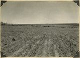
Image
3,451
Format
image/jpeg
3,451
Collection
Photo Archives
3,451
Filters:
Type:
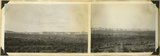
"Image"
Collection Name:
"Herbert E. Gregory"
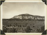
Format:
"image/jpeg"
251
-
275
of
3,451
<
6
7
8
9
10
11
12
13
14
15
>
Gallery view
Number of results to display per page
10
25
50
100
200
Sort by Relevance
Sort by Title A-Z
Sort by Title Z-A
Sort by Date Ascending
Sort by Date Descending
Sort by Last Modified Ascending
Sort by Last Modified Descending
Title
Date
Type
251
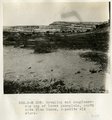
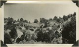
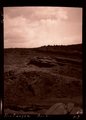
Beveling and conglomerate cap of lower peneplain, north side Blue Canon, opposite old store.
1913
Image
252
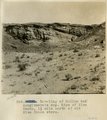
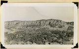
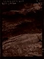
Beveling below Black Falls, looking north.
1913
Image
253
Beveling of McElmo and conglomerate cap. Edge of Blue Canon, 1 1/2 mile north of old Blue Canon store.
1913
Image
254
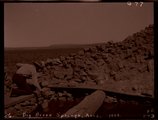
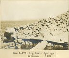
Big Burro Springs, Arizona, 1909 (negative for photo G-77)
1909
Image
255
Big Burro Springs, Arizona, 1909 (photo G-77)
1909
Image
256
Big Meadow Canyon. Carmel formation. Kane County, Utah.
1930
Image
257
Big Plains, west dipping surface eroded on east dipping Chinle beds, now coated with coalescing fans. Little Creek Terrace in right background, Kane County, UT, 1939
1939
Image
258
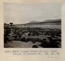
Black Creek Valley, Arizona (negative for photo G-11)
1909
Image
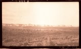
259
Black Creek valley, east toward Baigaiche Mt. VI, 45, 55 (Photo G299)
1911
Image
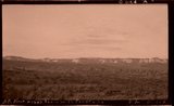
260
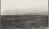
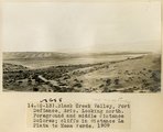
Black Creek Valley, Fort Defiance, Ariz. Looking north. Foreground and middle distance Dolores; cliffs in distance La Plata to Mesa Verde, 1909 (photo G-13)
1909
Image
261
Black Creek Valley, Fort Defiance, Ariz. Looking north. Foreground and middle distance Dolores; cliffs in distance La Plata to Mesa Verde, 1909 (photo G-13)
1909
Image
262
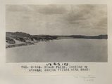
Black Falls, looking up stream; canyon filled with sand (Photo G426)
1913
Image
263
Black Ledge. Cliff of rhyolite that for about 20 miles forms the rim of the Markagunt Plateau. The escarpment is the upthrown side of a fault concealed by the talus. Hoosier Lake, Iron County, UT, 1942
1942
Image
264
Black Mountain culminating in Richardson Peak (altitude 9900 feet), viewed from southwest. Eroded crater and extensive basaltic flows overlying Cretaceous and Tertiary sediments. View looking north east edge of Kolob Terrace. Iron County, UT, 1942
1942
Image
265
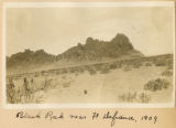
Black Rock near Ft. Defiance, 1909
1909
Image
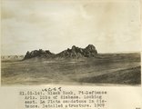
266
Black Rock, Ft. Defiance, Ariz. Dike of diabase. Looking east. La Plata sandstone in distance. Detailed structure, 1909 (photo G-14)
1909
Image
267
Block mesas from south, panorama.
1937
Image
268
Block mesas from south, panorama.
1937
Image
269
Block mesas from the south, panorama.
1937
Image
270
Block Mesas, east of Elephant Gap. Navajo sandstone capped by Carmel. Kane County, Utah, 1936.
1936
Image
271
Blue Canyon, Ariz. (negative for G-5)
1909
Image
272
Blue Canyon, Ft. Defiance, Ariz. (negative for G-4)
1909
Image
273
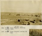
Blue Canyon, looking north, 1914
1914
Image
274
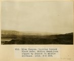
Blue Canyon, looking toward Black Mesa. McElmo sandstone capped by Mancos in middle distance, 1914
1914
Image
275
Blue Springs meadow at Leigh ranch. Stream from big springs (lower left) meanders across an ancient lake bed and escapes through a water gap (center distance). Garfield County, UT, 1944
1944
Image
251
-
275
of
3,451
<
6
7
8
9
10
11
12
13
14
15
>