TO
| Author | Title | Subject | Date | Publication Type | ||
|---|---|---|---|---|---|---|
| 226 |
 |
Thomson, Kenneth Clair | Mineral deposits of the Deep Creek Mountains, Tooele and Juab Counties, Utah: Georeferenced map files | Mines and mineral resources -- Utah -- Deep Creek Mountains | 1970-08 | thesis |
| 227 |
 |
Thomson, Kenneth Clair | Mineral deposits of the Deep Creek Mountains, Tooele and Juab Counties, Utah (Google Earth map overlay KMZ file) | Mines and mineral resources -- Utah -- Deep Creek Mountains | 1970-08 | map |
| 228 |
 |
Thomson, Kenneth Clair | Mineral deposits of the Deep Creek Mountains, Tooele and Juab Counties, Utah (Thesis and maps) | Mines and mineral resources -- Utah -- Deep Creek Mountains | 1970-08 | thesis |
| 229 |
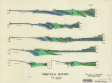 |
Blakey, Ronald Clyde | Plate 2: Structural sections | 1970-08 | thesis | |
| 230 |
 |
Blakey, Ronald Clyde | Plate 3: Structural map of the Paria NW quadrangle, Kane County, Utah | 1970-08 | thesis | |
| 231 |
 |
Blakey, Ronald Clyde | Plate 4: Topographic features of the Paria NW quadrangle, Kane County, Utah | 1970-08 | thesis | |
| 232 |
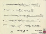 |
Blakey, Ronald Clyde | Plate 3: Structural sections | 1970-08 | thesis | |
| 233 |
 |
Blakey, Ronald Clyde | Plate 1: Geologic map of the Paria NW quadrangle, Kane County, Utah | 1970-08 | thesis | |
| 234 |
 |
Blakey, Ronald Clyde | Geology of the Paria Northwest quadrangle Kane County, Utah-Maps | Geology -- Utah -- Kane County -- Paria Northwest quadrangle | 1970-08 | thesis |
| 235 |
 |
Heron, Thomas Murray | Boundary layer flow over sloping terrain | 1971 | thesis | |
| 236 |
 |
Crockett, Frederick James | A Preliminary study of the use of oxygen isotope ratios as an exploration tool in the Park City District, Utah | 1971 | thesis | |
| 237 |
 |
Rees, Delbert Clyde | Geology and diatremes of Desert Mountain, Utah | Geology -- Utah -- Desert Mountain; Thesis and dissertation georeferencing project | 1971-06 | thesis |
| 238 |
 |
Sayre, Robert Lewis | Geology and mineral deposits of the western portion church hills, Millard County, Utah | Geology; Utah; Church Hills region; Mines and mineral resources; Thesis and dissertation georeferencing project | 1971-06 | thesis |
| 239 |
 |
Randolph Edward Scheffel | The Extraction of copper from Crysocolla with NTA | 1972 | thesis | |
| 240 |
 |
Baghoomian, Ovaness | Excess pore pressure and in situ measurement of shear strength gain in clays | Soils -- Testing; Clay -- Analysis | 1972-06 | thesis |
| 241 |
 |
Doyuran, Vedat | Geology and ground-water resources of Ogden Valley, Utah | Geology -- Utah -- Ogden Valley; Groundwater -- Utah -- Ogden Valley; Thesis and dissertation georeferencing project | 1972-06 | thesis |
| 242 |
 |
Williamson, Charles Ross | Carbonate petrology of the Green River Formation (Eocene), Uinta Basin, Utah and Colorado | Petrology; Utah; Green River Fomartion; Colorado; Thesis and dissertation georeferencing project | 1972-08 | thesis |
| 243 |
 |
Monsalve, Obdulio Alfonso | Geology of the San Arroyo gas Field Grand County, Utah | Geology; Utah; Grand County; Natural gas; Thesis and dissertation georeferencing project | 1972-08 | thesis |
| 244 |
 |
Sadeghi, Ali Reza | Structural geology of the Willard Peak area, North-Central Wasatch Mountains, Utah | Geology -- Structural -- Utah -- Willard Peak area; Thesis and dissertation georeferencing project | 1972-12 | thesis |
| 245 |
 |
Sadeghi, Ali Reza | Plate 1: Geologic map of the Willard Peak area, North-Central Wasatch Mountains, Utah (Google Earth map overlay KMZ file) | Geology -- Structural -- Utah -- Willard Peak area; Thesis and dissertation georeferencing project | 1972-12 | thesis |
| 246 |
 |
Sadeghi, Ali Reza | Structural geology of the Willard Peak Area, North-Central Wasatch Mountains, Utah: Georeferenced map files | Geology -- Structural -- Utah -- Willard Peak area | 1972-12 | thesis |
| 247 |
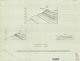 |
Sadeghi, Ali Reza | Plate 2: Structure sections for geologic map of the Willard Peak area | 1972-12 | thesis | |
| 248 |
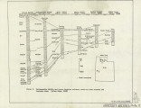 |
Sadeghi, Ali Reza | Plate 3: Palinspastic middle and upper Cambrian columnar sections from western and northern Utah | 1972-12 | thesis | |
| 249 |
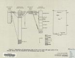 |
Sadeghi, Ali Reza | Plate 4: Correlation of Precambrian rocks of the lower plate and upper plate of the Willard thrust with the Huntsville and Cottonwood areas | 1972-12 | thesis | |
| 250 |
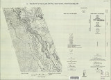 |
Sadeghi, Ali Reza | Plate 1: Geologic map of the Willard Peak area, North-Central Wasatch Mountains, Utah | 1972-12 | thesis |
