1 - 25 of 69
Number of results to display per page
TitleDateType
1 Areas Used by the Goshute People and Areas Potentially Impacted by Southern Nevada Water AuthorityImage/StillImage
2 Navajo Book 2a: PictureImage/StillImage
3 Navajo Book 2b: Photo Description1915Image/StillImage
4 Map of Uintah Valley Reserve, formed by order of President Abraham Lincoln, 1861.Image/StillImage
5 Map of a portion of the Uncompahgre Ute Indian Reservation, surveyed and subdivided for allotments to the Uncompahgre Ute Indians in accordance with the Act approved June 1880 by authority of Honorable N. C. McFarland, Commissioner General Land Office Daniel G. Major U.S. Surveyor 1882-18831882; 1883Image/StillImage
6 Map of the Southern Part of the Former Uintah Indian Reservation Showing the Irrigation System of Indian AllotmentsImage/StillImage
7 Map of the Northern Part of the Former Uintah Indian Reservation Showing the Irrigation SystemImage/StillImage
8 Sketch of Uintah Ouray Agencies.Image/StillImage
9 Uintah Indian Reservation Boundaries; Sheet Number 1Image/StillImage
10 Uintah Indian Reservation Boundaries; Sheet Number 3Image/StillImage
11 Uintah Indian Reservation Boundaries; Sheet Number 5Image/StillImage
12 Map of Indian Reservation. 1884Image/StillImage
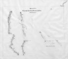
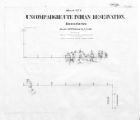
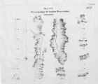
13 Map of Uncompahgre Ute Indian Reservation Boundaries, Sheet Number 1, 1889Image/StillImage
14 Map of Uncompahgre Ute Indian Reservation Boundaries, Sheet Number 3, 1889Image/StillImage
15 Map of Uncompahgre Ute Indian Reservation Boundaries, Sheet Number 4, 1889Image/StillImage
16 Map of Uncompahgre Ute Indian Reservation Boundaries, Sheet Number 6, 1889Image/StillImage
17 Map of Uncompahgre Ute Indian Reservation Boundaries, Sheet Number 8, 1889Image/StillImage
18 Uinta Indian Reservation Utah, under act of March 3, 1905 and President's Proclamation dated July 14, 1905Image/StillImage
19 Uintah Indian Reservation Boundaries Sheet Number 4Image/StillImage
20 Uintah Indian Reservation Boundaries; Sheet Number 2Image/StillImage
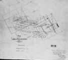
21 Map of Uncompahgre Ute reservation, Includes parcel divisionsImage/StillImage
22 Map of Part of the West Boundary of the Uncompahgre Ute Indian Reservation as Surveyed by William B. DougallImage/StillImage
23 Map of Uncompahgre Ute Indian Reservation Boundaries, Sheet Number 2, 1889Image/StillImage
24 Map of Uncompahgre Ute Indian Reservation Boundaries, Sheet Number 7, 1889Image/StillImage
25 Map of Uintah Irrigation Project June 1926 Myton, UtahImage/StillImage
1 - 25 of 69