Home
Browse
Ask Us
Chat
Harmful Language Statement
Log in
Theses & Dissertations
Advanced Search
Year
1950
1951
1952
1953
1954
1955
1956
1957
1958
1959
1960
1961
TO
1950
1951
1952
1953
1954
1955
1956
1957
1958
1959
1960
1961
Type
Image
6
Format
image/jpeg
6
Collection
Theses & Dissertations
6
Filters:
Type:
"Image"
Publication Type:
"thesis"
Format:
image
1
-
25
of
6
Gallery view
Number of results to display per page
10
25
50
100
200
Sort by Relevance
Sort by Title A-Z
Sort by Title Z-A
Sort by Date Ascending
Sort by Date Descending
Sort by Last Modified Ascending
Sort by Last Modified Descending
Title
Date
Type
1
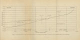
Figure 4: Longitudinal profile of Middle Canyon showing locations of the profiles across the canyon, the nickpoint, and the hypothetical profile before rejuvenation
1960-08
Image
2
Plate 1: Geologic map of Northern Bryce Canyon National Park
1961-06
Image
3
Plate 3: Geologic map and sections of Wanship-Park City region, Utah
1952-06
Image
4
Map 1: Geologic map of Antelope intrusive and vicinity
1950
Image
5
Plate 3: Geologic map of portion of Northwestern Uinta Mountains, Utah
1951
Image
6
Plate1-part1 Geologic map of the Central Mineral Range, Beaver County, Utah
1957-08
Image
1
-
25
of
6