Home
Browse
Ask Us
Chat
Harmful Language Statement
Log in
Advanced Search
Year
1841
1842
1843
1844
1845
1846
1847
1848
1849
1850
1851
1852
1853
1854
1855
1856
1857
1858
1859
1860
1861
1862
1863
1864
1865
1866
1867
1868
1869
1870
1871
1872
1873
1874
1875
1876
1877
1878
1879
1880
1881
1882
1883
1884
1885
1886
1887
1888
1889
1890
1891
1892
1893
1894
1895
1896
1897
1898
1899
1900
1901
1902
1903
1904
1905
1906
1907
1908
1909
1910
1911
1912
1913
1914
1915
1916
1917
1918
1919
1920
1921
1922
1923
1924
1925
1926
1927
1928
1929
1930
1931
1932
1933
1934
1935
1936
1937
1938
1939
1940
1941
1942
1943
1944
1945
1946
1947
1948
1949
1950
1951
1952
1953
1954
1955
1956
1957
1958
1959
1960
1961
1962
1963
1964
1965
1966
1967
1968
1969
1970
1971
1972
1973
1974
1975
1976
1977
1978
1979
1980
1981
1982
1983
1984
1985
1986
1987
1988
1989
1990
1991
1992
1993
1994
1995
1996
1997
1998
1999
2000
2001
2002
2003
2004
2005
2006
2007
2008
2009
2010
2011
2012
2013
2014
2015
2016
2017
2018
2019
2020
TO
1841
1842
1843
1844
1845
1846
1847
1848
1849
1850
1851
1852
1853
1854
1855
1856
1857
1858
1859
1860
1861
1862
1863
1864
1865
1866
1867
1868
1869
1870
1871
1872
1873
1874
1875
1876
1877
1878
1879
1880
1881
1882
1883
1884
1885
1886
1887
1888
1889
1890
1891
1892
1893
1894
1895
1896
1897
1898
1899
1900
1901
1902
1903
1904
1905
1906
1907
1908
1909
1910
1911
1912
1913
1914
1915
1916
1917
1918
1919
1920
1921
1922
1923
1924
1925
1926
1927
1928
1929
1930
1931
1932
1933
1934
1935
1936
1937
1938
1939
1940
1941
1942
1943
1944
1945
1946
1947
1948
1949
1950
1951
1952
1953
1954
1955
1956
1957
1958
1959
1960
1961
1962
1963
1964
1965
1966
1967
1968
1969
1970
1971
1972
1973
1974
1975
1976
1977
1978
1979
1980
1981
1982
1983
1984
1985
1986
1987
1988
1989
1990
1991
1992
1993
1994
1995
1996
1997
1998
1999
2000
2001
2002
2003
2004
2005
2006
2007
2008
2009
2010
2011
2012
2013
2014
2015
2016
2017
2018
2019
2020
Type
Image
67
Text
36
Format
image/jpeg
67
application/pdf
36
Collection
Aileen Clyde Oral History Project
17
John Mills Whitaker Papers
1
Philip T. Blair Family Papers
17
Theses & Dissertations
1
Utah Historical Society Railroad Map ...
67
Filters:
Subject:
"Utah--History"
1
-
25
of
103
<
1
2
3
4
5
>
Gallery view
Number of results to display per page
10
25
50
100
200
Sort by Relevance
Sort by Title A-Z
Sort by Title Z-A
Sort by Date Ascending
Sort by Date Descending
Sort by Last Modified Ascending
Sort by Last Modified Descending
Title
Date
Type
Setname
1
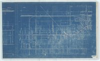
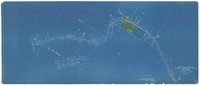
Right of Way Map and Track Map; Salt Lake City to Saltair Beach, Utah; Fragment of Downtown Salt Lake City map
1916
Image
dha_ucrm
2
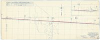
Joint Yard; Salt Lake and Utah Railroad and Oregon Short Line Railroad; South End; 721 + 11.5 Southern Limit of Joint Yard; Sandy Utah; Draper Utah
Image
dha_ucrm
3
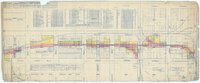
Oregon Short Line Railroad and Los Angeles and Salt Lake Railroad; V. Ut. 1 1 Sandy
Image
dha_ucrm
4
Business and railroad correspondence to Brigham Young
1869; 1876
Text
uum_ptbf
5
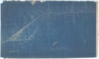
Denver and Rio Grande Railroad and Salt Lake and Utah Railroad; Fragment of map of 9th South to Roper Yard
1914; 1933
Image
dha_ucrm
6
Station Map - Lands; Oregon Short Line Railroad; Salt Lake County Main Line Map No. 5a
1917; 1933
Image
dha_ucrm
7
Los Angeles and Salt Lake Railroad - Main Line - Goss to Jerome; Mile post 612 to mile post 637
1924
Image
dha_ucrm
8
Right of Way Map and Track Map; Denver and Rio Grande Railroad; Salt Lake Division; Salt Lake County Map 1; UTAH V-3-A 11
1919; 1927
Image
dha_ucrm
9
Right of Way Map and Track Map; Western Pacific Railroad Company; Garfield to Fox Main Line Change; V-1 UTAH S-28-A
1927; 1930; 1936
Image
dha_ucrm
10
Right of Way Map and Track Map; Western Pacific Railroad Company; Garfield to Fox Main Line Change; V-1 UTAH S-28-B
1927; 1936
Image
dha_ucrm
11
Right of Way Map and Track Map; Western Pacific Railroad Company; Station 1011 + 48.04 to Station 800 + 77.64
1914; 1927; 1930
Image
dha_ucrm
12
Right of Way Map and Track Map; Western Pacific Railroad Company; Station 378 + 37.64 to Station 167 + 17.64
1914; 1927; 1936
Image
dha_ucrm
13
Right of Way Map and Track Map; Western Pacific Railroad Company; Station Jordan Avenue to Station Union Depot; V. 1. UTAH No. S. 31 C
1914; 1927; 1930; 1936
Image
dha_ucrm
14
Right of Way Map and Track Map; Union Pacific Railroad; Oregon Short Line Railroad; V. Ut. 2 1
1923
Image
dha_ucrm
15
Right of Way Map and Track Map; Western Pacific Railroad Company; Station Gordon Avenue to Station West of Orange Street; V. 1. UTAH No. S. 31A
1914; 1927
Image
dha_ucrm
16
Right of Way Map and Track Map; Western Pacific Railroad Company; Station Orange Street to Station Jordan Avenue; V. 1 UTAH No. S. 31B
1914; 1927
Image
dha_ucrm
17
Lands Map; Main Line Los Angeles and Salt Lake Railroad; Garfield Line Change; Salt Lake County; Station 93 + 34.3 to Station 320 + 00
1933
Image
dha_ucrm
18
Utah Southern Railroad Company resolution to issue bonds
1871-06-05
Text
uum_ptbf
19
Right of Way Map and Track Map; Main Line Los Angeles and Salt Lake Railroad; Provo Sub Div.; Salt Lake County; Sheet No. 30 of V. 18
1914; 1936
Image
dha_ucrm
20
Right of Way Map and Track Map; Main Line Los Angeles and Salt Lake Railroad; Provo Sub Div.; Salt Lake County; Sheet No. 32 of V. 18
1914; 1933
Image
dha_ucrm
21
Right of Way Map and Track Map; Main Line Los Angeles and Salt Lake Railroad; Sixth Sub Div.; Salt Lake County; V. 17 32
1914; 1933
Image
dha_ucrm
22
Right of Way Map and Track Map; Main Line Los Angeles and Salt Lake Railroad; Provo Sub Div.; Salt Lake County; Sheet No. 31 of V. 18
1914; 1933
Image
dha_ucrm
23
Right of Way Map and Track Map; Main Line Los Angeles and Salt Lake Railroad; Provo Sub Div.; Salt Lake County; Sheet No. 33 of V. 18
1916; 1917; 1920
Image
dha_ucrm
24
Right of Way Map and Track Map; Main Line Los Angeles and Salt Lake Railroad; Sixth Sub Div.; Salt Lake County; Station 146 + 72 to Survey Station 357 + 92
1914; 1933
Image
dha_ucrm
25
Right of Way Map and Track Map; Main Line Los Angeles and Salt Lake Railroad; Sixth Sub Div.; Salt Lake County; Station 569 + 12 to Station 700 + 00
1914; 1933
Image
dha_ucrm
1
-
25
of
103
<
1
2
3
4
5
>