Home
Browse
Ask Us
Chat
Harmful Language Statement
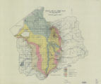
Log in
Advanced Search
Year
1851
1852
1853
1854
1855
1856
1857
1858
1859
1860
1861
1862
1863
1864
1865
1866
1867
1868
1869
1870
1871
1872
1873
1874
1875
1876
1877
1878
1879
1880
1881
1882
1883
1884
1885
1886
1887
1888
1889
1890
1891
1892
1893
1894
1895
1896
1897
1898
1899
1900
1901
1902
1903
1904
1905
1906
1907
1908
1909
1910
1911
1912
1913
1914
1915
1916
1917
1918
1919
1920
1921
1922
1923
1924
1925
1926
1927
1928
1929
1930
1931
1932
1933
1934
1935
1936
1937
1938
1939
1940
1941
1942
1943
1944
1945
1946
1947
1948
1949
1950
1951
1952
1953
1954
1955
1956
1957
1958
1959
1960
1961
1962
1963
1964
1965
1966
1967
1968
1969
1970
1971
1972
1973
1974
1975
1976
1977
1978
1979
1980
1981
1982
1983
1984
1985
1986
1987
1988
1989
1990
1991
1992
1993
1994
1995
1996
1997
1998
1999
2000
2001
2002
2003
2004
2005
2006
2007
2008
2009
2010
2011
2012
2013
2014
2015
2016
2017
2018
2019
2020
2021
2022
2023
2024
TO
1851
1852
1853
1854
1855
1856
1857
1858
1859
1860
1861
1862
1863
1864
1865
1866
1867
1868
1869
1870
1871
1872
1873
1874
1875
1876
1877
1878
1879
1880
1881
1882
1883
1884
1885
1886
1887
1888
1889
1890
1891
1892
1893
1894
1895
1896
1897
1898
1899
1900
1901
1902
1903
1904
1905
1906
1907
1908
1909
1910
1911
1912
1913
1914
1915
1916
1917
1918
1919
1920
1921
1922
1923
1924
1925
1926
1927
1928
1929
1930
1931
1932
1933
1934
1935
1936
1937
1938
1939
1940
1941
1942
1943
1944
1945
1946
1947
1948
1949
1950
1951
1952
1953
1954
1955
1956
1957
1958
1959
1960
1961
1962
1963
1964
1965
1966
1967
1968
1969
1970
1971
1972
1973
1974
1975
1976
1977
1978
1979
1980
1981
1982
1983
1984
1985
1986
1987
1988
1989
1990
1991
1992
1993
1994
1995
1996
1997
1998
1999
2000
2001
2002
2003
2004
2005
2006
2007
2008
2009
2010
2011
2012
2013
2014
2015
2016
2017
2018
2019
2020
2021
2022
2023
2024
Type
Text
904
Image
283
Image/StillImage
83
Sound
4
Image/MovingImage
1
Format
application/pdf
954
image/jpeg
328
application/vnd.google-earth.kmz
3
application/xml
2
Collection
American Flame Research Committee
1
Bennion Center Archive
7
College of Nursing
53
College of Pharmacy
19
Department of City and Metropolitan P...
3
Eccles Health Sciences Library History
13
Electronic University Archive
15
Encoded Archival Description (EAD) Fi...
2
Gerontology Interdisciplinary Program
1
Graduate Nursing Project
5
History of the Health Sciences
19
Honors Theses Closed Archive
1
Honors Theses Open Access
1
Illuminations
30
More Than A Flag: Utah State Flag Red...
267
Neighborhood Partners
2
Online Public Health Library
1
Peoples of Utah Revisited
4
School of Medicine Yearbooks
8
Theses & Dissertations
71
Topaz Museum
3
UAIDA Main Collection
24
UScholar Works
3
Uintah County Regional History Center...
71
University Archival Photographs (P0305)
1
Utah Historical Society Oral History ...
4
Utah Medical Association Bulletin
311
Utah Nurse
87
Utah Pharmacy Digest
232
Utah State Board Of Regents
17
Water Wise Utah
10
Western Soundscape Spectrograms
1
Westminster University Institutional ...
2
More
Filters:
Subject:
"Utah"
1
-
25
of
1,289
<
1
2
3
4
5
6
7
8
9
10
>
Gallery view
Number of results to display per page
10
25
50
100
200
Sort by Relevance
Sort by Title A-Z
Sort by Title Z-A
Sort by Date Ascending
Sort by Date Descending
Sort by Last Modified Ascending
Sort by Last Modified Descending
Title
Date
Type
Setname
1
Goshute Skull Valley Reservation Geothermal Resources Map
2004-01-14
Image/StillImage
uaida_main
2
Land Map for Pleasant Valley
1981
Image/StillImage
ucl_maps
3
Uintah County Roads - Collier Pass, Dog Valley Roads 2012
2012
Image/StillImage
ucl_maps
4
Quality and sources of shallow ground water in areas of recent residential development in Salt Lake Valley, Salt Lake County, Utah
2003
Text
uu_wwu
5
Plate1 Geologic map of Jordan Valley, Salt Lake County, Utah
Image
ir_etd
6
Plate2 Major Lake Bonneville sand and gravel deposits, Jordan Valley, Salt Lake County, Utah
Image
ir_etd
7
Uintah County Roads - Steinaker Draw, Little Valley, Red Mountain, Taylor Mountain, Carter Military Roads 2012
2012
Image/StillImage
ucl_maps
8
Utah Cambodian Community Buddhist Temple Magazine
2014
Text
dha_pour
9
Ground-water conditions in Utah: spring of 2007
2007
Text
uu_wwu
10
Plate3 Principle geomorphic features of Lower Jordan Valley
Image
ir_etd
11
Ground-water conditions in Utah: spring of 2006
2006
Text
uu_wwu
12
Evaluation of the ground-water flow model for northern Utah Valley, Utah, updated to conditions through 2002
2006
Text
uu_wwu
13
Hydrology and simulation of ground-water flow in Cedar Valley, Iron County, Utah
2005
Text
uu_wwu
14
State of Utah, Land Ownership and Public Management - 1973
1973
Image/StillImage
ucl_maps
15
Vernal, Utah 1993
1993
Image/StillImage
ucl_maps
16
Ashley, Utah reprint edition of Dec. 1885 map
1885
Image/StillImage
ucl_maps
17
Landscape with Monument Valley desert scape with blue sky, Utah coat of Arms is in center of blue circle
2022-03-20
Image
dha_mtaf
18
Promontory US DOI BLM 1973
1973
Image/StillImage
ucl_maps
19
Utah health status update: northwest Salt Lake Valley community health survey /
2000-12
ehsl_ophl
20
Vernal, Utah-Colorado 1980
1980
Image/StillImage
ucl_maps
21
Ashley Valley Survey T5S R20 East SLM, 1880s
1879; 1880; 1881; 1882; 1883; 1884; 1885; 1886; 1887; 1888; 1889
Image/StillImage
ucl_maps
22
Petrology of Lake Bonneville Gravels Salt Lake County, Utah
Text
ir_etd
23
Plate1 Geologic map of Jordan Valley, Salt Lake County, Utah (Google Earth map overlay KMZ file)
ir_etd
24
H. Bert and Diana Jensen Home Directions
Image/StillImage
ucl_maps
25
Plate3 Principle geomorphic features of Lower Jordan Valley (Google Earth map overlay KMZ file)
ir_etd
1
-
25
of
1,289
<
1
2
3
4
5
6
7
8
9
10
>