Home
Browse
Ask Us
Chat
Harmful Language Statement
Log in
Advanced Search
Year
1860
1861
1862
1863
1864
1865
1866
1867
1868
1869
1870
1871
1872
1873
1874
1875
1876
1877
1878
1879
1880
1881
1882
1883
1884
1885
1886
1887
1888
1889
1890
1891
1892
1893
1894
1895
1896
1897
1898
1899
1900
1901
1902
1903
1904
1905
1906
1907
1908
1909
1910
1911
1912
1913
1914
1915
1916
1917
1918
1919
1920
1921
1922
1923
1924
1925
1926
1927
1928
1929
1930
1931
1932
1933
1934
1935
1936
1937
1938
1939
1940
1941
1942
1943
1944
1945
1946
1947
1948
1949
1950
1951
1952
1953
1954
1955
1956
1957
1958
1959
1960
1961
1962
1963
1964
1965
1966
1967
1968
1969
1970
1971
1972
1973
1974
1975
1976
1977
1978
1979
1980
1981
1982
1983
1984
1985
1986
1987
1988
1989
1990
1991
1992
1993
1994
1995
1996
1997
1998
1999
2000
2001
2002
2003
2004
2005
2006
2007
2008
2009
2010
2011
2012
2013
2014
2015
2016
2017
2018
2019
2020
2021
2022
TO
1860
1861
1862
1863
1864
1865
1866
1867
1868
1869
1870
1871
1872
1873
1874
1875
1876
1877
1878
1879
1880
1881
1882
1883
1884
1885
1886
1887
1888
1889
1890
1891
1892
1893
1894
1895
1896
1897
1898
1899
1900
1901
1902
1903
1904
1905
1906
1907
1908
1909
1910
1911
1912
1913
1914
1915
1916
1917
1918
1919
1920
1921
1922
1923
1924
1925
1926
1927
1928
1929
1930
1931
1932
1933
1934
1935
1936
1937
1938
1939
1940
1941
1942
1943
1944
1945
1946
1947
1948
1949
1950
1951
1952
1953
1954
1955
1956
1957
1958
1959
1960
1961
1962
1963
1964
1965
1966
1967
1968
1969
1970
1971
1972
1973
1974
1975
1976
1977
1978
1979
1980
1981
1982
1983
1984
1985
1986
1987
1988
1989
1990
1991
1992
1993
1994
1995
1996
1997
1998
1999
2000
2001
2002
2003
2004
2005
2006
2007
2008
2009
2010
2011
2012
2013
2014
2015
2016
2017
2018
2019
2020
2021
2022
Type
Text
219
Image
16
Image/StillImage
16
Sound
2
Format
application/pdf
234
image/jpeg
25
Collection
American Flame Research Committee
1
College of Nursing
5
College of Pharmacy
9
Eccles Health Sciences Library History
11
Electronic University Archive
6
Extractions from the Land: Mining and...
1
Gerontology Interdisciplinary Program
1
Graduate Nursing Project
4
History of the Health Sciences
7
Illuminations
14
More Than A Flag: Utah State Flag Red...
8
Neighborhood Partners
1
Photo Archives
1
Regional History Center
1
School of Medicine Yearbooks
7
Theses & Dissertations
10
Uintah County Regional History Center...
15
Utah Historical Society Oral History ...
2
Utah Medical Association Bulletin
26
Utah Nurse
16
Utah Pharmacy Digest
104
Utah State Board Of Regents
3
Water Wise Utah
2
Western Soundscape Spectrograms
2
Westminster College Institutional Rep...
2
More
Filters:
Subject:
"Utah"
1
-
25
of
259
<
1
2
3
4
5
6
7
8
9
10
>
Gallery view
Number of results to display per page
10
25
50
100
200
Sort by Relevance
Sort by Title A-Z
Sort by Title Z-A
Sort by Date Ascending
Sort by Date Descending
Sort by Last Modified Ascending
Sort by Last Modified Descending
Title
Date
Type
Setname
1
Black Ridge Gilsonite Mine - Profile View, Plot Plan, Topographical Profile View - February 1971
1971
Image/StillImage
ucl_maps
2
Unidentified bridge and river, April 10, 1948
1948-04-10
Image/StillImage
uum_map
3
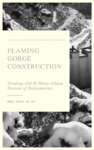
Flaming Gorge Construction Photo Album
1958; 1959; 1960; 1961; 1962; 1963; 1964
Text
ucl_rhc
4
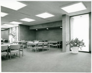
Eccles Health Sciences Library Alcove Study Space
Image
ehsl_hhs
5
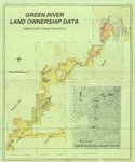
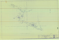
Green River Land Ownership Data - Generated From FWS Maps
Image/StillImage
ucl_maps
6
College of Pharmacy, University of Utah, Class of 1986. "Senior Banquet" Invitation
1986
ehsl_cop
7
Green River - Flaming Gorge National Recreation Area, Ashley National Forest
Image/StillImage
ucl_maps
8
Crescent Tram Railroad crossing bridge
1945; 1946; 1947; 1948; 1949; 1950; 1951; 1952; 1953; 1954; 1955
Image
dha_eftl
9
Energy Project Sites, Uintah County 1980s
1980; 1981; 1982; 1983; 1984; 1985; 1986; 1987; 1988; 1989
Image/StillImage
ucl_maps
10
Utah - John Jarvie Historic Property - BLM
1949
Image/StillImage
ucl_maps
11
The Denver Northwestern and Pacific Railway, Moffat Road and Projected Lines 1911
1911
Image/StillImage
ucl_maps
12
Gold beehive within a gold ring on a background of green diamond and green, orange and sky blue stripes
2022-04-27
Image
dha_mtaf
13
Red rock colored Delicate Arch on blue background
2022-01-19
Image
dha_mtaf
14
Canyonlands, USA Southeastern Utah's Family Vacation Land Brochure
Image/StillImage
ucl_maps
15
Purple mountains with a waterfall coming off one peak, an orange sky with sun behind the mountains and a snowflake to the right side, at the base there is a river with an otter, a bridge crossing to the mountains with a bear
2022
Image
dha_mtaf
16
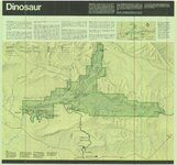
Dinosaur National Monument, 1986
1986
Image/StillImage
ucl_maps
17
Dutch John, Utah-Colorado-Wyoming 1981
1981
Image/StillImage
ucl_maps
18
Bryce Canyon National Park, site BRCABridgeHollow, National Park Service sound spectrograms
Image
uu_wss_spec
19
Dutch John, Utah 1997
1997
Image/StillImage
ucl_maps
20
Characterization of Pyrolysis Products from a Utah Green River Oil Shale by 13C NMR, GC/MS, and FTIR
2013-10-14
Text
ir_eua
21
Little Bonanza Gilsonite Mines Layout Plat - Ziegler Chemical & Mineral Corp
1987; 1995; 1996
Image/StillImage
ucl_maps
22
Natural Bridges National Monument, Site NABR001, National Park Service sound spectrograms
Image
uu_wss_spec
23
Gray mountains with blue sky and orange arch below
2022-04-30
Image
dha_mtaf
24
Blue and red horizontal background with blue section bigger, gold hexagon at center and five white stars in an arch above
2022-04-18
Image
dha_mtaf
25
Blue background with orange geometric shapes on the edges with white constellation in center
2022-02-22
Image
dha_mtaf
1
-
25
of
259
<
1
2
3
4
5
6
7
8
9
10
>