Home
Browse
Ask Us
Chat
Harmful Language Statement
Log in
Advanced Search
Year
1860
1861
1862
1863
1864
1865
1866
1867
1868
1869
1870
1871
1872
1873
1874
1875
1876
1877
1878
1879
1880
1881
1882
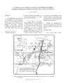
1883
1884
1885
1886
1887
1888
1889
1890
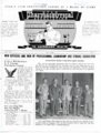
1891
1892
1893
1894
1895
1896
1897
1898
1899
1900
1901
1902
1903
1904
1905
1906
1907
1908
1909
1910
1911
1912
1913
1914
1915
1916
1917
1918
1919
1920
1921
1922
1923
1924
1925
1926
1927
1928
1929
1930
1931
1932
1933
1934
1935
1936
1937
1938
1939
1940
1941
1942
1943
1944
1945
1946
1947
1948
1949
1950
1951
1952
1953
1954
1955
1956
1957
1958
1959
1960
1961
1962
1963
1964
1965
1966
1967
1968
1969
1970
1971
1972
1973
1974
1975
1976
1977
1978
1979
1980
1981
1982
1983
1984
1985
1986
1987
1988
1989
1990
1991
1992
1993
1994
1995
1996
1997
1998
1999
2000
2001
2002
2003
2004
2005
2006
2007
2008
2009
2010
2011
2012
2013
2014
2015
2016
2017
2018
2019
2020
2021
2022
TO
1860
1861
1862
1863
1864
1865
1866
1867
1868
1869
1870
1871
1872
1873
1874
1875
1876
1877
1878
1879
1880
1881
1882
1883
1884
1885
1886
1887
1888
1889
1890
1891
1892
1893
1894
1895
1896
1897
1898
1899
1900
1901
1902
1903
1904
1905
1906
1907
1908
1909
1910
1911
1912
1913
1914
1915
1916
1917
1918
1919
1920
1921
1922
1923
1924
1925
1926
1927
1928
1929
1930
1931
1932
1933
1934
1935
1936
1937
1938
1939
1940
1941
1942
1943
1944
1945
1946
1947
1948
1949
1950
1951
1952
1953
1954
1955
1956
1957
1958
1959
1960
1961
1962
1963
1964
1965
1966
1967
1968
1969
1970
1971
1972
1973
1974
1975
1976
1977
1978
1979
1980
1981
1982
1983
1984
1985
1986
1987
1988
1989
1990
1991
1992
1993
1994
1995
1996
1997
1998
1999
2000
2001
2002
2003
2004
2005
2006
2007
2008
2009
2010
2011
2012
2013
2014
2015
2016
2017
2018
2019
2020
2021
2022
Type
Text
219
Image
16
Image/StillImage
16
Sound
2
Format
application/pdf
234
image/jpeg
25
Collection
American Flame Research Committee
1
College of Nursing
5
College of Pharmacy
9
Eccles Health Sciences Library History
11
Electronic University Archive
6
Extractions from the Land: Mining and...
1
Gerontology Interdisciplinary Program
1
Graduate Nursing Project
4
History of the Health Sciences
7
Illuminations
14
More Than A Flag: Utah State Flag Red...
8
Neighborhood Partners
1
Photo Archives
1
Regional History Center
1
School of Medicine Yearbooks
7
Theses & Dissertations
10
Uintah County Regional History Center...
15
Utah Historical Society Oral History ...
2
Utah Medical Association Bulletin
26
Utah Nurse
16
Utah Pharmacy Digest
104
Utah State Board Of Regents
3
Water Wise Utah
2
Western Soundscape Spectrograms
2
Westminster College Institutional Rep...
2
More
Filters:
Subject:
"Utah"
26
-
50
of
259
<
1
2
3
4
5
6
7
8
9
10
>
Gallery view
Number of results to display per page
10
25
50
100
200
Sort by Relevance
Sort by Title A-Z
Sort by Title Z-A
Sort by Date Ascending
Sort by Date Descending
Sort by Last Modified Ascending
Sort by Last Modified Descending
Title
Date
Type
Setname
26
Light blue and brown diagonally split background with light brown Delicate Arch is in center
2022-01-29
Image
dha_mtaf
27
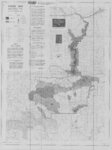
Pony Express Route - April 3, 1860 to October 24, 1861
1860; 1861; 1960
Image/StillImage
ucl_maps
28
Blue background with white, orange and light blue sections of a hexagon in center
2022-04-04
Image
dha_mtaf
29
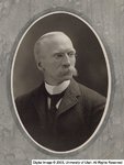
Cummings, Byron, A.M.
Image
ehsl_hhs
30
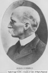
Cummings, Byron, A.M.
Image
ehsl_hhs
31
United States Department of the Interior Geological Survey, Dinosaur National Monument, Colorado - Utah, 1971
1971
Image/StillImage
ucl_maps
32
Dutch John, Utah-Colorado-Wyoming 1982
1981; 1982
Image/StillImage
ucl_maps
33
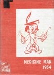
School of Medicine Yearbook - 1954
1954
Text
ehsl_som_mmyb
34
Urban Indian Center of Salt Lake Community Health Representative Needs Assessment
2020
Text
ehsl_gradnu
35
Ashley National Forest Travel Map - Flaming Gorge, Vernal, Roosevelt, and Duchesne Ranger Districts 1971
1971
Image/StillImage
ucl_maps
36
School of Medicine Yearbook - 1960
1960
Text
ehsl_som_mmyb
37
IAIMS Newsletter- Summer 2008
2008
Text
ehsl_history
38
Tectonic controls on alluvial architecture in the upper Cretaceous John Henry Member, Straight Cliffs Formation, Southern Utah
2013-05
Text
ir_etd
39
Utah Pharmacy Digest
1950
Text
ehsl_upd
40
An industrial hygiene field study of dental laboratories in the greater Salt Lake area.
1983-06
Text
ir_etd
41
Water resources data: Utah: water year 2002
2003
Text
uu_wwu
42
Utah Pharmacy Digest
1949
Text
ehsl_upd
43
Oral history interview with Areva Huish
2010-06-15
Text; Sound
dha_uhsoh
44
Utah Pharmacy Digest
1949
Text
ehsl_upd
45
Utah Pharmacy Digest
1949
Text
ehsl_upd
46
Ambient resonance of rock arches
2015
Text
ir_etd
47
Utah Pharmacy Digest
1984
Text
ehsl_upd
48
George Pantalos Oral History
2022
Text
ehsl_hhs
49
Oil impregnated carbonate rocks of the Timpoweap Member Moenkopi Formation, Hurricane Cliffs area, Utah and Arizona
1979
Text
ir_eua
50
Earth Energy Resources, Inc. oil sands production in Utah: Continued development
2009-02-27
Text
ir_eua
26
-
50
of
259
<
1
2
3
4
5
6
7
8
9
10
>