Home
Browse
Ask Us
Chat
Harmful Language Statement
Log in
Advanced Search
Year
1846
1847
1848
1849
1850
1851
1852
1853
1854
1855
1856
1857
1858
1859
1860
1861
1862
1863
1864
1865
1866
1867
1868
1869
1870
1871
1872
1873
1874
1875
1876
1877
1878
1879
1880
1881
1882
1883
1884
1885
1886
1887
1888
1889
1890
1891
1892
1893
1894
1895
1896
1897
1898
1899
1900
1901
1902
1903
1904
1905
1906
1907
1908
1909
1910
1911
1912
1913
1914
1915
1916
1917
1918
1919
1920
1921
1922
1923
1924
1925
1926
1927
1928
1929
1930
1931
1932
1933
1934
1935
1936
1937
1938
1939
1940
1941
1942
1943
1944
1945
1946
1947
1948
1949
1950
1951
1952
1953
1954
1955
1956
1957
1958
1959
1960
1961
1962
1963
1964
1965
1966
1967
1968
1969
1970
1971
1972
1973
1974
1975
1976
1977
1978
1979
1980
1981
1982
1983
1984
1985
1986
1987
1988
1989
1990
1991
1992
1993
1994
1995
1996
1997
1998
1999
2000
2001
2002
2003
2004
2005
2006
2007
2008
2009
2010
2011
2012
2013
2014
2015
2016
2017
TO
1846
1847
1848
1849
1850
1851
1852
1853
1854
1855
1856
1857
1858
1859
1860
1861
1862
1863
1864
1865
1866
1867
1868
1869
1870
1871
1872
1873
1874
1875
1876
1877
1878
1879
1880
1881
1882
1883
1884
1885
1886
1887
1888
1889
1890
1891
1892
1893
1894
1895
1896
1897
1898
1899
1900
1901
1902
1903
1904
1905
1906
1907
1908
1909
1910
1911
1912
1913
1914
1915
1916
1917
1918
1919
1920
1921
1922
1923
1924
1925
1926
1927
1928
1929
1930
1931
1932
1933
1934
1935
1936
1937
1938
1939
1940
1941
1942
1943
1944
1945
1946
1947
1948
1949
1950
1951
1952
1953
1954
1955
1956
1957
1958
1959
1960
1961
1962
1963
1964
1965
1966
1967
1968
1969
1970
1971
1972
1973
1974
1975
1976
1977
1978
1979
1980
1981
1982
1983
1984
1985
1986
1987
1988
1989
1990
1991
1992
1993
1994
1995
1996
1997
1998
1999
2000
2001
2002
2003
2004
2005
2006
2007
2008
2009
2010
2011
2012
2013
2014
2015
2016
2017
Type
Image/StillImage
527
Format
image/jpeg
398
application/pdf
126
Collection
Photo Archives
29
Regional History Center
19
Sustainability U
1
UAIDA Main Collection
63
Uintah County Regional History Center...
415
Filters:
Subject:
"Utah"
Type:
"Image/StillImage"
276
-
300
of
527
<
7
8
9
10
11
12
13
14
15
16
>
Gallery view
Number of results to display per page
10
25
50
100
200
Sort by Relevance
Sort by Title A-Z
Sort by Title Z-A
Sort by Date Ascending
Sort by Date Descending
Sort by Last Modified Ascending
Sort by Last Modified Descending
Title
Date
Type
Setname
276
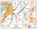
Paiute Reservation Geothermal Resources Map
2004-01-14
Image/StillImage
uaida_main
277
Paiute Reservation Goethermal Resources Map
2004-01-14
Image/StillImage
uaida_main
278
Pariatte-Northwest Castle Peak Area (Ziegler Chemical & Mineral Corp)
Image/StillImage
ucl_maps
279
Part of Moffat Town (Gusher) First Addition (Sometimes Referred to as "Plat A")
Image/StillImage
ucl_maps
280
Partial Map of Gusher, Utah
1963; 1964
Image/StillImage
ucl_maps
281
Partial Map of Gusher, Utah
Image/StillImage
ucl_maps
282
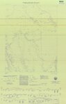
Pauite Reservation Wind Resource Map
2004-01-14
Image/StillImage
uaida_main
283
Pauite Reservation Wind Resource Map
2004-01-14
Image/StillImage
uaida_main
284
Pelican Lake, Utah - 1964
1964
Image/StillImage
ucl_maps
285
Pelican Lake, Utah 1999 - National Wetlands Inventory
1999
Image/StillImage
ucl_maps
286
Phase 1 Inventory of Undeveloped Areas - State of Utah
1927
Image/StillImage
ucl_maps
287
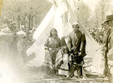
Photo of an Indian child in a tepee entrance.
1910; 1911; 1912; 1913; 1914; 1915; 1916; 1917; 1918; 1919; 1920
Image/StillImage
uaida_main
288
Photo of an Indian child standing in front of a tepee.
1910; 1911; 1912; 1913; 1914; 1915; 1916; 1917; 1918; 1919; 1920
Image/StillImage
uaida_main
289
Photo of an Indian Family
1909-05-06
Image/StillImage
uaida_main
290
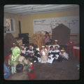
Photograph from St. Christopher's Mission (2:07:14)
1940
Image/StillImage
uaida_main
291
Photograph from St. Christopher's Mission (2:11:04)
1972-01
Image/StillImage
uaida_main
292
Photograph from St. Christopher's Mission (2:11:10)
1973-09
Image/StillImage
uaida_main
293
Photograph from St. Christopher's Mission (2:17:19)
1973-09
Image/StillImage
uaida_main
294
Photograph from St. Christopher's Mission (2:18:02)
1940
Image/StillImage
uaida_main
295
Photograph from St. Christopher's Mission (2:18:15)
1940
Image/StillImage
uaida_main
296
Plat of Dickson's Addition to Moffat Townsite 1922
1922
Image/StillImage
ucl_maps
297
Plat of the Town of Moffat in Uintah County, Utah 1905
1905
Image/StillImage
ucl_maps
298
Plat of the Town of Moffat, in Uintah County, Utah 1906
1906
Image/StillImage
ucl_maps
299
Plat of the Townsite of Avalon, Utah 1923
1923
Image/StillImage
ucl_maps
300
Plat of the Townsite of Lapoint, Utah - 1913
1913
Image/StillImage
ucl_maps
276
-
300
of
527
<
7
8
9
10
11
12
13
14
15
16
>