|
|
Title | Date | Type | Setname |
| 201 |
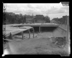 |
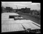
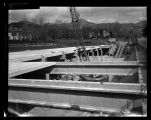
Reservoir Capping (13th East 1st South) -Shot 1 | 1956-04-18 | Image/StillImage | dha_sltnc |
| 202 |
 |
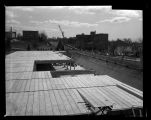
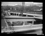
Reservoir Capping (13th East 1st South) -Shot 2 | 1956-04-18 | Image/StillImage | dha_sltnc |
| 203 |
 |
Reservoir Capping (13th East 1st South) -Shot 3 | 1956-04-18 | Image/StillImage | dha_sltnc |
| 204 |
 |
Reservoir Capping (13th East 1st South) -Shot 4 | 1956-04-18 | Image/StillImage | dha_sltnc |
| 205 |
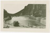 |
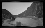
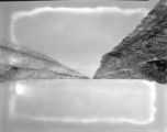
Reservoir near Big Cottonwood Canyon | 1900; 1901; 1902; 1903; 1904; 1905; 1906; 1907; 1908; 1909; 1910; 1911; 1912; 1913; 1914; 1915; 1916; 1917; 1918; 1919; 1920; 1921; 1922; 1923; 1924; 1925 | Image/StillImage | dha_gmo |
| 206 |
 |
Reservoir or dam | 1900; 1901; 1902; 1903; 1904; 1905; 1906; 1907; 1908; 1909; 1910; 1911; 1912; 1913; 1914; 1915; 1916; 1917; 1918; 1919; 1920; 1921; 1922; 1923; 1924; 1925 | Image/StillImage | dha_gmo |
| 207 |
 |
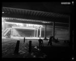
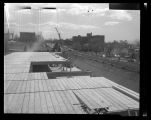
Reservoir Repair - 13th East -Shot 1 | 1956-04-06 | Image/StillImage | dha_sltnc |
| 208 |
 |
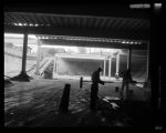
Reservoir Repair - 13th East -Shot 2 | 1956-04-06 | Image/StillImage | dha_sltnc |
| 209 |
 |
Reservoir Repair - 13th East -Shot 3 | 1956-04-06 | Image/StillImage | dha_sltnc |
| 210 |
 |
Reservoir Repair - 13th East -Shot 4 | 1956-04-06 | Image/StillImage | dha_sltnc |
| 211 |
 |
Reservoir Repair - 13th East -Shot 5 | 1956-04-06 | Image/StillImage | dha_sltnc |
| 212 |
 |
Reservoir Repair - 13th East -Shot 6 | 1956-04-06 | Image/StillImage | dha_sltnc |
| 213 |
 |
Reservoir Repair - 13th East -Shot 7 | 1956-04-06 | Image/StillImage | dha_sltnc |
| 214 |
 |
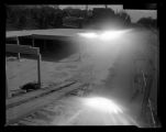
S.L.C. - Thirteenth East P.10 | 1936-11-21 | Image/StillImage | dha_cp |
| 215 |
 |
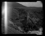
Sevier River flood of 1983, vicinity of Delta, Utah [015] | 1983-06 | Image | dc_bpc |
| 216 |
 |
Suicide Rock, Parley's Canyon -Shot 1 | 1943-05-14 | Image/StillImage | dha_sltnc |
| 217 |
 |
Suicide Rock, Parley's Canyon -Shot 2 | 1943-05-14 | Image/StillImage | dha_sltnc |
| 218 |
 |
Sunset - Upper Geyser Basin | 1908-08-16 | Image | dha_scp |
| 219 |
 |
Tree at Twin Lakes | 1905-04-04 | Image/StillImage | dha_gmo |
| 220 |
 |
Trees at Twin Lakes | 1900; 1901; 1902; 1903; 1904; 1905; 1906; 1907; 1908; 1909; 1910; 1911; 1912; 1913; 1914; 1915; 1916; 1917; 1918; 1919; 1920; 1921; 1922; 1923; 1924; 1925 | Image/StillImage | dha_gmo |
| 221 |
 |
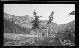
Twin Lakes | 1900; 1901; 1902; 1903; 1904; 1905; 1906; 1907; 1908; 1909; 1910; 1911; 1912; 1913; 1914; 1915; 1916; 1917; 1918; 1919; 1920; 1921; 1922; 1923; 1924; 1925 | Image/StillImage | dha_gmo |
| 222 |
 |
Twin Lakes | 1905-04-04 | Image/StillImage | dha_gmo |
| 223 |
 |
Twin Lakes | 1905-04-04 | Image/StillImage | dha_gmo |
| 224 |
 |
Twin Lakes | 1900; 1901; 1902; 1903; 1904; 1905; 1906; 1907; 1908; 1909; 1910; 1911; 1912; 1913; 1914; 1915; 1916; 1917; 1918; 1919; 1920; 1921; 1922; 1923; 1924; 1925 | Image/StillImage | dha_gmo |
| 225 |
 |
Twin Lakes in Big Cottonwood Canyon | 1900; 1901; 1902; 1903; 1904; 1905; 1906; 1907; 1908; 1909; 1910; 1911; 1912; 1913; 1914; 1915; 1916; 1917; 1918; 1919; 1920; 1921; 1922; 1923; 1924; 1925 | Image/StillImage | dha_gmo |
| 226 |
 |
Twin Lakes of Big Cottonwood Canyon | 1900; 1901; 1902; 1903; 1904; 1905; 1906; 1907; 1908; 1909; 1910; 1911; 1912; 1913; 1914; 1915; 1916; 1917; 1918; 1919; 1920; 1921; 1922; 1923; 1924; 1925 | Image/StillImage | dha_gmo |
| 227 |
 |
Uintah Unit Alernative No. 4 Coyote Basin Alternative | | Text | uaida_main |
| 228 |
 |
Upalco Unit Alternative No. 8 Twin Pots Alternative | 1995-01 | Text | uaida_main |
| 229 |
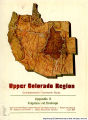 |
Upper Colorado Region Comprehensive Framework Study: Appendix X, Irrigation and Drainage | 1971-06 | Text | wwdl_documents |
| 230 |
 |
Utah Power and Light Buildings | 1916-03-03 | Image | dha_scp |
| 231 |
 |
Utah Power and Light Plant, Oneida | 1920; 1916; 1917; 1918; 1919; 1921; 1922; 1923; 1924 | Image | dha_scp |
| 232 |
 |
Utah Power and Light, Oneida Plant | 1910; 1906; 1907; 1908; 1909; 1911; 1912; 1913; 1914 | Image | dha_scp |
| 233 |
 |
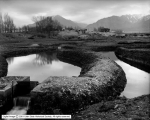
Watchman's House, Mountain Dell, Parley's Canyon | 1917-12-22 | Image | dha_ce |
| 234 |
 |
Water Dept. Water, Aug. 1934 | 1938-08-30 | Image | dha_cbfm |
| 235 |
 |
Water resources data, Colorado, water year 2004 | 2005 | Text | wwdl_er |
| 236 |
 |
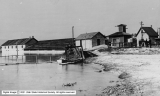
Welsh Trout Farm, Fish Runs on West Side | 1917-12-22 | Image | dha_scp |
| 237 |
 |
Welsh Trout Farm, General View, State Fish Hatchery | 1917-12-22 | Image | dha_scp |
| 238 |
 |
Welsh Trout Farm, New Fish Runs | 1917-12-22 | Image | dha_scp |
| 239 |
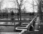 |
Welsh Trout Farm, Overflow of Water from Fish Run | 1917-12-22 | Image | dha_scp |
| 240 |
 |
Welsh Trout Farm, Southwest View | 1917-12-22 | Image | dha_scp |