Home
Browse
Ask Us
Chat
Harmful Language Statement
Log in
Advanced Search
Year
1850
1851
1852
1853
1854
1855
1856
1857
1858
1859
1860
1861
1862
1863
1864
1865
1866
1867
1868
1869
1870
1871
1872
1873
1874
1875
1876
1877
1878
1879
1880
1881
1882
1883
1884
1885
1886
1887
1888
1889
1890
1891
1892
1893
1894
1895
1896
1897
1898
1899
1900
1901
1902
1903
1904
1905
1906
1907
1908
1909
1910
1911
1912
1913
1914
1915
1916
1917
1918
1919
1920
1921
1922
1923
1924
1925
1926
1927
1928
1929
1930
1931
1932
1933
1934
1935
1936
1937
1938
1939
1940
1941
1942
1943
1944
1945
1946
1947
1948
1949
1950
1951
1952
1953
1954
1955
1956
1957
1958
1959
1960
1961
1962
1963
1964
1965
1966
1967
1968
1969
1970
1971
1972
1973
1974
1975
1976
1977
1978
1979
1980
1981
1982
1983
1984
1985
1986
1987
1988
1989
1990
1991
1992
1993
1994
1995
1996
1997
1998
1999
2000
2001
2002
2003
2004
2005
2006
2007
2008
2009
2010
2011
2012
2013
2014
2015
2016
2017
2018
2019
2020
2021
2022
2023
TO
1850
1851
1852
1853
1854
1855
1856
1857
1858
1859
1860
1861
1862
1863
1864
1865
1866
1867
1868
1869
1870
1871
1872
1873
1874
1875
1876
1877
1878
1879
1880
1881
1882
1883
1884
1885
1886
1887
1888
1889
1890
1891
1892
1893
1894
1895
1896
1897
1898
1899
1900
1901
1902
1903
1904
1905
1906
1907
1908
1909
1910
1911
1912
1913
1914
1915
1916
1917
1918
1919
1920
1921
1922
1923
1924
1925
1926
1927
1928
1929
1930
1931
1932
1933
1934
1935
1936
1937
1938
1939
1940
1941
1942
1943
1944
1945
1946
1947
1948
1949
1950
1951
1952
1953
1954
1955
1956
1957
1958
1959
1960
1961
1962
1963
1964
1965
1966
1967
1968
1969
1970
1971
1972
1973
1974
1975
1976
1977
1978
1979
1980
1981
1982
1983
1984
1985
1986
1987
1988
1989
1990
1991
1992
1993
1994
1995
1996
1997
1998
1999
2000
2001
2002
2003
2004
2005
2006
2007
2008
2009
2010
2011
2012
2013
2014
2015
2016
2017
2018
2019
2020
2021
2022
2023
Type
Image
1,165
Image/StillImage
104
Text
24
Image/MovingImage
2
Sound
2
Format
image/jpeg
1,230
application/pdf
81
video/mp4
2
Collection
Afton Watkins Gardner Collection
13
Beckwith Photograph Collection
27
Classified Photographs
947
Clifton Bray Film Negatives
2
Electronic University Archive
1
O.L. Tapp Film Collection
1
Park City Historical Society & Museum
176
Peoples of Utah Revisited
2
Photo Archives
5
Regional History Center
2
Shipler Commercial Photographers
47
Theses & Dissertations
12
Thorne Photographs
19
UAIDA Main Collection
22
Uintah County Regional History Center...
35
Utah Historical Society Oral History ...
1
Vernal Express Photographs
2
More
Filters:
Subject:
"Mining"
1051
-
1075
of
1,314
<
38
39
40
41
42
43
44
45
46
47
>
Gallery view
Number of results to display per page
10
25
50
100
200
Sort by Relevance
Sort by Title A-Z
Sort by Title Z-A
Sort by Date Ascending
Sort by Date Descending
Sort by Last Modified Ascending
Sort by Last Modified Descending
Title
Date
Type
Setname
1051
Potash Mining--Texas Gulf Sulphur Co. P.2
Image
dha_cp
1052
Potash Mining--Texas Gulf Sulphur Co. P.3
Image
dha_cp
1053
Potash Mining--Texas Gulf Sulphur Co. P.4
Image
dha_cp
1054
Potash Mining--Texas Gulf Sulphur Co. P.5
Image
dha_cp
1055
Potash--Alunite, Utah P.1
1917-06-26
Image
dha_cp
1056
Potash--Alunite, Utah P.2
1917-06-26
Image
dha_cp
1057
Potash--Bonneville Ltd. P.1
Image
dha_cp
1058
Potash--Bonneville Ltd. P.2
Image
dha_cp
1059
Potash--Bonneville Ltd. P.3
Image
dha_cp
1060
Potash--Bonneville Ltd. P.4
Image
dha_cp
1061
Potash--Bonneville Ltd. P.5
Image
dha_cp
1062
Potash--Bonneville Ltd. P.6
Image
dha_cp
1063
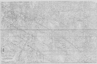
Profile Map of the Country Boy Mine (copy of original)
Image/StillImage
ucl_maps
1064
Proposed Mine Plan for the Tom Taylor Mine on the Little Emma Gilsonite Vein - Section 3, T10S, R24E, Uinta County, Utah
1997
Image/StillImage
ucl_maps
1065
Prospecting on the Ute Reservation, an ominous meeting
1879-10-25
Image/StillImage
uaida_main
1066
Pulling drinking water from a mine, 1970 - shots 1 and 2
1970
Image
pc_hsm
1067
Pulling drinking water from a mine, 1970 - shots 3 and 4
1970
Image
pc_hsm
1068
Pulling drinking water from a mine, 1970 - shots 5 and 6
1970
Image
pc_hsm
1069
Pulling drinking water from a mine, 1970 - shots 7, 8, and 9
1970
Image
pc_hsm
1070
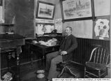
R.C. Chambers in Ontario office
1900-01
Image
pc_hsm
1071
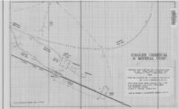
Rainbow Area Topographic Map Showing Gilsonite Veins, Leases & Claims - Ziegler Chemical & Mineral Corp
1979; 1996
Image/StillImage
ucl_maps
1072
Rainbow Mine
Image
ucl_tp
1073
Rainbow Mine
1941
Image
ucl_tp
1074
Red Mountain Town
1888-09
Image/StillImage
dha_awg
1075
Robert Bruce Chisholm
Image
dha_cp
1051
-
1075
of
1,314
<
38
39
40
41
42
43
44
45
46
47
>