| Title | Date | Type | Setname | ||
|---|---|---|---|---|---|
| 101 |
 |
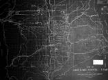
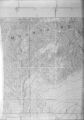
Map on Wall at Walgreen Drug Store, May 1936 | 1936-05-28 | Image | dha_cbfm |
| 102 |
 |
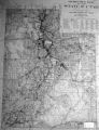
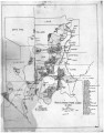
Map showing the boundary of the Shoshone Indian territory | 1941 | Image/StillImage | uaida_main |
| 103 |
 |
Map, [ca. 1953] | 1953 | Text | uaida_main |
| 104 |
 |
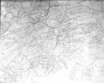
Map, annotated | 1975 | Image | dha_eftl |
| 105 |
 |
Map, July 1938 | 1938-07-12 | Image | dha_cbfm |
| 106 |
 |
Map, July 1938 | 1938-07-12 | Image | dha_cbfm |
| 107 |
 |
Map, Mar. 1938 | 1938-03-03 | Image | dha_cbfm |
| 108 |
 |
Map, Mar. 1938 | 1938-03-03 | Image | dha_cbfm |
| 109 |
 |
Map, Mar. 1938 | 1938-03-03 | Image | dha_cbfm |
| 110 |
 |
Map, May 1938 | 1938-05-16 | Image | dha_cbfm |
| 111 |
 |
Map, Salt Lake Valley | 1975 | Image | dha_eftl |
| 112 |
 |
N.A. Dunyon, Copy of Section of Map | 1923-03-03 | Image/StillImage | dha_scnpp |
| 113 |
 |
Naval Supply Depot, Clearfield P.20 | 1950; 1951; 1952; 1953; 1954; 1955; 1956; 1957; 1958; 1959; 1960; 1961; 1962; 1963 | Image/StillImage | dha_cp |
| 114 |
 |
Naval Supply Depot, Clearfield P.21 | 1962 | Image/StillImage | dha_cp |
| 115 |
 |
Notes from St. Christopher's Mission, 1940's | 1940; 1941; 1942; 1942; 1943; 1944; 1945; 1946; 1947; 1948; 1949 | Text | uaida_main |
| 116 |
 |
Notes on the History of the Southern Paiutes and Western Shoshonis | 1971 | Text | uaida_main |
| 117 |
 |
Old Map | 1952-03-10 | Image | dha_scp |
| 118 |
 |
Ophir Mono Mines Co., Murray Godbe, Copy of Drawing (Map of Principal Mining District of Utah) | 1930-03-21 | Image/StillImage | dha_scnpp |
| 119 |
 |
Ophir Mono Mines, Map | 1930-10-13 | Image/StillImage | dha_scnpp |
| 120 |
 |
Pahute Indian Home Lands in 1850 | 1850 | Image/StillImage | uaida_main |
| 121 |
 |
PEUP | 1949 | Image | dc_bpc |
| 122 |
 |
Princeton University Conference Booklet dated April 1958 | 1958-04-16; 1958-04-17 | Text | uum_asap |
| 123 |
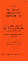 |
Princeton University Conference Program dated April 1958 | 1958-04-16; 1958-04-17 | Text | uum_asap |
| 124 |
 |
Problems of Navajo Male Graduates of Intermountain School During Their First Year of Employment | 1959 | Text | uaida_main |
| 125 |
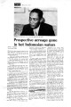 |
Prospective acreage gone in hot Indonesian waters | 1970-03-30 | Text; Image/StillImage | uum_asap |