|
|
Title | Date | Type | Setname |
| 301 |
 |
Map: Early Bronze Age Sites in China | | Image | uu_aah_art |
| 302 |
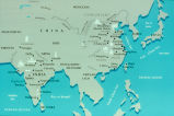 |
Map: Early China | | Image | uu_aah_art |
| 303 |
 |
Map: East Asia, circa 615 CE | | Image | uu_aah_art |
| 304 |
 |
Map: East Asia, circa 715 CE | | Image | uu_aah_art |
| 305 |
 |
Map: East Coast Prehistoric Cultures | | Image | uu_aah_art |
| 306 |
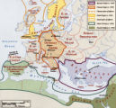 |
Map: Empires and Spheres of Influence | | Image | uu_aah_art |
| 307 |
 |
Map: Europe during the 14th Century CE | | Image | uu_aah_art |
| 308 |
 |
Map: Europe, 1648 CE | | Image | uu_aah_art |
| 309 |
 |
Map: Europe, about 1100 CE | | Image | uu_aah_art |
| 310 |
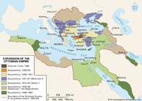 |
Map: Extent of Ottoman Empire, 1300-1699 CE | | Image | uu_aah_art |
| 311 |
 |
Map: Fatimid Caliphate Rule | | Image | uu_aah_art |
| 312 |
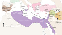 |
Map: Fatimid Caliphate Rule | | Image | uu_aah_art |
| 313 |
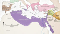 |
Map: Fatimid Dynasty | | Image | uu_aah_art |
| 314 |
 |
Map: Flemish / Dutch Lowlands, 1585 - 1700 | | Image | uu_aah_art |
| 315 |
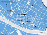 |
Map: Florence, Italy, 1400 CE | | Image | uu_aah_art |
| 316 |
 |
Map: Han Empire | | Image | uu_aah_art |
| 317 |
 |
Map: Historical Sites in the Kyoto, Osaka, and Nara areas | | Image | uu_aah_art |
| 318 |
 |
Map: Important Archaeological Sites of the Erlitou culture period | | Image | uu_aah_art |
| 319 |
 |
Map: India, South and Central Asia | | Image | uu_aah_art |
| 320 |
 |
Map: Italy | | Image | uu_aah_art |
| 321 |
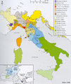 |
Map: Italy, c.1410 CE | | Image | uu_aah_art |
| 322 |
 |
Map: Japan | | Image | uu_aah_art |
| 323 |
 |
Map: Kiln Sites of China | | Image | uu_aah_art |
| 324 |
 |
Map: Korea | | Image | uu_aah_art |
| 325 |
 |
Map: Korea | | Image | uu_aah_art |
| 326 |
 |
Map: Latin America around the year 1500, with the principal native societies and the three empires: Aztec, Mayan, and Incan | | Image | uu_aah_art |
| 327 |
 |
Map: Latin America Political Map | | Image | uu_aah_art |
| 328 |
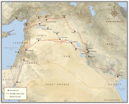 |
Map: Location of Dura Europos in the Middle East | | Image | uu_aah_art |
| 329 |
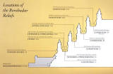 |
Map: Location of the Borobudur reliefs | | Image | uu_aah_art |
| 330 |
 |
Map: Locations of 1937 Paris World's Fair, the Berlin Olympics, Nuremberg Rallies, and Great German and Degenerate Art Exhibits | | Image | uu_aah_art |
| 331 |
 |
Map: Major sites in Rome, Italy | | Image | uu_aah_art |
| 332 |
 |
Map: Major Sites of the Eastern Zhou Dynasty | | Image | uu_aah_art |
| 333 |
 |
Map: Major Sites of the Qin State and Dynasty | | Image | uu_aah_art |
| 334 |
 |
Map: Major Sites of the Shang Dynasty, Erligang Culture | | Image | uu_aah_art |
| 335 |
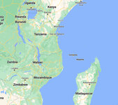 |
Map: Makonde people were in contemporary Kenya, Tanzania, and Mozambique | | Image | uu_aah_art |
| 336 |
 |
Map: Mediterranean and Northern Africa | | Image | uu_aah_art |
| 337 |
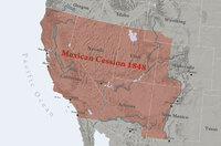 |
Map: Mexican Cession 1848 | | Image | uu_aah_art |
| 338 |
 |
Map: Minoan Crete and the Bronze Age Aegean | | Image | uu_aah_art |
| 339 |
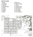 |
Map: Nara, Japan | | Image | uu_aah_art |
| 340 |
 |
Map: Nigeria in West Africa | | Image | uu_aah_art |
| 341 |
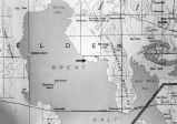 |
Map: Northen Great Salt Lake Area | | Image | uu_aah_art |
| 342 |
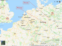 |
Map: Northern Europe showing Dessau and Weimar, Germany | | Image | uu_aah_art |
| 343 |
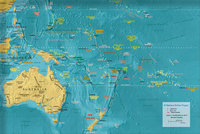 |
Map: Oceania | | Image | uu_aah_art |
| 344 |
 |
Map: Osogbo | | Image | uu_aah_art |
| 345 |
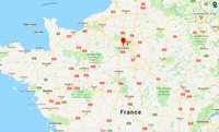 |
Map: Paris and Versailles, France | | Image | uu_aah_art |
| 346 |
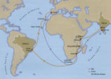 |
Map: Pedro Álvares Cabral's Voyage to and from India with the discovery of Brazil | | Image | uu_aah_art |
| 347 |
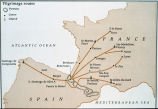 |
Map: Pilgrimage Routes of France and Spain | | Image | uu_aah_art |
| 348 |
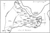 |
Map: Plan of Constantinople during the Middle Byzantine Period | | Image | uu_aah_art |
| 349 |
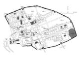 |
Map: Pompeii | | Image | uu_aah_art |
| 350 |
 |
Map: Pompeii in 79 CE | | Image | uu_aah_art |
| 351 |
 |
Map: Portuguese America in 1750 | | Image | uu_aah_art |
| 352 |
 |
Map: Portuguese Voyage Routes, 15th and 16th Century CE | | Image | uu_aah_art |
| 353 |
 |
Map: Prehistoric Europe and the Near East | | Image | uu_aah_art |
| 354 |
 |
Map: Principal Sites of Ancient Egypt | | Image | uu_aah_art |
| 355 |
 |
Map: Pueblo Cultures in the American Southwest | | Image | uu_aah_art |
| 356 |
 |
Map: Qin Dynasty, China | | Image | uu_aah_art |
| 357 |
 |
Map: Regional bronze-using cultures during the Shang Dynasty | | Image | uu_aah_art |
| 358 |
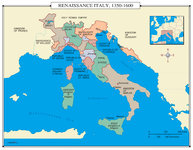 |
Map: Renaissance Italy 1350 - 1600 CE | | Image | uu_aah_art |
| 359 |
 |
Map: Rio de Janeiro | | Image | uu_aah_art |
| 360 |
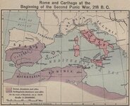 |
Map: Roman and Carthaginian Territories at the beginning of the Second Punic War, 218 BCE | | Image | uu_aah_art |
| 361 |
 |
Map: Route of Mansa Musa's hajj | | Image | uu_aah_art |
| 362 |
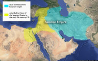 |
Map: Sasanian Empire showing original territory and extended territory in early 7th century CE | | Image | uu_aah_art |
| 363 |
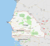 |
Map: Senegal | | Image | uu_aah_art |
| 364 |
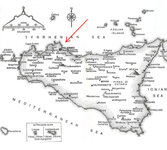 |
Map: Sicily | | Image | uu_aah_art |
| 365 |
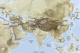 |
Map: Silk Road Land and Sea Routes | | Image | uu_aah_art |
| 366 |
 |
Map: Sites of Buddhist and Hindu Temples in Central and East Java | | Image | uu_aah_art |
| 367 |
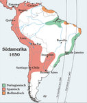 |
Map: South America around 1650 | | Image | uu_aah_art |
| 368 |
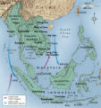 |
Map: Southeast Asia | | Image | uu_aah_art |
| 369 |
 |
Map: Southeast Asia | | Image | uu_aah_art |
| 370 |
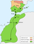 |
Map: Spread of Almoravid Empire | | Image | uu_aah_art |
| 371 |
 |
Map: Spread of Buddhism, ca. 200-900 CE | | Image | uu_aah_art |
| 372 |
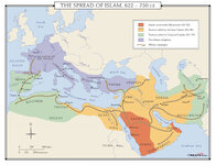 |
Map: Spread of Islam, 622-750 CE | | Image | uu_aah_art |
| 373 |
 |
Map: Sri Lanka, Sites with Paintings of the Early and Middle Historical Periods | | Image | uu_aah_art |
| 374 |
 |
Map: The Byzantine Empire circa 1000 CE | | Image | uu_aah_art |
| 375 |
 |
Map: The Crusader States 1100 CE | | Image | uu_aah_art |
| 376 |
 |
Map: The Crusader States 1118 CE | | Image | uu_aah_art |
| 377 |
 |
Map: The Empire on the Eve of the French Revolution, 1789 | | Image | uu_aah_art |
| 378 |
 |
Map: The greatest extent of Napoleon I's First Empire, 1812 | | Image | uu_aah_art |
| 379 |
 |
Map: The Greek World | | Image | uu_aah_art |
| 380 |
 |
Map: The Han Empire and the Silk Road | | Image | uu_aah_art |
| 381 |
 |
Map: The Hohenstaufen Empire under Frederick II | | Image | uu_aah_art |
| 382 |
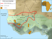 |
Map: The Mali Empire | | Image | uu_aah_art |
| 383 |
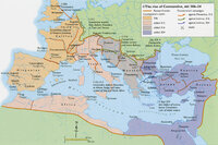 |
Map: The Rise of Constantine, 306 - 324 CE | | Image | uu_aah_art |
| 384 |
 |
Map: The Roman Empire | | Image | uu_aah_art |
| 385 |
 |
Map: The Roman Empire in the Second Century CE | | Image | uu_aah_art |
| 386 |
 |
Map: The Silk Road | | Image | uu_aah_art |
| 387 |
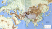 |
Map: The Silk Roads, ca. 200-900 CE | | Image | uu_aah_art |
| 388 |
 |
Map: Topographical Map of Italy | | Image | uu_aah_art |
| 389 |
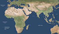 |
Map: Trans Saharan Trade and Sea Routes | | Image | uu_aah_art |
| 390 |
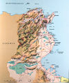 |
Map: Tunisia | | Image | uu_aah_art |
| 391 |
 |
Map: Umayyad Emirate, c. 850 CE, Umayyad Caliphate, c. 950 CE | | Image | uu_aah_art |
| 392 |
 |
Mapping of the Terr. West of the Rocky Mts. P.1 | | Image | dha_cp |
| 393 |
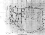 |
Mapping the Trans-Mississippi West P.1 | | Image | dha_cp |
| 394 |
 |
Mapping the world in medieval and early modern Western and Arabic Travel Accounts | 2017 | Text | ir_etd |
| 395 |
 |
Meeker Incident | | Image/StillImage | uaida_main |
| 396 |
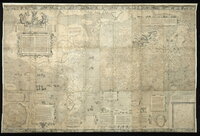 |
Mercator world map of 1569 (Nova et Aucta Orbis Terrae Descriptio ad Usum Navigantium Emendate Accommodata) | | Image | uu_aah_art |
| 397 |
 |
Mercator's Map of the World | | Image | uu_aah_art |
| 398 |
 |
Mercur, Utah P.1 | | Image | dha_cp |
| 399 |
 |
Military Installations, Utah P.1 | | Image | dha_cp |
| 400 |
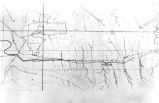 |
Mining Map of Big & Little Cottonwood P.1 | | Image | dha_cp |