Home
Browse
Ask Us
Chat
Harmful Language Statement
Log in
Advanced Search
Year
1849
1850
1851
1852
1853
1854
1855
1856
1857
1858
1859
1860
1861
1862
1863
1864
1865
1866
1867
1868
1869
1870
1871
1872
1873
1874
1875
1876
1877
1878
1879
1880
1881
1882
1883
1884
1885
1886
1887
1888
1889
1890
1891
1892
1893
1894
1895
1896
1897
1898
1899
1900
1901
1902
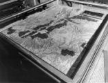
1903
1904
1905
1906
1907
1908
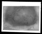
1909
1910
1911
1912
1913
1914
1915
1916
1917
1918
1919
1920
1921
1922
1923
1924
1925
1926
1927
1928
1929
1930
1931
1932
1933
1934
1935
1936
1937
1938
1939
1940
1941
1942
1943
1944
1945
1946
1947
1948
1949
1950
1951
1952
1953
1954
1955
1956
1957
1958
1959
1960
1961
1962
1963
1964
1965
1966
1967
1968
1969
1970
1971
1972
1973
1974
1975
1976
1977
1978
1979
1980
1981
1982
1983
1984
1985
1986
1987
1988
1989
1990
1991
1992
1993
1994
1995
1996
1997
1998
1999
2000
2001
2002
2003
2004
2005
2006
2007
2008
2009
2010
2011
2012
2013
2014
2015
2016
2017
2018
2019
TO
1849
1850
1851
1852
1853
1854
1855
1856
1857
1858
1859
1860
1861
1862
1863
1864
1865
1866
1867
1868
1869
1870
1871
1872
1873
1874
1875
1876
1877
1878
1879
1880
1881
1882
1883
1884
1885
1886
1887
1888
1889
1890
1891
1892
1893
1894
1895
1896
1897
1898
1899
1900
1901
1902
1903
1904
1905
1906
1907
1908
1909
1910
1911
1912
1913
1914
1915
1916
1917
1918
1919
1920
1921
1922
1923
1924
1925
1926
1927
1928
1929
1930
1931
1932
1933
1934
1935
1936
1937
1938
1939
1940
1941
1942
1943
1944
1945
1946
1947
1948
1949
1950
1951
1952
1953
1954
1955
1956
1957
1958
1959
1960
1961
1962
1963
1964
1965
1966
1967
1968
1969
1970
1971
1972
1973
1974
1975
1976
1977
1978
1979
1980
1981
1982
1983
1984
1985
1986
1987
1988
1989
1990
1991
1992
1993
1994
1995
1996
1997
1998
1999
2000
2001
2002
2003
2004
2005
2006
2007
2008
2009
2010
2011
2012
2013
2014
2015
2016
2017
2018
2019
Type
Image/StillImage
80
Text
66
Image
37
Format
image/jpeg
102
application/pdf
76
application/xml
3
Collection
Aziz Suryal Atiya papers
5
Beckwith Photograph Collection
8
Classified Photographs
10
Clifton Bray Film Negatives
10
Extractions from the Land: Mining and...
2
Marriott Library Digital Stacks
1
Olympic Legacy
5
Peoples of Utah Revisited
2
Photo Archives
5
Salt Lake Tribune Negative Collection
14
Shipler Collection Negative Preservat...
18
Shipler Commercial Photographers
6
Ski and Snow Sports Archives
1
UAIDA Main Collection
87
Vernal Express Photographs
2
Western Waters Electronic Resources
4
Westminster College Finding Aids (EAD)
3
More
Filters:
Subject:
"Maps"
Year End:
2006
51
-
75
of
183
<
1
2
3
4
5
6
7
8
>
Gallery view
Number of results to display per page
10
25
50
100
200
Sort by Relevance
Sort by Title A-Z
Sort by Title Z-A
Sort by Date Ascending
Sort by Date Descending
Sort by Last Modified Ascending
Sort by Last Modified Descending
Title
Date
Type
Setname
51
Boundary of Shoshone Indian Territory and Neighboring Tribes
1957
Image/StillImage
uaida_main
52
Boundary of Shoshone Indian Territory, Linguistic Boundaries of Shoshone and Bannock.
1941
Image/StillImage
uaida_main
53
Boundary of Shoshone Indian Territory, showing the locations of the Bannock
1957
Image/StillImage
uaida_main
54
Boundary of Shoshone Indian Territory, showing the locations of the Bannock from 1819 to 1951
1957
Image/StillImage
uaida_main
55
Boundary of Shoshone Indian Territory, showing the locations where the Bannock and Shoshone reported together 1819-1956
1957
Image/StillImage
uaida_main
56
Boundary of Shoshone Indian Territory; Doty Map of 1863 Indian Claims Commission
1957
Image/StillImage
uaida_main
57
C. P. Overfield, Front of Ticket Office at Denver and Rio Grande Railroad Company Station
1929-03-19
Image/StillImage
dha_scnpp
58
C. P. Overfield, Front of Ticket Office at Denver and Rio Grande Railroad Company Station
1929-03-19
Image/StillImage
dha_scnpp
59
Capitol Building-Exhibits P.1
1920; 1921; 1922; 1923; 1924; 1925; 1926; 1927; 1928; 1929; 1930; 1931; 1932; 1933; 1934; 1935; 1936; 1937; 1938; 1939; 1940; 1941; 1942; 1943; 1944; 1945; 1946; 1947; 1948; 1949; 1950
Image/StillImage
dha_cp
60
Colorado River -- Excursions p.14
1935; 1936; 1937; 1938; 1939; 1940; 1941; 1942; 1943; 1944; 1945
Image/StillImage
dha_cp
61
David Stanley Westminster College faculty member's papers
1991; 1992; 1993; 1994; 1995; 1996; 1997; 1998; 1999; 2000; 2001; 2002; 2003; 2004; 2005; 2006; 2007; 2008
wc_ead
62
Dept. of Int. Indian Irrigation Service, Copy of Blue Print, Blackfoot River & Gray Lake Dev.
1921-06-18
Image/StillImage
dha_scnpp
63
Dinosaur National Monument
1958-05-29
Image
ucl_vep
64
Dr.S.H. Goodwin
1926-08-09
Image/StillImage
dha_scnpp
65
El Palacio, volume 30, nos.19-20 (May 20, 1931) [02]: Map, Nine Mile Canyon
1931-05-20
Image
dc_bpc
66
Escalante Valley Improvement Company Map
1915-11-19
Image
dha_scp
67
F.B. Cook
1936-05-20
Image/StillImage
dha_scnpp
68
F.J. Salathe Jr., Copy of Section of Map
1928-09-01
Image/StillImage
dha_scnpp
69
Father Escalante's Map
1941
Text
uaida_main
70
Field Notes from Survey of Uintah Reservation
1875-09-25
Text
uaida_main
71
Ford Motor CO.
1925-08-13
Image/StillImage
dha_scnpp
72
Ford Motor CO.
1925-08-13
Image/StillImage
dha_scnpp
73
Frederick G. Burton Presbyterian Church in Utah research collection, 1871-2006 (bulk 1871-1951)
1871; 1872; 1873; 1874; 1875; 1876; 1877; 1878; 1879; 1880; 1881; 1882; 1883; 1884; 1885; 1886; 1887; 1888; 1889; 1890; 1891; 1892; 1893; 1894; 1895; 1896; 1897; 1898; 1899; 1900; 1901; 1902; 1903; 1904; 1905; 1906; 1907; 1908; 1909; 1910; 1911; 1912; 1913; 1914; 1915; 1916; 1917; 1918; 1919; 1920; ...
wc_ead
74
Goshute Skull Valley Reservation Geothermal Resources Map
2004-01-14
Image/StillImage
uaida_main
75
Ground-water data for the Warm Springs Indian Reservation and contiguous areas, north-central Oregon
1996
Text
wwdl_er
51
-
75
of
183
<
1
2
3
4
5
6
7
8
>