|
|
Title | Date | Type | Setname |
| 401 |
 |
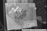
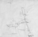
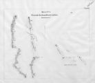
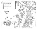
Mormon Battalion Map P.1 | | Image | dha_cp |
| 402 |
 |
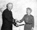
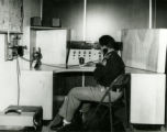
MX Missile meetings [12] | 1981 | Image | dc_bpc |
| 403 |
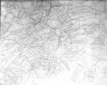 |
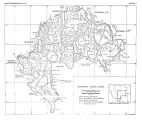
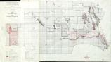
N.A. Dunyon, Copy of Section of Map | 1923-03-03 | Image/StillImage | dha_scnpp |
| 404 |
 |
Naval Supply Depot, Clearfield P.20 | 1950; 1951; 1952; 1953; 1954; 1955; 1956; 1957; 1958; 1959; 1960; 1961; 1962; 1963 | Image/StillImage | dha_cp |
| 405 |
 |
Naval Supply Depot, Clearfield P.21 | 1962 | Image/StillImage | dha_cp |
| 406 |
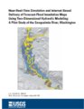 |
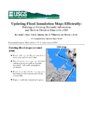
Near-real-time simulation and internet-based delivery of forecast-flood inundation maps using two-dimensional hydraulic modeling: a pilot study of the Snoqualmie River, Washington | 2002 | Text | wwdl_er |
| 407 |
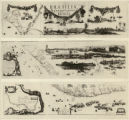 |
New Hydrographic and Geographic Map of Brazil, containing the Provinces of Ciriji, with Itapuama in Paranambuca, Itamaraca, Paraiba, and Potigi to the Rio Grande | | Image | uu_aah_art |
| 408 |
 |
New World Map | | Image | uu_aah_art |
| 409 |
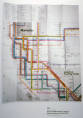 |
New York Metropolitan Transit Authority Subway Guide | | Image | uu_aah_art |
| 410 |
 |
Northern New Mexico Before 1846 | | Image/StillImage | uaida_main |
| 411 |
 |
Notes from St. Christopher's Mission, 1940's | 1940; 1941; 1942; 1942; 1943; 1944; 1945; 1946; 1947; 1948; 1949 | Text | uaida_main |
| 412 |
 |
Notes on the History of the Southern Paiutes and Western Shoshonis | 1971 | Text | uaida_main |
| 413 |
 |
Novus Orbis sive America | | Image | uu_aah_art |
| 414 |
 |
Old Map | 1952-03-10 | Image | dha_scp |
| 415 |
 |
Opening of the Uncompahgre Reservation | | Image/StillImage | uaida_main |
| 416 |
 |
Ophir Mono Mines Co., Murray Godbe, Copy of Drawing (Map of Principal Mining District of Utah) | 1930-03-21 | Image/StillImage | dha_scnpp |
| 417 |
 |
Ophir Mono Mines, Map | 1930-10-13 | Image/StillImage | dha_scnpp |
| 418 |
 |
Pahute Indian Home Lands in 1850 | 1850 | Image/StillImage | uaida_main |
| 419 |
 |
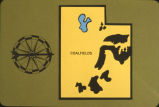
Paiute Reservation Geothermal Resources Map | 2004-01-14 | Image/StillImage | uaida_main |
| 420 |
 |
Paiute Reservation Goethermal Resources Map | 2004-01-14 | Image/StillImage | uaida_main |
| 421 |
 |
The Paiute Strip | | Image/StillImage | uaida_main |
| 422 |
 |
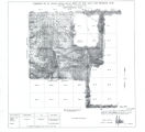
Partially Survayed Township 12th South, Range 19th West, Salt Lake Meridian_005 | | Image/StillImage | uaida_main |
| 423 |
 |
Pauite Reservation Wind Resource Map | 2004-01-14 | Image/StillImage | uaida_main |
| 424 |
 |
Pauite Reservation Wind Resource Map | 2004-01-14 | Image/StillImage | uaida_main |
| 425 |
 |
Peters Projection Map of the World | | Image | uu_aah_art |
| 426 |
 |
PEUP | 1949 | Image | dc_bpc |
| 427 |
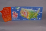 |
PIN SET, OLYMPIC TORCH RELAY PIN FOLDER | 1997 | Image | dha_olyleg |
| 428 |
 |
PIN SET, OLYMPIC TORCH RELAY PIN FOLDER | 1997 | Image | dha_olyleg |
| 429 |
 |
PIN, UNITED STATES OF AMERICA | 2002 | Image | dha_olyleg |
| 430 |
 |
Princeton University Conference Booklet dated April 1958 | 1958-04-16; 1958-04-17 | Text | uum_asap |
| 431 |
 |
Princeton University Conference Program dated April 1958 | 1958-04-16; 1958-04-17 | Text | uum_asap |
| 432 |
 |
Pro-Utah, Inc. Photograph Collection | | Image | uum_map |
| 433 |
 |
Pro-Utah, Inc. Photograph Collection | | Image | uum_map |
| 434 |
 |
Pro-Utah, Inc. Photograph Collection | | Image | uum_map |
| 435 |
 |
Pro-Utah, Inc. Photograph Collection | | Image | uum_map |
| 436 |
 |
Pro-Utah, Inc. Photograph Collection | | Image | uum_map |
| 437 |
 |
Pro-Utah, Inc. Photograph Collection | | Image | uum_map |
| 438 |
 |
Pro-Utah, Inc. Photograph Collection | | Image | uum_map |
| 439 |
 |
Problems of Navajo Male Graduates of Intermountain School During Their First Year of Employment | 1959 | Text | uaida_main |
| 440 |
 |
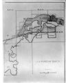
Proposed Southern Ute Reservation Reservation 1879, 1889 | | Image/StillImage | uaida_main |
| 441 |
 |
Prospective acreage gone in hot Indonesian waters | 1970-03-30 | Text; Image/StillImage | uum_asap |
| 442 |
 |
Provo River Project--Maps | 1937 | Image/StillImage | dha_sltnc |
| 443 |
 |
Removal of the Colorado Utes to Utah | | Image/StillImage | uaida_main |
| 444 |
 |
Report of a reconnaissance in the Ute country made in the year 1873, by Lieut. E. H. Ruffner, corps of engineers | 1873 | Image/StillImage | uaida_main |
| 445 |
 |
Reservation Boundary and General Land Status | | Image/StillImage | uaida_main |
| 446 |
 |
Safety Exhibit at Coconut Grove, Apr. 1938 | 1938-04-07 | Image | dha_cbfm |
| 447 |
 |
Safety Exhibit at Coconut Grove, Apr. 1938 | 1938-04-07 | Image | dha_cbfm |
| 448 |
 |
Salt Lake City Downtown Map | 1997; 1998; 1999; 2000; 2001; 2002 | Image | dha_olyleg |
| 449 |
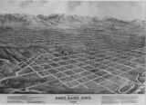 |
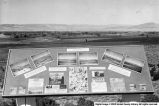
Salt Lake City Panoramic View-Illus. P.10 | 1875 | Image/StillImage | dha_cp |
| 450 |
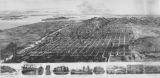 |
Salt Lake City Panoramic View-Illus. P.14 | 1891 | Image/StillImage | dha_cp |
| 451 |
 |
Salt Lake City Panoramic View-Illus. P.16 | 1878 | Image/StillImage | dha_cp |
| 452 |
 |
Salt Lake City, City and County Building P.55 | 1916-08-02 | Image/StillImage | dha_cp |
| 453 |
 |
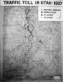
Salt Lake County--Maps Traffic Accidents | 1939-09 | Image/StillImage | dha_sltnc |
| 454 |
 |
Samuel McIntyre, Copy of Map | 1930-05-23 | Image/StillImage | dha_scnpp |
| 455 |
 |
Scenic Overlook Display | 1958-07-10 | Image | ucl_vep |
| 456 |
 |
The Seasonal Movements of the Shoshone-Bannock Peoples | | Image/StillImage | uaida_main |
| 457 |
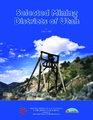 |
Selected mining districts of Utah | 2005 | Text | uum_mlds_public |
| 458 |
 |
Set 7 of undated correspondence written in Arabic | 1958 | Text | uum_asap |
| 459 |
 |
Shoshone Bannock/ Northwestern Soshone Reservations Geothermal Resource Map | 2004-01-14 | Image/StillImage | uaida_main |
| 460 |
 |
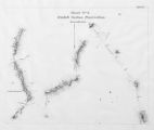
Sketch of Uintah Ouray Agencies. | | Image/StillImage | uaida_main |
| 461 |
 |
Southern Paiute Bands | | Image/StillImage | uaida_main |
| 462 |
 |
St. Christopher's Newsletter dated June 1973 | 1973 | Text | uaida_main |
| 463 |
 |
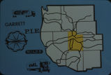
State Maps | | Image/StillImage | uaida_main |
| 464 |
 |
Surface Management Responsibility_001 | | Image/StillImage | uaida_main |
| 465 |
 |
Surface Management Responsibility_002 | | Image/StillImage | uaida_main |
| 466 |
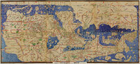 |
Tabula Rogeriana | | Image | uu_aah_art |
| 467 |
 |
Telegraph from Nevada Territorial Governor J.W. Nye to Superintendent Doty dtd January 24, 1862 | 1862-01-24 | Text | uaida_main |
| 468 |
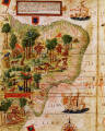 |
Terra Brasilis (detail) | | Image | uu_aah_art |
| 469 |
 |
Third Annual Report of the Board of Indian Commissioners | 1872 | Image/StillImage | uaida_main |
| 470 |
 |
Tintic War 1856 | | Image/StillImage | uaida_main |
| 471 |
 |
Township 12th South, Range 19th West, Salt Lake Meridian_001 | | Image/StillImage | uaida_main |
| 472 |
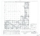 |
Township 12th South, Range 19th West, Salt Lake Meridian_002 | | Image/StillImage | uaida_main |
| 473 |
 |
Township 12th South, Range 19th West, Salt Lake Meridian_003 | | Image/StillImage | uaida_main |
| 474 |
 |
Township 12th South, Range 19th West, Salt Lake Meridian_004 | | Image/StillImage | uaida_main |
| 475 |
 |
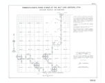
Township 13th South, Range 19th West, Salt Lake Meridian_001 | | Image/StillImage | uaida_main |
| 476 |
 |
Township 13th South, Range 19th West, Salt Lake Meridian_002 | | Image/StillImage | uaida_main |
| 477 |
 |
Township 13th South, Range 19th West, Salt Lake Meridian_003 | | Image/StillImage | uaida_main |
| 478 |
 |
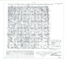
Township 9th South, Range 19th West, Salt Lake Meridian_001 | | Image/StillImage | uaida_main |
| 479 |
 |
Township 9th South, Range 19th West, Salt Lake Meridian_002 | | Image/StillImage | uaida_main |
| 480 |
 |
Township 9th South, Range 19th West, Salt Lake Meridian_003 | | Image/StillImage | uaida_main |
| 481 |
 |
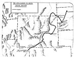
Transportation Routes in the Uintah Basin to 1910 | | Text | uaida_main |
| 482 |
 |
Trappers and Traders in Ute Lands 1820-1844 | | Image/StillImage | uaida_main |
| 483 |
 |
Tribune-Telegram Pioneer Trail Map -Shot 1 | 1947-06-25 | Image/StillImage | dha_sltnc |
| 484 |
 |
Tribune-Telegram Pioneer Trail Map -Shot 2 | 1947-06-25 | Image/StillImage | dha_sltnc |
| 485 |
 |
Tribune-Telegram Pioneer Trek Sign -Shot 1 | 1947 | Image/StillImage | dha_sltnc |
| 486 |
 |
Tribune-Telegram Pioneer Trek Sign -Shot 2 | 1947 | Image/StillImage | dha_sltnc |
| 487 |
 |
Tribune-Telegram Pioneer Trek Sign -Shot 3 | 1947 | Image/StillImage | dha_sltnc |
| 488 |
 |
U.S.O. P.01 | 1945-01-31 | Image/StillImage | dha_cp |
| 489 |
 |
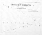
Uinta Indian Reservation Utah, under act of March 3, 1905 and President's Proclamation dated July 14, 1905 | | Image/StillImage | uaida_main |
| 490 |
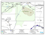 |
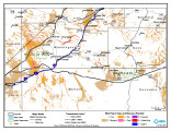
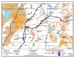
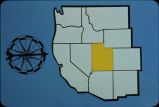
Uintah & Ouray Reservation Geothermal Map | 2004-01-13 | Image/StillImage | uaida_main |
| 491 |
 |
Uintah & Ouray Reservation Geothermal Map | 2004-01-13 | Image/StillImage | uaida_main |
| 492 |
 |
Uintah & Ouray Reservation Report from the U.S. Dept. of Energy | 2007-08-01 | Text | uaida_main |
| 493 |
 |
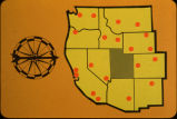
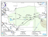
Uintah & Ouray Wind Resources Map | 2004-01-13 | Image/StillImage | uaida_main |
| 494 |
|
Uintah & Ouray Wind Resources Map | 2004-01-09 | Image/StillImage | uaida_main |
| 495 |
 |
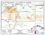
Uintah Basin Replacement Project March 1995 | 1995-03-10 | Image/StillImage | uaida_main |
| 496 |
 |
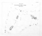
Uintah Indian Reservation and the Three Band Divisions 1903. | 1903 | Image/StillImage | uaida_main |
| 497 |
 |
Uintah Indian Reservation Boundaries Sheet Number 4 | | Image/StillImage | uaida_main |
| 498 |
 |
Uintah Indian Reservation Boundaries; Sheet Number 1 | | Image/StillImage | uaida_main |
| 499 |
 |
Uintah Indian Reservation Boundaries; Sheet Number 2 | | Image/StillImage | uaida_main |
| 500 |
 |
Uintah Indian Reservation Boundaries; Sheet Number 3 | | Image/StillImage | uaida_main |
| 501 |
 |
Uintah Indian Reservation Boundaries; Sheet Number 5 | | Image/StillImage | uaida_main |
| 502 |
 |
Uintah Unit Alernative No. 4 Coyote Basin Alternative | | Image/StillImage | uaida_main |
| 503 |
|
Uintah Unit Alernative No. 4 Coyote Basin Alternative | | Text | uaida_main |
| 504 |
 |
Uintah Unit Alternative No. 1 Lower Uinta Alternative | | Text | uaida_main |
| 505 |
 |
Universalis Cosmographia: Brazil as a River in a Country called "America" | | Image | uu_aah_art |
| 506 |
 |
Upalco Unit Alternative No. 8 Twin Pots Alternative | | Image/StillImage | uaida_main |
| 507 |
|
Upalco Unit Alternative No. 8 Twin Pots Alternative | 1995-01 | Text | uaida_main |
| 508 |
 |
Updating flood inundation maps efficiently: building on existing hydraulic information and modern elevation data with a GIS | 1998 | Text | wwdl_er |
| 509 |
 |
Updating flood maps efficiently using existing hydraulic models, very-high-accuracy elevation data, and a geographic information system- a pilot study on the Nisqually River, Washington | 2001 | Text | wwdl_er |
| 510 |
 |
Utah Churches, Missions NW | | Image | wc_pc |
| 511 |
 |
Utah Churches, Schools SW | | Image | wc_pc |
| 512 |
 |
Utah Churches, Schools, Missions SE. | | Image | wc_pc |
| 513 |
 |
Utah Council of Churches records | 1949; 1950; 1951; 1952; 1953; 1954; 1955; 1956; 1957; 1958; 1959; 1960; 1961; 1962; 1963; 1964; 1965; 1966 | | wc_ead |
| 514 |
 |
Utah County--Maps Traffic Accidents | 1939-09 | Image/StillImage | dha_sltnc |
| 515 |
 |
Utah Highway Patrol p. 1 | 1935; 1936; 1937; 1938; 1939; 1940; 1941; 1942; 1943; 1944; 1945; 1946; 1947 | Image/StillImage | dha_cp |
| 516 |
 |
Utah Power & Light Company, Copy of Map Showing Location of Electric Ranges | 1925-08-06 | Image/StillImage | dha_scnpp |
| 517 |
 |
Utah Power Blueprint, Ratliff Tunnel | 1923-11-27 | Image | dha_scp |
| 518 |
 |
Ute Indian Reservations in Utah Territory | | Image/StillImage | uaida_main |
| 519 |
|
Ute Indians: Before and after White Contact | 1966 | Text | uaida_main |
| 520 |
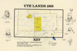 |
Ute Lands, 1868 | | Image/StillImage | uaida_main |
| 521 |
 |
Ute-White Relations in Colorado and New Mexico 1848-1855 | | Image/StillImage | uaida_main |
| 522 |
 |
Ute-White Relations in Utah 1847-1850 | | Image/StillImage | uaida_main |
| 523 |
 |
The Utes Journey to South Dakota 1906-1908 | | Image/StillImage | uaida_main |
| 524 |
 |
View of Venice | | Image | uu_aah_art |
| 525 |
 |
View of Venice (detail) | | Image | uu_aah_art |
| 526 |
 |
Visits to Mountain Meadows by Frank A. Beckwith [13] | 1950 | Image | dc_bpc |
| 527 |
 |
Visits to Mountain Meadows by Frank A. Beckwith [14] | 1950 | Image | dc_bpc |
| 528 |
 |
W. F. Bulkley photographs, poster 03, photo 06: Map of Wasatch mountain range | 1925; 1926; 1927; 1928; 1929; 1930; 1931; 1932; 1933; 1934; 1935 | Image | uum_map |
| 529 |
 |
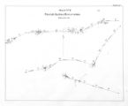
Walker War Map 1853-1854 | | Image/StillImage | uaida_main |
| 530 |
 |
We Shall Remain: Utah Indian Elementary Curriculum Guide - Fourth Grade Assessment | 2009 | Text | uaida_main |
| 531 |
 |
We Shall Remain: Utah Indian Elementary Curriculum Guide; 4th Grade | 2009 | Text | uaida_main |
| 532 |
|
We Shall Remain: Utah Indian High School Curriculum Guide | 2009 | Text | uaida_main |
| 533 |
|
We Shall Remain: Utah Indian Junior High Curriculum Guide | 2009 | Text | uaida_main |
| 534 |
 |
Western wilds | 1879 | Text | uaida_main |
| 535 |
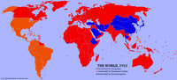 |
World Map showing areas controlled by Europeans, European Settlers, and Non-Europeans in 1922 | | Image | uu_aah_art |