|
|
Title | Date | Type | Setname |
| 201 |
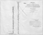 |
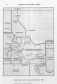
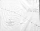
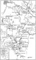
Map of Part of the West Boundary of the Uncompahgre Ute Indian Reservation as Surveyed by William B. Dougall | | Image/StillImage | uaida_main |
| 202 |
 |
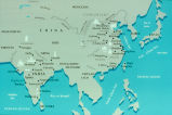
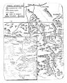
Map of Reservations of the Western United States and the Religions that Worked on the Reservations 1870's | 1873 | Image/StillImage | uaida_main |
| 203 |
 |
Map of Shoshone Indian Territory, and the Division of Shoshone Boundaries in Nevada | | Image/StillImage | uaida_main |
| 204 |
 |
Map of Shoshone Territory; Prepared by Doty, 1859 | | Image/StillImage | uaida_main |
| 205 |
 |
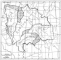
Map of Southern Colorado and the Ute Mountain Ute Reservation | | Image/StillImage | uaida_main |
| 206 |
 |
Map of Southern Ute Agencies | | Image/StillImage | uaida_main |
| 207 |
 |
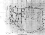
Map of Stock Mining Claims in the Uintah Basin | | Image/StillImage | uaida_main |
| 208 |
 |
Map of the Dutch capture of the town of Olinda in Pernambuco by the Dutch West Indies Company in February 1630 | | Image | uu_aah_art |
| 209 |
 |
Map of the Dutch Republic | | Image | uu_aah_art |
| 210 |
 |
Map of the Four Corners Region and the Reservation of the Ute Mountain Ute Tribe | | Image/StillImage | uaida_main |
| 211 |
 |
Map of the Homelands of Northern Shoshone, 1863 | | Image/StillImage | uaida_main |
| 212 |
 |
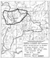
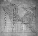
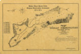
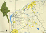
Map of the Northern Part of the Former Uintah Indian Reservation Showing the Irrigation System | | Image/StillImage | uaida_main |
| 213 |
 |
Map of the original range of the Bannock Indians according to Bureau of Indian Affairs, 1952. | | Image/StillImage | uaida_main |
| 214 |
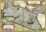 |
Map of the Pacific | | Image | uu_aah_art |
| 215 |
 |
Map of the Shoshone Tribes | | Image/StillImage | uaida_main |
| 216 |
 |
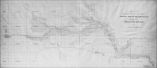
Map of the South West Boundary of the Uintah Indian Reserve Utah Territory. | | Image/StillImage | uaida_main |
| 217 |
 |
Map of the Southern Part of the Former Uintah Indian Reservation Showing the Irrigation System of Indian Allotments | | Image/StillImage | uaida_main |
| 218 |
 |
Map of the Uintah Basin and the Uintah Ouray Reservation | | Image/StillImage | uaida_main |
| 219 |
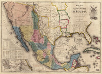 |
Map of the United States of Méjico (Mexico) | | Image | uu_aah_art |
| 220 |
 |
Map of Uintah Basin and Fort Duchesne | | Image/StillImage | uaida_main |
| 221 |
 |
Map of Uintah Reservation. Green River Area | | Image/StillImage | uaida_main |
| 222 |
 |
Map of Uintah Valley Reserve, formed by order of President Abraham Lincoln, 1861. | | Image/StillImage | uaida_main |
| 223 |
 |
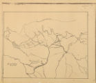
Map of Uncompahgre Ute Indian Reservation Boundaries, Sheet Number 1, 1889 | | Image/StillImage | uaida_main |
| 224 |
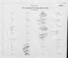 |
Map of Uncompahgre Ute Indian Reservation Boundaries, Sheet Number 2, 1889 | | Image/StillImage | uaida_main |
| 225 |
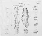 |
Map of Uncompahgre Ute Indian Reservation Boundaries, Sheet Number 3, 1889 | | Image/StillImage | uaida_main |
| 226 |
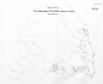 |
Map of Uncompahgre Ute Indian Reservation Boundaries, Sheet Number 4, 1889 | | Image/StillImage | uaida_main |
| 227 |
 |
Map of Uncompahgre Ute Indian Reservation Boundaries, Sheet Number 5, 1889 | | Image/StillImage | uaida_main |
| 228 |
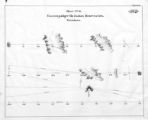 |
Map of Uncompahgre Ute Indian Reservation Boundaries, Sheet Number 6, 1889 | | Image/StillImage | uaida_main |
| 229 |
 |
Map of Uncompahgre Ute Indian Reservation Boundaries, Sheet Number 7, 1889 | | Image/StillImage | uaida_main |
| 230 |
 |
Map of Uncompahgre Ute Indian Reservation Boundaries, Sheet Number 8, 1889 | | Image/StillImage | uaida_main |
| 231 |
 |
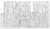
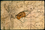
Map of Uncompahgre Ute reservation, Includes parcel divisions | | Image/StillImage | uaida_main |
| 232 |
 |
Map of Utah with Cross | 1951-10-18 | Image | dha_scp |
| 233 |
 |
Map of Ute Reservation in Western Colorado, and Lands Ceded Over Time | 1882 | Image/StillImage | uaida_main |
| 234 |
 |
Map of Ute Territory by Band | | Image/StillImage | uaida_main |
| 235 |
 |
Map of Ute Territory in Utah and Colorado by Band Name and Location | | Image/StillImage | uaida_main |
| 236 |
 |
Map of Walker River Paiute Tribe Original Reservation Centennial 1874-1974 | 1874 | Image/StillImage | uaida_main |
| 237 |
 |
Map of Western Indian Territory Before 1850 | | Image/StillImage | uaida_main |
| 238 |
 |
Map of Western Shoshone and Northern Paiute Territory | | Image/StillImage | uaida_main |
| 239 |
 |
Map on Wall at Walgreen Drug Store, May 1936 | 1936-05-28 | Image | dha_cbfm |
| 240 |
 |
Map on Wall at Walgreen Drug Store, May 1936 | 1936-05-28 | Image | dha_cbfm |
| 241 |
 |
Map showing boundaries of Northern Paiute, Southern Paiute, Shoshone Bannock and Ute | | Image/StillImage | uaida_main |
| 242 |
 |
Map showing Ravenna and Aachen | | Image | uu_aah_art |
| 243 |
 |
Map showing the boundary of the Shoshone Indian territory | 1941 | Image/StillImage | uaida_main |
| 244 |
 |
Map showing the dissolution of the former Roman Empire, c. 600 | | Image | uu_aah_art |
| 245 |
 |
Map showing three locations of Zhuang Hui's site-specific project "Longitude 109.88°E and Latitude 31.09°N | | Image | uu_aah_art |
| 246 |
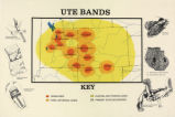 |
Map titled "Ute Bands Map" | | Image/StillImage | uaida_main |
| 247 |
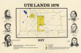 |
Map titled "Ute Lands, 1876" | | Image/StillImage | uaida_main |
| 248 |
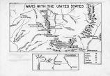 |
Map titled Wars with the United States | | Image/StillImage | uaida_main |
| 249 |
 |
Map titled, "Northern Ute Lands, 1905" | | Image/StillImage | uaida_main |
| 250 |
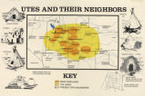 |
Map titled, "Utes and Their Neighbors" | | Image/StillImage | uaida_main |
| 251 |
 |
Map, [ca. 1953] | 1953 | Text | uaida_main |
| 252 |
 |
Map, annotated | 1975 | Image | dha_eftl |
| 253 |
 |
Map, July 1938 | 1938-07-12 | Image | dha_cbfm |
| 254 |
 |
Map, July 1938 | 1938-07-12 | Image | dha_cbfm |
| 255 |
 |
Map, Mar. 1938 | 1938-03-03 | Image | dha_cbfm |
| 256 |
 |
Map, Mar. 1938 | 1938-03-03 | Image | dha_cbfm |
| 257 |
 |
Map, Mar. 1938 | 1938-03-03 | Image | dha_cbfm |
| 258 |
 |
Map, May 1938 | 1938-05-16 | Image | dha_cbfm |
| 259 |
 |
Map, Salt Lake Valley | 1975 | Image | dha_eftl |
| 260 |
 |
Map: 11th - 12th Century Trade Routes | | Image | uu_aah_art |
| 261 |
 |
Map: 11th - 12th Century Trade Routes including Rome, Constantinople, Damascus, Jerusalem, and Dura-Europos | | Image | uu_aah_art |
| 262 |
 |
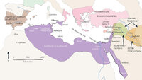
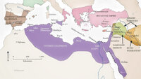
Map: Abbasid caliphate | | Image | uu_aah_art |
| 263 |
 |
Map: Ancient Egypt | | Image | uu_aah_art |
| 264 |
 |
Map: Ancient Near East | | Image | uu_aah_art |
| 265 |
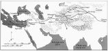 |
Map: Ancient Silk Routes between China and the West | | Image | uu_aah_art |
| 266 |
 |
Map: Approximate Spheres and Succession of the Xia, Shang, and Zhou Dynasties | | Image | uu_aah_art |
| 267 |
 |
Map: Areas in northeast Brazil occupied by the Dutch, showing the main regions under Johan Maurits van Nassau's rule, 1637 - 1644 | | Image | uu_aah_art |
| 268 |
 |
Map: Asia circa 1250 CE | | Image | uu_aah_art |
| 269 |
 |
Map: Asia circa 450 CE | | Image | uu_aah_art |
| 270 |
 |
Map: Asia circa 850 CE | | Image | uu_aah_art |
| 271 |
 |
Map: Australia | | Image | uu_aah_art |
| 272 |
 |
Map: Aztec Empire in 1518 CE | | Image | uu_aah_art |
| 273 |
 |
Map: Bagan (Pagan) Temples, Stupas, and Monasteries | | Image | uu_aah_art |
| 274 |
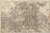 |
Map: Berlin | | Image | uu_aah_art |
| 275 |
 |
Map: Berlin, City Center | | Image | uu_aah_art |
| 276 |
 |
Map: Borobudur and Kedu Plain | | Image | uu_aah_art |
| 277 |
 |
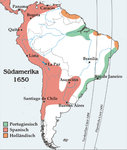
Map: Brazil | | Image | uu_aah_art |
| 278 |
 |
Map: Brazil | | Image | uu_aah_art |
| 279 |
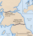 |
Map: Britain, showing Antonine Wall and Hadrian's Wall | | Image | uu_aah_art |
| 280 |
 |
Map: British Empire, excluding Americas, 1921 CE | | Image | uu_aah_art |
| 281 |
 |
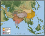
Map: Buddhist Asia | | Image | uu_aah_art |
| 282 |
 |
Map: Buddhist Sites in China, Central Asia, Korea, and Japan | | Image | uu_aah_art |
| 283 |
 |
Map: Buddhist Sites in India, Neighboring Regions, and Southeast Asia | | Image | uu_aah_art |
| 284 |
 |
Map: Buddhist World Showing the Main Pilgrimmage and Trade Routes | | Image | uu_aah_art |
| 285 |
 |
Map: Cairo and environs during Fatimid period | | Image | uu_aah_art |
| 286 |
 |
Map: Cairo and environs during Fatimid period | | Image | uu_aah_art |
| 287 |
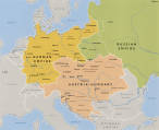 |
Map: Central Europe in 1890 | | Image | uu_aah_art |
| 288 |
 |
Map: Central Europe in 1930 | | Image | uu_aah_art |
| 289 |
 |
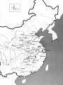
Map: China | | Image | uu_aah_art |
| 290 |
 |
Map: China and Korea, showing Neolithic and Bronze Age sites | | Image | uu_aah_art |
| 291 |
 |
Map: China during the Spring and Autumn Period | | Image | uu_aah_art |
| 292 |
 |
Map: China during the Warring States Period | | Image | uu_aah_art |
| 293 |
 |
Map: Christian Basilicas of Constantinian Rome | | Image | uu_aah_art |
| 294 |
 |
Map: Christian Reconquest in Iberia, 790-1300 CE | | Image | uu_aah_art |
| 295 |
 |
Map: Cities in India | | Image | uu_aah_art |
| 296 |
 |
Map: Constantinople in the early 4th century | | Image | uu_aah_art |
| 297 |
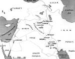 |
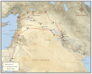
Map: Current Middle East Showing Ancient Mesopotamia | | Image | uu_aah_art |
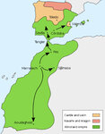
| 298 |
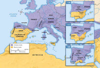 |
Map: Decline of Muslim Rule in the Iberian Peninsula that culminated in the Reconquista, Inquisition, and the rise of Spanish and Portuguese kingdoms, 1000-1300 CE | | Image | uu_aah_art |
| 299 |
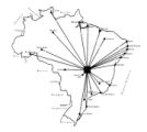 |
Map: Distances between Brasilia and other major Brazilian cities | | Image | uu_aah_art |
| 300 |
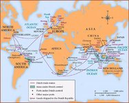 |
Map: Dutch Trade Routes | | Image | uu_aah_art |
| 301 |
 |
Map: Early Bronze Age Sites in China | | Image | uu_aah_art |
| 302 |
 |
Map: Early China | | Image | uu_aah_art |
| 303 |
 |
Map: East Asia, circa 615 CE | | Image | uu_aah_art |
| 304 |
 |
Map: East Asia, circa 715 CE | | Image | uu_aah_art |
| 305 |
 |
Map: East Coast Prehistoric Cultures | | Image | uu_aah_art |
| 306 |
 |
Map: Empires and Spheres of Influence | | Image | uu_aah_art |
| 307 |
 |
Map: Europe during the 14th Century CE | | Image | uu_aah_art |
| 308 |
 |
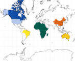
Map: Europe, 1648 CE | | Image | uu_aah_art |
| 309 |
 |
Map: Europe, about 1100 CE | | Image | uu_aah_art |
| 310 |
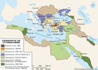 |
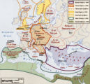
Map: Extent of Ottoman Empire, 1300-1699 CE | | Image | uu_aah_art |
| 311 |
 |
Map: Fatimid Caliphate Rule | | Image | uu_aah_art |
| 312 |
 |
Map: Fatimid Caliphate Rule | | Image | uu_aah_art |
| 313 |
 |
Map: Fatimid Dynasty | | Image | uu_aah_art |
| 314 |
 |
Map: Flemish / Dutch Lowlands, 1585 - 1700 | | Image | uu_aah_art |
| 315 |
 |
Map: Florence, Italy, 1400 CE | | Image | uu_aah_art |
| 316 |
 |
Map: Han Empire | | Image | uu_aah_art |
| 317 |
 |
Map: Historical Sites in the Kyoto, Osaka, and Nara areas | | Image | uu_aah_art |
| 318 |
 |
Map: Important Archaeological Sites of the Erlitou culture period | | Image | uu_aah_art |
| 319 |
 |
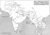
Map: India, South and Central Asia | | Image | uu_aah_art |
| 320 |
 |
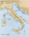
Map: Italy | | Image | uu_aah_art |
| 321 |
 |
Map: Italy, c.1410 CE | | Image | uu_aah_art |
| 322 |
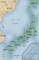 |
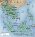
Map: Japan | | Image | uu_aah_art |
| 323 |
 |
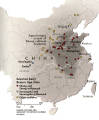
Map: Kiln Sites of China | | Image | uu_aah_art |
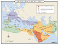
| 324 |
 |
Map: Korea | | Image | uu_aah_art |
| 325 |
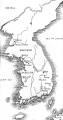 |
Map: Korea | | Image | uu_aah_art |
| 326 |
 |
Map: Latin America around the year 1500, with the principal native societies and the three empires: Aztec, Mayan, and Incan | | Image | uu_aah_art |
| 327 |
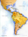 |
Map: Latin America Political Map | | Image | uu_aah_art |
| 328 |
 |
Map: Location of Dura Europos in the Middle East | | Image | uu_aah_art |
| 329 |
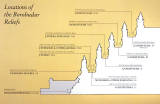 |
Map: Location of the Borobudur reliefs | | Image | uu_aah_art |
| 330 |
 |
Map: Locations of 1937 Paris World's Fair, the Berlin Olympics, Nuremberg Rallies, and Great German and Degenerate Art Exhibits | | Image | uu_aah_art |
| 331 |
 |
Map: Major sites in Rome, Italy | | Image | uu_aah_art |
| 332 |
 |
Map: Major Sites of the Eastern Zhou Dynasty | | Image | uu_aah_art |
| 333 |
 |
Map: Major Sites of the Qin State and Dynasty | | Image | uu_aah_art |
| 334 |
 |
Map: Major Sites of the Shang Dynasty, Erligang Culture | | Image | uu_aah_art |
| 335 |
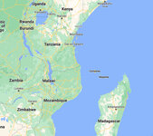 |
Map: Makonde people were in contemporary Kenya, Tanzania, and Mozambique | | Image | uu_aah_art |
| 336 |
 |
Map: Mediterranean and Northern Africa | | Image | uu_aah_art |
| 337 |
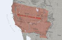 |
Map: Mexican Cession 1848 | | Image | uu_aah_art |
| 338 |
 |
Map: Minoan Crete and the Bronze Age Aegean | | Image | uu_aah_art |
| 339 |
 |
Map: Nara, Japan | | Image | uu_aah_art |
| 340 |
 |
Map: Nigeria in West Africa | | Image | uu_aah_art |
| 341 |
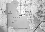 |
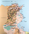
Map: Northen Great Salt Lake Area | | Image | uu_aah_art |
| 342 |
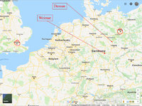 |
Map: Northern Europe showing Dessau and Weimar, Germany | | Image | uu_aah_art |
| 343 |
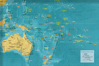 |
Map: Oceania | | Image | uu_aah_art |
| 344 |
 |
Map: Osogbo | | Image | uu_aah_art |
| 345 |
 |
Map: Paris and Versailles, France | | Image | uu_aah_art |
| 346 |
 |
Map: Pedro Álvares Cabral's Voyage to and from India with the discovery of Brazil | | Image | uu_aah_art |
| 347 |
 |
Map: Pilgrimage Routes of France and Spain | | Image | uu_aah_art |
| 348 |
 |
Map: Plan of Constantinople during the Middle Byzantine Period | | Image | uu_aah_art |
| 349 |
 |
Map: Pompeii | | Image | uu_aah_art |
| 350 |
 |
Map: Pompeii in 79 CE | | Image | uu_aah_art |
| 351 |
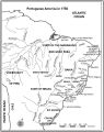 |
Map: Portuguese America in 1750 | | Image | uu_aah_art |
| 352 |
 |
Map: Portuguese Voyage Routes, 15th and 16th Century CE | | Image | uu_aah_art |
| 353 |
 |
Map: Prehistoric Europe and the Near East | | Image | uu_aah_art |
| 354 |
 |
Map: Principal Sites of Ancient Egypt | | Image | uu_aah_art |
| 355 |
 |
Map: Pueblo Cultures in the American Southwest | | Image | uu_aah_art |
| 356 |
 |
Map: Qin Dynasty, China | | Image | uu_aah_art |
| 357 |
 |
Map: Regional bronze-using cultures during the Shang Dynasty | | Image | uu_aah_art |
| 358 |
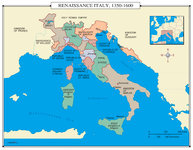 |
Map: Renaissance Italy 1350 - 1600 CE | | Image | uu_aah_art |
| 359 |
 |
Map: Rio de Janeiro | | Image | uu_aah_art |
| 360 |
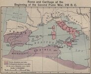 |
Map: Roman and Carthaginian Territories at the beginning of the Second Punic War, 218 BCE | | Image | uu_aah_art |
| 361 |
 |
Map: Route of Mansa Musa's hajj | | Image | uu_aah_art |
| 362 |
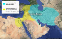 |
Map: Sasanian Empire showing original territory and extended territory in early 7th century CE | | Image | uu_aah_art |
| 363 |
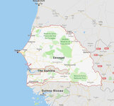 |
Map: Senegal | | Image | uu_aah_art |
| 364 |
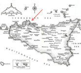 |
Map: Sicily | | Image | uu_aah_art |
| 365 |
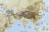 |
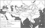
Map: Silk Road Land and Sea Routes | | Image | uu_aah_art |
| 366 |
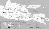 |
Map: Sites of Buddhist and Hindu Temples in Central and East Java | | Image | uu_aah_art |
| 367 |
 |
Map: South America around 1650 | | Image | uu_aah_art |
| 368 |
 |
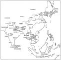
Map: Southeast Asia | | Image | uu_aah_art |
| 369 |
 |
Map: Southeast Asia | | Image | uu_aah_art |
| 370 |
 |
Map: Spread of Almoravid Empire | | Image | uu_aah_art |
| 371 |
 |
Map: Spread of Buddhism, ca. 200-900 CE | | Image | uu_aah_art |
| 372 |
 |
Map: Spread of Islam, 622-750 CE | | Image | uu_aah_art |
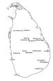
| 373 |
 |
Map: Sri Lanka, Sites with Paintings of the Early and Middle Historical Periods | | Image | uu_aah_art |
| 374 |
 |
Map: The Byzantine Empire circa 1000 CE | | Image | uu_aah_art |
| 375 |
 |
Map: The Crusader States 1100 CE | | Image | uu_aah_art |
| 376 |
 |
Map: The Crusader States 1118 CE | | Image | uu_aah_art |
| 377 |
 |
Map: The Empire on the Eve of the French Revolution, 1789 | | Image | uu_aah_art |
| 378 |
 |
Map: The greatest extent of Napoleon I's First Empire, 1812 | | Image | uu_aah_art |
| 379 |
 |
Map: The Greek World | | Image | uu_aah_art |
| 380 |
 |
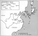
Map: The Han Empire and the Silk Road | | Image | uu_aah_art |
| 381 |
 |
Map: The Hohenstaufen Empire under Frederick II | | Image | uu_aah_art |
| 382 |
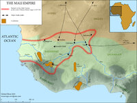 |
Map: The Mali Empire | | Image | uu_aah_art |
| 383 |
 |
Map: The Rise of Constantine, 306 - 324 CE | | Image | uu_aah_art |
| 384 |
 |
Map: The Roman Empire | | Image | uu_aah_art |
| 385 |
 |
Map: The Roman Empire in the Second Century CE | | Image | uu_aah_art |
| 386 |
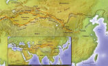 |
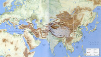
Map: The Silk Road | | Image | uu_aah_art |
| 387 |
 |
Map: The Silk Roads, ca. 200-900 CE | | Image | uu_aah_art |
| 388 |
 |
Map: Topographical Map of Italy | | Image | uu_aah_art |
| 389 |
 |
Map: Trans Saharan Trade and Sea Routes | | Image | uu_aah_art |
| 390 |
 |
Map: Tunisia | | Image | uu_aah_art |
| 391 |
 |
Map: Umayyad Emirate, c. 850 CE, Umayyad Caliphate, c. 950 CE | | Image | uu_aah_art |
| 392 |
 |
Mapping of the Terr. West of the Rocky Mts. P.1 | | Image | dha_cp |
| 393 |
 |
Mapping the Trans-Mississippi West P.1 | | Image | dha_cp |
| 394 |
 |
Mapping the world in medieval and early modern Western and Arabic Travel Accounts | 2017 | Text | ir_etd |
| 395 |
 |
Meeker Incident | | Image/StillImage | uaida_main |
| 396 |
 |
Mercator world map of 1569 (Nova et Aucta Orbis Terrae Descriptio ad Usum Navigantium Emendate Accommodata) | | Image | uu_aah_art |
| 397 |
 |
Mercator's Map of the World | | Image | uu_aah_art |
| 398 |
 |
Mercur, Utah P.1 | | Image | dha_cp |
| 399 |
 |
Military Installations, Utah P.1 | | Image | dha_cp |
| 400 |
 |
Mining Map of Big & Little Cottonwood P.1 | | Image | dha_cp |