Home
Browse
Ask Us
Chat
Harmful Language Statement
Log in
Advanced Search
Year
1873
1874
1875
1876
1877
1878
1879
1880
1881
1882
1883
1884
1885
1886
1887
1888
1889
1890
1891
1892
1893
1894
1895
1896
1897
1898
1899
1900
1901
1902
1903
1904
1905
1906
1907
1908
1909
1910
1911
1912
1913
1914
1915
1916
1917
1918
1919
1920
1921
1922
1923
1924
1925
1926
1927
1928
1929
1930
1931
1932
1933
1934
1935
1936
1937
1938
1939
1940
1941
1942
1943
1944
1945
1946
1947
1948
1949
1950
1951
1952
1953
1954
1955
1956
1957
1958
1959
1960
1961
1962
1963
1964
1965
1966
1967
1968
1969
1970
1971
1972
1973
1974
1975
1976
1977
1978
1979
1980
1981
1982
1983
1984
1985
1986
1987
1988
1989
1990
1991
1992
1993
1994
1995
1996
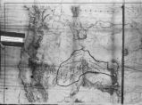
1997
1998
1999
2000
2001
2002
TO
1873
1874
1875
1876
1877
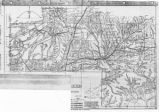
1878
1879
1880
1881
1882
1883
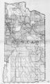
1884
1885
1886
1887
1888
1889
1890
1891
1892
1893
1894
1895
1896
1897
1898
1899
1900
1901
1902
1903
1904
1905
1906
1907
1908
1909
1910
1911
1912
1913
1914
1915
1916
1917
1918
1919
1920
1921
1922
1923
1924
1925
1926
1927
1928
1929
1930
1931
1932
1933
1934
1935
1936
1937
1938
1939
1940
1941
1942
1943
1944
1945
1946
1947
1948
1949
1950
1951
1952
1953
1954
1955
1956
1957
1958
1959
1960
1961
1962
1963
1964
1965
1966
1967
1968
1969
1970
1971
1972
1973
1974
1975
1976
1977
1978
1979
1980
1981
1982
1983
1984
1985
1986
1987
1988
1989
1990
1991
1992
1993
1994
1995
1996
1997
1998
1999
2000
2001
2002
Type
Image
269
Image/StillImage
140
Text
5
Format
image/jpeg
413
Collection
Art and Art History
169
Beckwith Photograph Collection
8
Classified Photographs
62
Clifton Bray Film Negatives
10
Extractions from the Land: Mining and...
2
Olympic Legacy
5
Peoples of Utah Revisited
1
Photo Archives
12
Salt Lake Tribune Negative Collection
14
Shipler Collection Negative Preservat...
18
Shipler Commercial Photographers
6
Ski and Snow Sports Archives
1
UAIDA Main Collection
98
Vernal Express Photographs
2
Westminster College Photographs
5
More
Filters:
Subject:
"Maps"
Format:
image
126
-
150
of
413
<
1
2
3
4
5
6
7
8
9
10
>
Gallery view
Number of results to display per page
10
25
50
100
200
Sort by Relevance
Sort by Title A-Z
Sort by Title Z-A
Sort by Date Ascending
Sort by Date Descending
Sort by Last Modified Ascending
Sort by Last Modified Descending
Title
Date
Type
Setname
126
Map of Indian Reservation. 1884
Image/StillImage
uaida_main
127
Map of Indian Reservations in the Western United States
Image/StillImage
uaida_main
128
Map of Indian Territory in the Western United States
Image/StillImage
uaida_main
129
Map of Indian Tribes of North America
Image/StillImage
uaida_main
130
Map of London Underground, After Re-Design
Image
uu_aah_art
131
Map of Navajo, Ute, and Jicarilla Apache Indian Reserves
Image/StillImage
uaida_main
132
Map of North America and Original Inhabitants' Territory.
Image/StillImage
uaida_main
133
Map of Northern Utah, Early Settlements
Image/StillImage
uaida_main
134
Map of Part of the West Boundary of the Uncompahgre Ute Indian Reservation as Surveyed by William B. Dougall
Image/StillImage
uaida_main
135
Map of Reservations of the Western United States and the Religions that Worked on the Reservations 1870's
1873
Image/StillImage
uaida_main
136
Map of Shoshone Indian Territory, and the Division of Shoshone Boundaries in Nevada
Image/StillImage
uaida_main
137
Map of Shoshone Territory; Prepared by Doty, 1859
Image/StillImage
uaida_main
138
Map of Southern Colorado and the Ute Mountain Ute Reservation
Image/StillImage
uaida_main
139
Map of Stock Mining Claims in the Uintah Basin
Image/StillImage
uaida_main
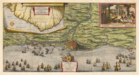
140
Map of the Dutch capture of the town of Olinda in Pernambuco by the Dutch West Indies Company in February 1630
Image
uu_aah_art
141
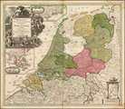
Map of the Dutch Republic
Image
uu_aah_art
142
Map of the Four Corners Region and the Reservation of the Ute Mountain Ute Tribe
Image/StillImage
uaida_main
143
Map of the Homelands of Northern Shoshone, 1863
Image/StillImage
uaida_main
144
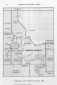
Map of the Northern Part of the Former Uintah Indian Reservation Showing the Irrigation System
Image/StillImage
uaida_main
145
Map of the original range of the Bannock Indians according to Bureau of Indian Affairs, 1952.
Image/StillImage
uaida_main
146
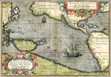
Map of the Pacific
Image
uu_aah_art
147
Map of the Shoshone Tribes
Image/StillImage
uaida_main
148
Map of the South West Boundary of the Uintah Indian Reserve Utah Territory.
Image/StillImage
uaida_main
149
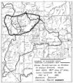
Map of the Southern Part of the Former Uintah Indian Reservation Showing the Irrigation System of Indian Allotments
Image/StillImage
uaida_main
150
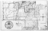
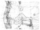
Map of the Uintah Basin and the Uintah Ouray Reservation
Image/StillImage
uaida_main
126
-
150
of
413
<
1
2
3
4
5
6
7
8
9
10
>